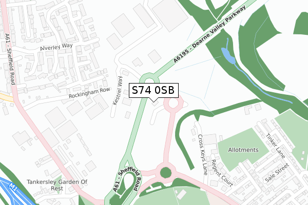
S74 0SB is located in the Rockingham electoral ward, within the metropolitan district of Barnsley and the English Parliamentary constituency of Barnsley East. The Sub Integrated Care Board (ICB) Location is NHS South Yorkshire ICB - 02P and the police force is South Yorkshire. This postcode has been in use since July 2019.


GetTheData
Source: OS Open Zoomstack (Ordnance Survey)
Licence: Open Government Licence (requires attribution)
Attribution: Contains OS data © Crown copyright and database right 2025
Source: Open Postcode Geo
Licence: Open Government Licence (requires attribution)
Attribution: Contains OS data © Crown copyright and database right 2025; Contains Royal Mail data © Royal Mail copyright and database right 2025; Source: Office for National Statistics licensed under the Open Government Licence v.3.0
| Easting | 435104 |
| Northing | 400556 |
| Latitude | 53.500554 |
| Longitude | -1.472263 |
GetTheData
Source: Open Postcode Geo
Licence: Open Government Licence
| Country | England |
| Postcode District | S74 |
➜ See where S74 is on a map | |
GetTheData
Source: Land Registry Price Paid Data
Licence: Open Government Licence
| Ward | Rockingham |
| Constituency | Barnsley East |
GetTheData
Source: ONS Postcode Database
Licence: Open Government Licence
| Regent Street (Sheffield Road) | Hoyland Common | 282m |
| Wood View (Sheffield Road) | Birdwell | 318m |
| The Drill Hall (Sheffield Road) | Birdwell | 331m |
| Queen Street (Sheffield Road) | Hoyland Common | 361m |
| The Walk (Sheffield Road) | Birdwell | 487m |
| Elsecar Station | 3km |
| Wombwell Station | 4.2km |
| Chapeltown Station | 4.3km |
GetTheData
Source: NaPTAN
Licence: Open Government Licence
GetTheData
Source: ONS Postcode Database
Licence: Open Government Licence


➜ Get more ratings from the Food Standards Agency
GetTheData
Source: Food Standards Agency
Licence: FSA terms & conditions
| Last Collection | |||
|---|---|---|---|
| Location | Mon-Fri | Sat | Distance |
| 268 Sheffield Road | 16:45 | 10:45 | 588m |
| Hoyland Road | 16:45 | 11:00 | 635m |
| 71 Westwood New Road | 16:45 | 10:30 | 637m |
GetTheData
Source: Dracos
Licence: Creative Commons Attribution-ShareAlike
The below table lists the International Territorial Level (ITL) codes (formerly Nomenclature of Territorial Units for Statistics (NUTS) codes) and Local Administrative Units (LAU) codes for S74 0SB:
| ITL 1 Code | Name |
|---|---|
| TLE | Yorkshire and The Humber |
| ITL 2 Code | Name |
| TLE3 | South Yorkshire |
| ITL 3 Code | Name |
| TLE31 | Barnsley, Doncaster and Rotherham |
| LAU 1 Code | Name |
| E08000016 | Barnsley |
GetTheData
Source: ONS Postcode Directory
Licence: Open Government Licence
The below table lists the Census Output Area (OA), Lower Layer Super Output Area (LSOA), and Middle Layer Super Output Area (MSOA) for S74 0SB:
| Code | Name | |
|---|---|---|
| OA | E00037614 | |
| LSOA | E01007424 | Barnsley 028E |
| MSOA | E02001536 | Barnsley 028 |
GetTheData
Source: ONS Postcode Directory
Licence: Open Government Licence
| S74 0QA | Cross Keys Lane | 118m |
| S74 0PN | Regent Court | 232m |
| S70 5SU | Locksley Gardens | 308m |
| S70 5TT | Wood View | 310m |
| S74 0BF | Regent Mews | 327m |
| S74 0PZ | Sheffield Road | 331m |
| S74 0PU | Regent Street | 344m |
| S74 0PR | Tinker Lane | 368m |
| S74 0PS | Steele Street | 377m |
| S70 5ST | Gildhurst Court | 383m |
GetTheData
Source: Open Postcode Geo; Land Registry Price Paid Data
Licence: Open Government Licence