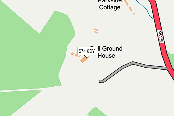
S74 0DY is located in the Rockingham electoral ward, within the metropolitan district of Barnsley and the English Parliamentary constituency of Barnsley East. The Sub Integrated Care Board (ICB) Location is NHS South Yorkshire ICB - 02P and the police force is South Yorkshire. This postcode has been in use since January 1980.


GetTheData
Source: OS OpenMap – Local (Ordnance Survey)
Source: OS VectorMap District (Ordnance Survey)
Licence: Open Government Licence (requires attribution)
| Easting | 435977 |
| Northing | 399193 |
| Latitude | 53.488245 |
| Longitude | -1.459259 |
GetTheData
Source: Open Postcode Geo
Licence: Open Government Licence
| Country | England |
| Postcode District | S74 |
➜ See where S74 is on a map | |
GetTheData
Source: Land Registry Price Paid Data
Licence: Open Government Licence
Elevation or altitude of S74 0DY as distance above sea level:
| Metres | Feet | |
|---|---|---|
| Elevation | 110m | 361ft |
Elevation is measured from the approximate centre of the postcode, to the nearest point on an OS contour line from OS Terrain 50, which has contour spacing of ten vertical metres.
➜ How high above sea level am I? Find the elevation of your current position using your device's GPS.
GetTheData
Source: Open Postcode Elevation
Licence: Open Government Licence
| Ward | Rockingham |
| Constituency | Barnsley East |
GetTheData
Source: ONS Postcode Database
Licence: Open Government Licence
| Parkside Cottages (Sheffield Road) | Hoyland Common | 268m |
| Broadcarr Road (Sheffield Road) | Harley | 590m |
| Broadcarr Road (Sheffield Road) | Harley | 639m |
| Steadfield Road (Parkside Road) | Hoyland Common | 723m |
| Parkside Road (Sheffield Road) | Hoyland Common | 730m |
| Elsecar Station | 2.4km |
| Chapeltown Station | 2.9km |
| Wombwell Station | 4.3km |
GetTheData
Source: NaPTAN
Licence: Open Government Licence
| Percentage of properties with Next Generation Access | 100.0% |
| Percentage of properties with Superfast Broadband | 100.0% |
| Percentage of properties with Ultrafast Broadband | 0.0% |
| Percentage of properties with Full Fibre Broadband | 0.0% |
Superfast Broadband is between 30Mbps and 300Mbps
Ultrafast Broadband is > 300Mbps
| Percentage of properties unable to receive 2Mbps | 0.0% |
| Percentage of properties unable to receive 5Mbps | 0.0% |
| Percentage of properties unable to receive 10Mbps | 0.0% |
| Percentage of properties unable to receive 30Mbps | 0.0% |
GetTheData
Source: Ofcom
Licence: Ofcom Terms of Use (requires attribution)
GetTheData
Source: ONS Postcode Database
Licence: Open Government Licence


➜ Get more ratings from the Food Standards Agency
GetTheData
Source: Food Standards Agency
Licence: FSA terms & conditions
| Last Collection | |||
|---|---|---|---|
| Location | Mon-Fri | Sat | Distance |
| 63 Stead Lane | 16:45 | 11:00 | 957m |
| 79 Clough Fields Road | 16:45 | 11:00 | 1,014m |
| Hoyland Road | 16:45 | 11:00 | 1,063m |
GetTheData
Source: Dracos
Licence: Creative Commons Attribution-ShareAlike
The below table lists the International Territorial Level (ITL) codes (formerly Nomenclature of Territorial Units for Statistics (NUTS) codes) and Local Administrative Units (LAU) codes for S74 0DY:
| ITL 1 Code | Name |
|---|---|
| TLE | Yorkshire and The Humber |
| ITL 2 Code | Name |
| TLE3 | South Yorkshire |
| ITL 3 Code | Name |
| TLE31 | Barnsley, Doncaster and Rotherham |
| LAU 1 Code | Name |
| E08000016 | Barnsley |
GetTheData
Source: ONS Postcode Directory
Licence: Open Government Licence
The below table lists the Census Output Area (OA), Lower Layer Super Output Area (LSOA), and Middle Layer Super Output Area (MSOA) for S74 0DY:
| Code | Name | |
|---|---|---|
| OA | E00037615 | |
| LSOA | E01007424 | Barnsley 028E |
| MSOA | E02001536 | Barnsley 028 |
GetTheData
Source: ONS Postcode Directory
Licence: Open Government Licence
| S74 0FD | Lidgett Grange | 415m |
| S74 0DX | Black Lane | 546m |
| S74 0ED | Wentworth Station | 604m |
| S74 0AH | Parkside Road | 666m |
| S74 0BZ | Warren View | 711m |
| S74 0LS | Bluebell Close | 738m |
| S74 0EE | Longley Spring | 752m |
| S74 0NP | Chapel Street | 762m |
| S74 0AQ | Elm Street | 773m |
| S74 0AL | Parkside Road | 776m |
GetTheData
Source: Open Postcode Geo; Land Registry Price Paid Data
Licence: Open Government Licence