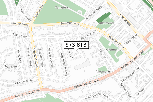
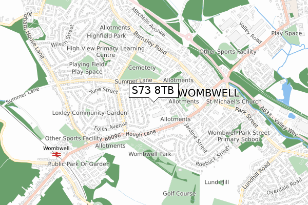
S73 8TB is located in the Wombwell electoral ward, within the metropolitan district of Barnsley and the English Parliamentary constituency of Barnsley East. The Sub Integrated Care Board (ICB) Location is NHS South Yorkshire ICB - 02P and the police force is South Yorkshire. This postcode has been in use since February 2020.


GetTheData
Source: OS Open Zoomstack (Ordnance Survey)
Licence: Open Government Licence (requires attribution)
Attribution: Contains OS data © Crown copyright and database right 2024
Source: Open Postcode Geo
Licence: Open Government Licence (requires attribution)
Attribution: Contains OS data © Crown copyright and database right 2024; Contains Royal Mail data © Royal Mail copyright and database right 2024; Source: Office for National Statistics licensed under the Open Government Licence v.3.0
| Easting | 439584 |
| Northing | 402902 |
| Latitude | 53.521323 |
| Longitude | -1.404435 |
GetTheData
Source: Open Postcode Geo
Licence: Open Government Licence
| Country | England |
| Postcode District | S73 |
➜ See where S73 is on a map ➜ Where is Wombwell? | |
GetTheData
Source: Land Registry Price Paid Data
Licence: Open Government Licence
| Ward | Wombwell |
| Constituency | Barnsley East |
GetTheData
Source: ONS Postcode Database
Licence: Open Government Licence
2023 14 DEC £160,000 |
2023 29 SEP £200,000 |
105, WELLS LANE, WOMBWELL, BARNSLEY, S73 8TB 2021 30 JUN £165,000 |
2021 11 JUN £142,500 |
6, WELLS LANE, WOMBWELL, BARNSLEY, S73 8TB 2021 30 APR £142,500 |
77, WELLS LANE, WOMBWELL, BARNSLEY, S73 8TB 2021 29 APR £165,000 |
109, WELLS LANE, WOMBWELL, BARNSLEY, S73 8TB 2021 8 APR £140,000 |
2021 29 JAN £165,000 |
75, WELLS LANE, WOMBWELL, BARNSLEY, S73 8TB 2020 11 DEC £165,000 |
2, WELLS LANE, WOMBWELL, BARNSLEY, S73 8TB 2020 3 DEC £147,500 |
GetTheData
Source: HM Land Registry Price Paid Data
Licence: Contains HM Land Registry data © Crown copyright and database right 2024. This data is licensed under the Open Government Licence v3.0.
| Winders Place (Hough Lane) | Wombwell | 225m |
| Winders Place (Hough Lane) | Wombwell | 235m |
| Bondfield Crescent (Copeland Road) | Wombwell | 266m |
| Tune Street (Copeland Road) | Wombwell | 282m |
| Copeland Road (Hough Lane) | Wombwell | 316m |
| Wombwell Station | 0.9km |
| Elsecar Station | 2.9km |
| Barnsley Station | 6.1km |
GetTheData
Source: NaPTAN
Licence: Open Government Licence
GetTheData
Source: ONS Postcode Database
Licence: Open Government Licence


➜ Get more ratings from the Food Standards Agency
GetTheData
Source: Food Standards Agency
Licence: FSA terms & conditions
| Last Collection | |||
|---|---|---|---|
| Location | Mon-Fri | Sat | Distance |
| 57 Hough Lane | 16:30 | 11:00 | 301m |
| Wombwell Delivery Office | 17:10 | 12:00 | 416m |
| St Georges Arms | 16:30 | 12:00 | 496m |
GetTheData
Source: Dracos
Licence: Creative Commons Attribution-ShareAlike
The below table lists the International Territorial Level (ITL) codes (formerly Nomenclature of Territorial Units for Statistics (NUTS) codes) and Local Administrative Units (LAU) codes for S73 8TB:
| ITL 1 Code | Name |
|---|---|
| TLE | Yorkshire and The Humber |
| ITL 2 Code | Name |
| TLE3 | South Yorkshire |
| ITL 3 Code | Name |
| TLE31 | Barnsley, Doncaster and Rotherham |
| LAU 1 Code | Name |
| E08000016 | Barnsley |
GetTheData
Source: ONS Postcode Directory
Licence: Open Government Licence
The below table lists the Census Output Area (OA), Lower Layer Super Output Area (LSOA), and Middle Layer Super Output Area (MSOA) for S73 8TB:
| Code | Name | |
|---|---|---|
| OA | E00037789 | |
| LSOA | E01007453 | Barnsley 026C |
| MSOA | E02001534 | Barnsley 026 |
GetTheData
Source: ONS Postcode Directory
Licence: Open Government Licence
| S73 8EY | Rectory Close | 97m |
| S73 0ED | Princess Gardens | 105m |
| S73 8TX | Bondfield Close | 128m |
| S73 8BQ | Rectory Close | 130m |
| S73 0EB | Kingsway | 157m |
| S73 8TJ | Wooley Avenue | 158m |
| S73 8TR | Bondfield Crescent | 165m |
| S73 0EA | Kingsway | 169m |
| S73 0EE | Queens Gardens | 186m |
| S73 8TH | Wooley Avenue | 195m |
GetTheData
Source: Open Postcode Geo; Land Registry Price Paid Data
Licence: Open Government Licence