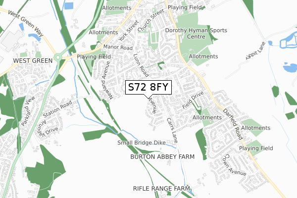
S72 8FY is located in the Cudworth electoral ward, within the metropolitan district of Barnsley and the English Parliamentary constituency of Barnsley East. The Sub Integrated Care Board (ICB) Location is NHS South Yorkshire ICB - 02P and the police force is South Yorkshire. This postcode has been in use since July 2018.


GetTheData
Source: OS Open Zoomstack (Ordnance Survey)
Licence: Open Government Licence (requires attribution)
Attribution: Contains OS data © Crown copyright and database right 2025
Source: Open Postcode Geo
Licence: Open Government Licence (requires attribution)
Attribution: Contains OS data © Crown copyright and database right 2025; Contains Royal Mail data © Royal Mail copyright and database right 2025; Source: Office for National Statistics licensed under the Open Government Licence v.3.0
| Easting | 438706 |
| Northing | 408286 |
| Latitude | 53.569777 |
| Longitude | -1.417016 |
GetTheData
Source: Open Postcode Geo
Licence: Open Government Licence
| Country | England |
| Postcode District | S72 |
➜ See where S72 is on a map ➜ Where is Cudworth? | |
GetTheData
Source: Land Registry Price Paid Data
Licence: Open Government Licence
| Ward | Cudworth |
| Constituency | Barnsley East |
GetTheData
Source: ONS Postcode Database
Licence: Open Government Licence
2024 18 OCT £262,500 |
59, CARRS AVENUE, CUDWORTH, BARNSLEY, S72 8FY 2022 25 NOV £362,995 |
90, CARRS AVENUE, CUDWORTH, BARNSLEY, S72 8FY 2022 23 SEP £323,495 |
88, CARRS AVENUE, CUDWORTH, BARNSLEY, S72 8FY 2022 23 SEP £289,995 |
86, CARRS AVENUE, CUDWORTH, BARNSLEY, S72 8FY 2022 9 SEP £270,995 |
2022 24 JUN £254,995 |
70, CARRS AVENUE, CUDWORTH, BARNSLEY, S72 8FY 2022 24 JUN £264,995 |
74, CARRS AVENUE, CUDWORTH, BARNSLEY, S72 8FY 2022 24 JUN £274,995 |
2021 16 JUN £240,000 |
64, CARRS AVENUE, CUDWORTH, BARNSLEY, S72 8FY 2021 4 JUN £249,995 |
GetTheData
Source: HM Land Registry Price Paid Data
Licence: Contains HM Land Registry data © Crown copyright and database right 2025. This data is licensed under the Open Government Licence v3.0.
| Newtown Avenue (Lunn Road) | Cudworth | 186m |
| Quarry Vale (White Cross Road) | Cudworth | 203m |
| Wells Street (Lunn Road) | Cudworth | 301m |
| Wells Street (Lunn Road) | Cudworth | 365m |
| White Cross Road (Darfield Road) | Cudworth | 422m |
| Barnsley Station | 4.3km |
GetTheData
Source: NaPTAN
Licence: Open Government Licence
| Percentage of properties with Next Generation Access | 100.0% |
| Percentage of properties with Superfast Broadband | 100.0% |
| Percentage of properties with Ultrafast Broadband | 100.0% |
| Percentage of properties with Full Fibre Broadband | 98.0% |
Superfast Broadband is between 30Mbps and 300Mbps
Ultrafast Broadband is > 300Mbps
| Percentage of properties unable to receive 2Mbps | 0.0% |
| Percentage of properties unable to receive 5Mbps | 0.0% |
| Percentage of properties unable to receive 10Mbps | 0.0% |
| Percentage of properties unable to receive 30Mbps | 0.0% |
GetTheData
Source: Ofcom
Licence: Ofcom Terms of Use (requires attribution)
GetTheData
Source: ONS Postcode Database
Licence: Open Government Licence


➜ Get more ratings from the Food Standards Agency
GetTheData
Source: Food Standards Agency
Licence: FSA terms & conditions
| Last Collection | |||
|---|---|---|---|
| Location | Mon-Fri | Sat | Distance |
| Manor Road | 16:00 | 11:45 | 432m |
| Snydale Road | 16:00 | 09:00 | 480m |
| Darfield Road | 16:00 | 09:00 | 530m |
GetTheData
Source: Dracos
Licence: Creative Commons Attribution-ShareAlike
The below table lists the International Territorial Level (ITL) codes (formerly Nomenclature of Territorial Units for Statistics (NUTS) codes) and Local Administrative Units (LAU) codes for S72 8FY:
| ITL 1 Code | Name |
|---|---|
| TLE | Yorkshire and The Humber |
| ITL 2 Code | Name |
| TLE3 | South Yorkshire |
| ITL 3 Code | Name |
| TLE31 | Barnsley, Doncaster and Rotherham |
| LAU 1 Code | Name |
| E08000016 | Barnsley |
GetTheData
Source: ONS Postcode Directory
Licence: Open Government Licence
The below table lists the Census Output Area (OA), Lower Layer Super Output Area (LSOA), and Middle Layer Super Output Area (MSOA) for S72 8FY:
| Code | Name | |
|---|---|---|
| OA | E00037225 | |
| LSOA | E01007347 | Barnsley 008D |
| MSOA | E02001516 | Barnsley 008 |
GetTheData
Source: ONS Postcode Directory
Licence: Open Government Licence
| S72 8EJ | Carrs Lane | 71m |
| S72 8DZ | Newtown Avenue | 132m |
| S72 8EL | Low Cudworth Green | 141m |
| S72 8DX | Newtown Avenue | 142m |
| S72 8XB | Newland Avenue | 147m |
| S72 8EA | White Cross Road | 171m |
| S72 8EF | Low Cudworth Green | 178m |
| S72 8DS | Lunn Road | 193m |
| S72 8EQ | Carrs Lane | 195m |
| S72 8DU | Newtown Green | 220m |
GetTheData
Source: Open Postcode Geo; Land Registry Price Paid Data
Licence: Open Government Licence