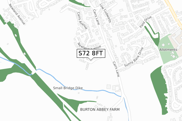
S72 8FT is located in the Cudworth electoral ward, within the metropolitan district of Barnsley and the English Parliamentary constituency of Barnsley East. The Sub Integrated Care Board (ICB) Location is NHS South Yorkshire ICB - 02P and the police force is South Yorkshire. This postcode has been in use since April 2020.


GetTheData
Source: OS Open Zoomstack (Ordnance Survey)
Licence: Open Government Licence (requires attribution)
Attribution: Contains OS data © Crown copyright and database right 2025
Source: Open Postcode Geo
Licence: Open Government Licence (requires attribution)
Attribution: Contains OS data © Crown copyright and database right 2025; Contains Royal Mail data © Royal Mail copyright and database right 2025; Source: Office for National Statistics licensed under the Open Government Licence v.3.0
| Easting | 438779 |
| Northing | 408051 |
| Latitude | 53.567659 |
| Longitude | -1.415943 |
GetTheData
Source: Open Postcode Geo
Licence: Open Government Licence
| Country | England |
| Postcode District | S72 |
➜ See where S72 is on a map ➜ Where is Cudworth? | |
GetTheData
Source: Land Registry Price Paid Data
Licence: Open Government Licence
| Ward | Cudworth |
| Constituency | Barnsley East |
GetTheData
Source: ONS Postcode Database
Licence: Open Government Licence
2022 14 JUL £325,000 |
2022 18 FEB £218,000 |
2020 28 AUG £265,996 |
10, RING FARM VIEW, CUDWORTH, BARNSLEY, S72 8FT 2020 31 JUL £269,995 |
6, RING FARM VIEW, CUDWORTH, BARNSLEY, S72 8FT 2020 31 JUL £229,995 |
8, RING FARM VIEW, CUDWORTH, BARNSLEY, S72 8FT 2020 17 JUL £237,995 |
17, RING FARM VIEW, CUDWORTH, BARNSLEY, S72 8FT 2020 3 JUL £299,995 |
4, RING FARM VIEW, CUDWORTH, BARNSLEY, S72 8FT 2020 26 JUN £264,995 |
15, RING FARM VIEW, CUDWORTH, BARNSLEY, S72 8FT 2020 12 JUN £234,995 |
11, RING FARM VIEW, CUDWORTH, BARNSLEY, S72 8FT 2020 12 JUN £231,995 |
GetTheData
Source: HM Land Registry Price Paid Data
Licence: Contains HM Land Registry data © Crown copyright and database right 2025. This data is licensed under the Open Government Licence v3.0.
| Quarry Vale (White Cross Road) | Cudworth | 403m |
| Newtown Avenue (Lunn Road) | Cudworth | 430m |
| West View (Darfield Road) | Cudworth | 518m |
| West View (Darfield Road) | Cudworth | 537m |
| White Cross Road (Darfield Road) | Cudworth | 545m |
| Barnsley Station | 4.3km |
GetTheData
Source: NaPTAN
Licence: Open Government Licence
GetTheData
Source: ONS Postcode Database
Licence: Open Government Licence


➜ Get more ratings from the Food Standards Agency
GetTheData
Source: Food Standards Agency
Licence: FSA terms & conditions
| Last Collection | |||
|---|---|---|---|
| Location | Mon-Fri | Sat | Distance |
| Darfield Road | 16:00 | 09:00 | 515m |
| Snydale Road | 16:00 | 09:00 | 666m |
| Manor Road | 16:00 | 11:45 | 678m |
GetTheData
Source: Dracos
Licence: Creative Commons Attribution-ShareAlike
The below table lists the International Territorial Level (ITL) codes (formerly Nomenclature of Territorial Units for Statistics (NUTS) codes) and Local Administrative Units (LAU) codes for S72 8FT:
| ITL 1 Code | Name |
|---|---|
| TLE | Yorkshire and The Humber |
| ITL 2 Code | Name |
| TLE3 | South Yorkshire |
| ITL 3 Code | Name |
| TLE31 | Barnsley, Doncaster and Rotherham |
| LAU 1 Code | Name |
| E08000016 | Barnsley |
GetTheData
Source: ONS Postcode Directory
Licence: Open Government Licence
The below table lists the Census Output Area (OA), Lower Layer Super Output Area (LSOA), and Middle Layer Super Output Area (MSOA) for S72 8FT:
| Code | Name | |
|---|---|---|
| OA | E00037225 | |
| LSOA | E01007347 | Barnsley 008D |
| MSOA | E02001516 | Barnsley 008 |
GetTheData
Source: ONS Postcode Directory
Licence: Open Government Licence
| S72 8EQ | Carrs Lane | 165m |
| S72 8JH | Woodland View | 213m |
| S72 8SL | Lakeland Close | 253m |
| S72 8EJ | Carrs Lane | 258m |
| S72 8XB | Newland Avenue | 272m |
| S72 8EF | Low Cudworth Green | 278m |
| S72 8JG | Sunny Bank Drive | 297m |
| S72 8SJ | Abbey Farm View | 305m |
| S72 8RH | Field Drive | 328m |
| S72 8EL | Low Cudworth Green | 332m |
GetTheData
Source: Open Postcode Geo; Land Registry Price Paid Data
Licence: Open Government Licence