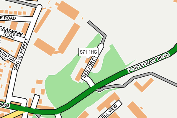
S71 1HG is located in the Central electoral ward, within the metropolitan district of Barnsley and the English Parliamentary constituency of Barnsley Central. The Sub Integrated Care Board (ICB) Location is NHS South Yorkshire ICB - 02P and the police force is South Yorkshire. This postcode has been in use since June 2001.


GetTheData
Source: OS OpenMap – Local (Ordnance Survey)
Source: OS VectorMap District (Ordnance Survey)
Licence: Open Government Licence (requires attribution)
| Easting | 435480 |
| Northing | 406214 |
| Latitude | 53.551364 |
| Longitude | -1.465956 |
GetTheData
Source: Open Postcode Geo
Licence: Open Government Licence
| Country | England |
| Postcode District | S71 |
➜ See where S71 is on a map ➜ Where is Barnsley? | |
GetTheData
Source: Land Registry Price Paid Data
Licence: Open Government Licence
Elevation or altitude of S71 1HG as distance above sea level:
| Metres | Feet | |
|---|---|---|
| Elevation | 70m | 230ft |
Elevation is measured from the approximate centre of the postcode, to the nearest point on an OS contour line from OS Terrain 50, which has contour spacing of ten vertical metres.
➜ How high above sea level am I? Find the elevation of your current position using your device's GPS.
GetTheData
Source: Open Postcode Elevation
Licence: Open Government Licence
| Ward | Central |
| Constituency | Barnsley Central |
GetTheData
Source: ONS Postcode Database
Licence: Open Government Licence
| Beevor Hall (Pontefract Road) | Hoyle Mill | 110m |
| Beevor Hall (Pontefract Road) | Hoyle Mill | 116m |
| Market Close (Pontefract Road) | Hoyle Mill | 384m |
| Market Close (Pontefract Road) | Hoyle Mill | 392m |
| Chilton Street (Doncaster Road) | Barnsley Town Centre | 422m |
| Barnsley Station | 0.8km |
| Dodworth Station | 4.4km |
| Wombwell Station | 5km |
GetTheData
Source: NaPTAN
Licence: Open Government Licence
GetTheData
Source: ONS Postcode Database
Licence: Open Government Licence


➜ Get more ratings from the Food Standards Agency
GetTheData
Source: Food Standards Agency
Licence: FSA terms & conditions
| Last Collection | |||
|---|---|---|---|
| Location | Mon-Fri | Sat | Distance |
| Oakwell Ins Services | 16:00 | 11:00 | 320m |
| St Peters Church | 18:30 | 11:00 | 452m |
| Post Office | 18:30 | 11:00 | 464m |
GetTheData
Source: Dracos
Licence: Creative Commons Attribution-ShareAlike
The below table lists the International Territorial Level (ITL) codes (formerly Nomenclature of Territorial Units for Statistics (NUTS) codes) and Local Administrative Units (LAU) codes for S71 1HG:
| ITL 1 Code | Name |
|---|---|
| TLE | Yorkshire and The Humber |
| ITL 2 Code | Name |
| TLE3 | South Yorkshire |
| ITL 3 Code | Name |
| TLE31 | Barnsley, Doncaster and Rotherham |
| LAU 1 Code | Name |
| E08000016 | Barnsley |
GetTheData
Source: ONS Postcode Directory
Licence: Open Government Licence
The below table lists the Census Output Area (OA), Lower Layer Super Output Area (LSOA), and Middle Layer Super Output Area (MSOA) for S71 1HG:
| Code | Name | |
|---|---|---|
| OA | E00168691 | |
| LSOA | E01007337 | Barnsley 015D |
| MSOA | E02001523 | Barnsley 015 |
GetTheData
Source: ONS Postcode Directory
Licence: Open Government Licence
| S71 1HH | Mount Osborne Industrial Park | 160m |
| S71 1DU | Oakwell Vale | 216m |
| S71 1EU | Grove Street | 239m |
| S71 1EZ | Pontefract Road | 244m |
| S71 1HA | Pontefract Road | 280m |
| S71 1EX | Grove Street | 283m |
| S71 1EJ | Coniston Road | 289m |
| S71 1ES | Grasmere Road | 301m |
| S71 1HD | Oakwell Terrace | 307m |
| S71 1EP | Rydal Terrace | 325m |
GetTheData
Source: Open Postcode Geo; Land Registry Price Paid Data
Licence: Open Government Licence