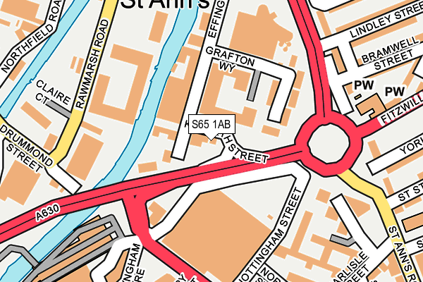
S65 1AB is located in the Boston Castle electoral ward, within the metropolitan district of Rotherham and the English Parliamentary constituency of Rotherham. The Sub Integrated Care Board (ICB) Location is NHS South Yorkshire ICB - 03L and the police force is South Yorkshire. This postcode has been in use since February 1990.


GetTheData
Source: OS OpenMap – Local (Ordnance Survey)
Source: OS VectorMap District (Ordnance Survey)
Licence: Open Government Licence (requires attribution)
| Easting | 443060 |
| Northing | 393348 |
| Latitude | 53.435162 |
| Longitude | -1.353316 |
GetTheData
Source: Open Postcode Geo
Licence: Open Government Licence
| Country | England |
| Postcode District | S65 |
➜ See where S65 is on a map ➜ Where is Rotherham? | |
GetTheData
Source: Land Registry Price Paid Data
Licence: Open Government Licence
Elevation or altitude of S65 1AB as distance above sea level:
| Metres | Feet | |
|---|---|---|
| Elevation | 30m | 98ft |
Elevation is measured from the approximate centre of the postcode, to the nearest point on an OS contour line from OS Terrain 50, which has contour spacing of ten vertical metres.
➜ How high above sea level am I? Find the elevation of your current position using your device's GPS.
GetTheData
Source: Open Postcode Elevation
Licence: Open Government Licence
| Ward | Boston Castle |
| Constituency | Rotherham |
GetTheData
Source: ONS Postcode Database
Licence: Open Government Licence
| Selborne Street (St Anns Road) | Rotherham Town Centre | 216m |
| Selborne Street (St Anns Road) | Rotherham Town Centre | 236m |
| Rawson Road (Fitzwilliam Road) | Rotherham Town Centre | 278m |
| Hatherley Road (Fitzwilliam Road) | Rotherham Town Centre | 290m |
| Rotherham Interchange (Corporation St) | Rotherham Town Centre | 297m |
| Rotherham Central Station | 0.6km |
| Meadowhall Station | 4.4km |
GetTheData
Source: NaPTAN
Licence: Open Government Licence
Estimated total energy consumption in S65 1AB by fuel type, 2015.
| Consumption (kWh) | 15,121 |
|---|---|
| Meter count | 14 |
| Mean (kWh/meter) | 1,080 |
| Median (kWh/meter) | 1,104 |
GetTheData
Source: Postcode level gas estimates: 2015 (experimental)
Source: Postcode level electricity estimates: 2015 (experimental)
Licence: Open Government Licence
GetTheData
Source: ONS Postcode Database
Licence: Open Government Licence


➜ Get more ratings from the Food Standards Agency
GetTheData
Source: Food Standards Agency
Licence: FSA terms & conditions
| Last Collection | |||
|---|---|---|---|
| Location | Mon-Fri | Sat | Distance |
| Ashley Business Court | 18:30 | 12:15 | 243m |
| Ashley Business Centre | 17:00 | 247m | |
| Wharncliffe Street | 16:00 | 12:00 | 251m |
GetTheData
Source: Dracos
Licence: Creative Commons Attribution-ShareAlike
The below table lists the International Territorial Level (ITL) codes (formerly Nomenclature of Territorial Units for Statistics (NUTS) codes) and Local Administrative Units (LAU) codes for S65 1AB:
| ITL 1 Code | Name |
|---|---|
| TLE | Yorkshire and The Humber |
| ITL 2 Code | Name |
| TLE3 | South Yorkshire |
| ITL 3 Code | Name |
| TLE31 | Barnsley, Doncaster and Rotherham |
| LAU 1 Code | Name |
| E08000018 | Rotherham |
GetTheData
Source: ONS Postcode Directory
Licence: Open Government Licence
The below table lists the Census Output Area (OA), Lower Layer Super Output Area (LSOA), and Middle Layer Super Output Area (MSOA) for S65 1AB:
| Code | Name | |
|---|---|---|
| OA | E00039083 | |
| LSOA | E01007714 | Rotherham 017B |
| MSOA | E02001594 | Rotherham 017 |
GetTheData
Source: ONS Postcode Directory
Licence: Open Government Licence
| S65 1BL | Effingham Street | 97m |
| S60 1RU | Rawmarsh Road | 159m |
| S65 1HN | Spring Walk | 210m |
| S65 1SA | St Anns Road | 212m |
| S65 1HY | Drummond Street | 225m |
| S65 1PN | St Anns Road | 229m |
| S65 1RL | St Anns Road | 232m |
| S65 1HP | Norfolk Court | 241m |
| S65 1AL | Effingham Street | 262m |
| S65 1RZ | Bramwell Street | 283m |
GetTheData
Source: Open Postcode Geo; Land Registry Price Paid Data
Licence: Open Government Licence