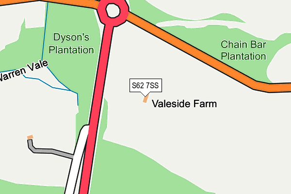
S62 7SS is located in the Rawmarsh East electoral ward, within the metropolitan district of Rotherham and the English Parliamentary constituency of Wentworth and Dearne. The Sub Integrated Care Board (ICB) Location is NHS South Yorkshire ICB - 03L and the police force is South Yorkshire. This postcode has been in use since January 1980.


GetTheData
Source: OS OpenMap – Local (Ordnance Survey)
Source: OS VectorMap District (Ordnance Survey)
Licence: Open Government Licence (requires attribution)
| Easting | 444200 |
| Northing | 397684 |
| Latitude | 53.474058 |
| Longitude | -1.335552 |
GetTheData
Source: Open Postcode Geo
Licence: Open Government Licence
| Country | England |
| Postcode District | S62 |
➜ See where S62 is on a map | |
GetTheData
Source: Land Registry Price Paid Data
Licence: Open Government Licence
Elevation or altitude of S62 7SS as distance above sea level:
| Metres | Feet | |
|---|---|---|
| Elevation | 60m | 197ft |
Elevation is measured from the approximate centre of the postcode, to the nearest point on an OS contour line from OS Terrain 50, which has contour spacing of ten vertical metres.
➜ How high above sea level am I? Find the elevation of your current position using your device's GPS.
GetTheData
Source: Open Postcode Elevation
Licence: Open Government Licence
| Ward | Rawmarsh East |
| Constituency | Wentworth And Dearne |
GetTheData
Source: ONS Postcode Database
Licence: Open Government Licence
| Old Warren Vale (Warren Vale) | Rawmarsh | 160m |
| Old Warren Vale (Warren Vale) | Rawmarsh | 201m |
| Wentworth Road (Warren Vale) | Warren Vale | 249m |
| Wentworth Road (Warren Vale) | Warren Vale | 301m |
| Pipe House Lane (Thorogate) | Rawmarsh | 420m |
| Swinton (South Yorks) Station | 2.4km |
| Mexborough Station | 3.6km |
| Rotherham Central Station | 4.9km |
GetTheData
Source: NaPTAN
Licence: Open Government Licence
GetTheData
Source: ONS Postcode Database
Licence: Open Government Licence


➜ Get more ratings from the Food Standards Agency
GetTheData
Source: Food Standards Agency
Licence: FSA terms & conditions
| Last Collection | |||
|---|---|---|---|
| Location | Mon-Fri | Sat | Distance |
| Sandhill Post Office | 17:00 | 11:30 | 742m |
| Monkwood Post Office | 17:00 | 11:45 | 851m |
| 2 Thackeray Avenue | 16:00 | 11:30 | 954m |
GetTheData
Source: Dracos
Licence: Creative Commons Attribution-ShareAlike
The below table lists the International Territorial Level (ITL) codes (formerly Nomenclature of Territorial Units for Statistics (NUTS) codes) and Local Administrative Units (LAU) codes for S62 7SS:
| ITL 1 Code | Name |
|---|---|
| TLE | Yorkshire and The Humber |
| ITL 2 Code | Name |
| TLE3 | South Yorkshire |
| ITL 3 Code | Name |
| TLE31 | Barnsley, Doncaster and Rotherham |
| LAU 1 Code | Name |
| E08000018 | Rotherham |
GetTheData
Source: ONS Postcode Directory
Licence: Open Government Licence
The below table lists the Census Output Area (OA), Lower Layer Super Output Area (LSOA), and Middle Layer Super Output Area (MSOA) for S62 7SS:
| Code | Name | |
|---|---|---|
| OA | E00039377 | |
| LSOA | E01007771 | Rotherham 006A |
| MSOA | E02001583 | Rotherham 006 |
GetTheData
Source: ONS Postcode Directory
Licence: Open Government Licence
| S62 7HL | Pipehouse Lane | 337m |
| S62 7PR | Hague Avenue | 413m |
| S62 7QA | Hague Avenue | 435m |
| S62 7PZ | Hague Avenue | 462m |
| S62 7HN | Thorogate | 464m |
| S62 7QZ | Burkinshaw Avenue | 499m |
| S62 7QT | Kempwell Drive | 500m |
| S62 7QU | Burkinshaw Avenue | 500m |
| S62 5QJ | Bradlea Rise | 510m |
| S62 5QL | Queen Street | 538m |
GetTheData
Source: Open Postcode Geo; Land Registry Price Paid Data
Licence: Open Government Licence