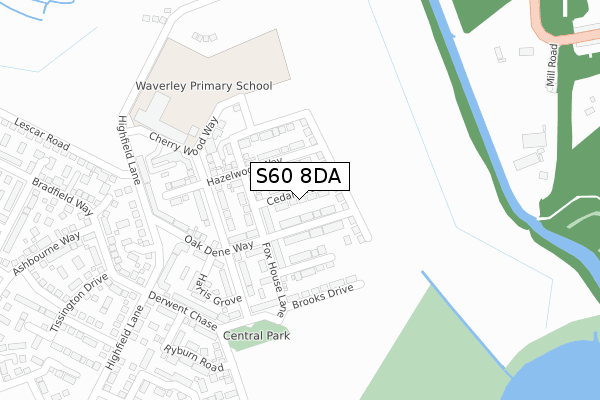
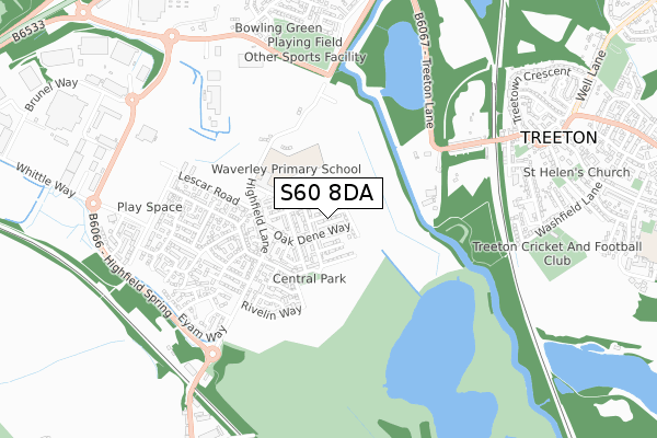
S60 8DA is located in the Rother Vale electoral ward, within the metropolitan district of Rotherham and the English Parliamentary constituency of Rother Valley. The Sub Integrated Care Board (ICB) Location is NHS South Yorkshire ICB - 03L and the police force is South Yorkshire. This postcode has been in use since December 2018.


GetTheData
Source: OS Open Zoomstack (Ordnance Survey)
Licence: Open Government Licence (requires attribution)
Attribution: Contains OS data © Crown copyright and database right 2025
Source: Open Postcode Geo
Licence: Open Government Licence (requires attribution)
Attribution: Contains OS data © Crown copyright and database right 2025; Contains Royal Mail data © Royal Mail copyright and database right 2025; Source: Office for National Statistics licensed under the Open Government Licence v.3.0
| Easting | 442315 |
| Northing | 387529 |
| Latitude | 53.382939 |
| Longitude | -1.365308 |
GetTheData
Source: Open Postcode Geo
Licence: Open Government Licence
| Country | England |
| Postcode District | S60 |
➜ See where S60 is on a map ➜ Where is Waverley? | |
GetTheData
Source: Land Registry Price Paid Data
Licence: Open Government Licence
| Ward | Rother Vale |
| Constituency | Rother Valley |
GetTheData
Source: ONS Postcode Database
Licence: Open Government Licence
17, CEDAR GROVE, WAVERLEY, ROTHERHAM, S60 8DA 2019 25 OCT £302,950 |
13, CEDAR GROVE, WAVERLEY, ROTHERHAM, S60 8DA 2019 25 OCT £278,950 |
23, CEDAR GROVE, WAVERLEY, ROTHERHAM, S60 8DA 2019 25 OCT £299,950 |
GetTheData
Source: HM Land Registry Price Paid Data
Licence: Contains HM Land Registry data © Crown copyright and database right 2025. This data is licensed under the Open Government Licence v3.0.
| Mill Lane (Treeton Lane) | Treeton | 498m |
| Treeton Lane (Mill Lane) | Treeton | 584m |
| Poplar Way (Orgreave Road) | Catcliffe | 611m |
| Sheffield Lane (Poplar Way) | Catcliffe | 747m |
| Arundel Street (Station Road) | Treeton | 749m |
| Woodhouse Station | 2.2km |
| Darnall Station | 3.1km |
| Meadowhall Station | 5km |
GetTheData
Source: NaPTAN
Licence: Open Government Licence
| Percentage of properties with Next Generation Access | 100.0% |
| Percentage of properties with Superfast Broadband | 100.0% |
| Percentage of properties with Ultrafast Broadband | 100.0% |
| Percentage of properties with Full Fibre Broadband | 100.0% |
Superfast Broadband is between 30Mbps and 300Mbps
Ultrafast Broadband is > 300Mbps
| Percentage of properties unable to receive 2Mbps | 0.0% |
| Percentage of properties unable to receive 5Mbps | 0.0% |
| Percentage of properties unable to receive 10Mbps | 0.0% |
| Percentage of properties unable to receive 30Mbps | 0.0% |
GetTheData
Source: Ofcom
Licence: Ofcom Terms of Use (requires attribution)
GetTheData
Source: ONS Postcode Database
Licence: Open Government Licence


➜ Get more ratings from the Food Standards Agency
GetTheData
Source: Food Standards Agency
Licence: FSA terms & conditions
| Last Collection | |||
|---|---|---|---|
| Location | Mon-Fri | Sat | Distance |
| Station Road | 16:00 | 10:30 | 749m |
| Sheffield Lane | 16:00 | 10:30 | 860m |
| Treeton Post Office | 17:00 | 12:00 | 978m |
GetTheData
Source: Dracos
Licence: Creative Commons Attribution-ShareAlike
The below table lists the International Territorial Level (ITL) codes (formerly Nomenclature of Territorial Units for Statistics (NUTS) codes) and Local Administrative Units (LAU) codes for S60 8DA:
| ITL 1 Code | Name |
|---|---|
| TLE | Yorkshire and The Humber |
| ITL 2 Code | Name |
| TLE3 | South Yorkshire |
| ITL 3 Code | Name |
| TLE31 | Barnsley, Doncaster and Rotherham |
| LAU 1 Code | Name |
| E08000018 | Rotherham |
GetTheData
Source: ONS Postcode Directory
Licence: Open Government Licence
The below table lists the Census Output Area (OA), Lower Layer Super Output Area (LSOA), and Middle Layer Super Output Area (MSOA) for S60 8DA:
| Code | Name | |
|---|---|---|
| OA | E00038874 | |
| LSOA | E01007665 | Rotherham 027A |
| MSOA | E02001604 | Rotherham 027 |
GetTheData
Source: ONS Postcode Directory
Licence: Open Government Licence
| S60 8BE | Oak Dene Way | 131m |
| S60 8BB | Waverley Walk | 177m |
| S60 8AL | Highfield Lane | 278m |
| S60 8AU | Ryburn Road | 318m |
| S60 8DL | Bradfield Way | 321m |
| S60 8AY | Highfield Square | 366m |
| S60 8AW | Loxley Road | 390m |
| S60 8AX | Rivelin Way | 399m |
| S60 8AP | Tissington Drive | 423m |
| S60 8AQ | Castleton Way | 431m |
GetTheData
Source: Open Postcode Geo; Land Registry Price Paid Data
Licence: Open Government Licence