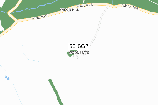
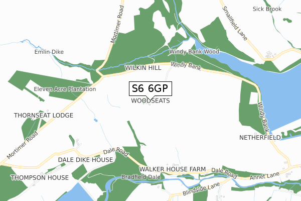
S6 6GP is located in the Stannington electoral ward, within the metropolitan district of Sheffield and the English Parliamentary constituency of Sheffield, Hallam. The Sub Integrated Care Board (ICB) Location is NHS South Yorkshire ICB - 03N and the police force is South Yorkshire. This postcode has been in use since January 2018.


GetTheData
Source: OS Open Zoomstack (Ordnance Survey)
Licence: Open Government Licence (requires attribution)
Attribution: Contains OS data © Crown copyright and database right 2025
Source: Open Postcode Geo
Licence: Open Government Licence (requires attribution)
Attribution: Contains OS data © Crown copyright and database right 2025; Contains Royal Mail data © Royal Mail copyright and database right 2025; Source: Office for National Statistics licensed under the Open Government Licence v.3.0
| Easting | 424874 |
| Northing | 392453 |
| Latitude | 53.428302 |
| Longitude | -1.627119 |
GetTheData
Source: Open Postcode Geo
Licence: Open Government Licence
| Country | England |
| Postcode District | S6 |
➜ See where S6 is on a map | |
GetTheData
Source: Land Registry Price Paid Data
Licence: Open Government Licence
| Ward | Stannington |
| Constituency | Sheffield, Hallam |
GetTheData
Source: ONS Postcode Database
Licence: Open Government Licence
| Thompson House Green (Dale Road) | Low Bradfield | 692m |
| Thompson House Green (Dale Road) | Low Bradfield | 693m |
| Annet Lane (Dale Road) | Low Bradfield | 897m |
| Blindside Lane (Dale Road) | Low Bradfield | 897m |
| Annet Lane (Fair House Lane) | Low Bradfield | 1,307m |
GetTheData
Source: NaPTAN
Licence: Open Government Licence
| Percentage of properties with Next Generation Access | 100.0% |
| Percentage of properties with Superfast Broadband | 0.0% |
| Percentage of properties with Ultrafast Broadband | 0.0% |
| Percentage of properties with Full Fibre Broadband | 0.0% |
Superfast Broadband is between 30Mbps and 300Mbps
Ultrafast Broadband is > 300Mbps
| Percentage of properties unable to receive 2Mbps | 0.0% |
| Percentage of properties unable to receive 5Mbps | 0.0% |
| Percentage of properties unable to receive 10Mbps | 0.0% |
| Percentage of properties unable to receive 30Mbps | 100.0% |
GetTheData
Source: Ofcom
Licence: Ofcom Terms of Use (requires attribution)
GetTheData
Source: ONS Postcode Database
Licence: Open Government Licence


➜ Get more ratings from the Food Standards Agency
GetTheData
Source: Food Standards Agency
Licence: FSA terms & conditions
| Last Collection | |||
|---|---|---|---|
| Location | Mon-Fri | Sat | Distance |
| Bradfield Post Office | 16:00 | 11:30 | 1,554m |
| Towngate | 16:15 | 11:30 | 1,962m |
| Ughill | 16:00 | 11:30 | 2,239m |
GetTheData
Source: Dracos
Licence: Creative Commons Attribution-ShareAlike
The below table lists the International Territorial Level (ITL) codes (formerly Nomenclature of Territorial Units for Statistics (NUTS) codes) and Local Administrative Units (LAU) codes for S6 6GP:
| ITL 1 Code | Name |
|---|---|
| TLE | Yorkshire and The Humber |
| ITL 2 Code | Name |
| TLE3 | South Yorkshire |
| ITL 3 Code | Name |
| TLE32 | Sheffield |
| LAU 1 Code | Name |
| E08000019 | Sheffield |
GetTheData
Source: ONS Postcode Directory
Licence: Open Government Licence
The below table lists the Census Output Area (OA), Lower Layer Super Output Area (LSOA), and Middle Layer Super Output Area (MSOA) for S6 6GP:
| Code | Name | |
|---|---|---|
| OA | E00041195 | |
| LSOA | E01008128 | Sheffield 008C |
| MSOA | E02001618 | Sheffield 008 |
GetTheData
Source: ONS Postcode Directory
Licence: Open Government Licence
| S6 6LE | 1096m | |
| S6 6LB | 1602m | |
| S6 6LG | High Bradfield | 1983m |
| S6 6HY | 2000m | |
| S6 6HW | New Road | 2013m |
| S6 6JN | Agden | 2043m |
| S6 6HX | Old Coach Road | 2235m |
| S6 6HU | Ughill | 2256m |
| S6 6LJ | High Bradfield | 2464m |
| S6 6JE | Strines | 3172m |
GetTheData
Source: Open Postcode Geo; Land Registry Price Paid Data
Licence: Open Government Licence