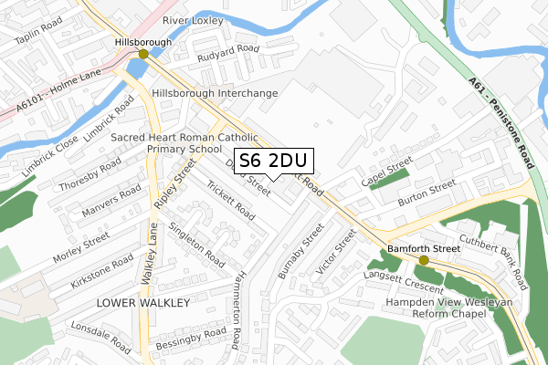
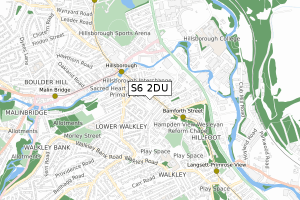
S6 2DU is located in the Walkley electoral ward, within the metropolitan district of Sheffield and the English Parliamentary constituency of Sheffield Central. The Sub Integrated Care Board (ICB) Location is NHS South Yorkshire ICB - 03N and the police force is South Yorkshire. This postcode has been in use since February 2019.


GetTheData
Source: OS Open Zoomstack (Ordnance Survey)
Licence: Open Government Licence (requires attribution)
Attribution: Contains OS data © Crown copyright and database right 2025
Source: Open Postcode Geo
Licence: Open Government Licence (requires attribution)
Attribution: Contains OS data © Crown copyright and database right 2025; Contains Royal Mail data © Royal Mail copyright and database right 2025; Source: Office for National Statistics licensed under the Open Government Licence v.3.0
| Easting | 433525 |
| Northing | 389391 |
| Latitude | 53.400303 |
| Longitude | -1.497252 |
GetTheData
Source: Open Postcode Geo
Licence: Open Government Licence
| Country | England |
| Postcode District | S6 |
➜ See where S6 is on a map ➜ Where is Sheffield? | |
GetTheData
Source: Land Registry Price Paid Data
Licence: Open Government Licence
| Ward | Walkley |
| Constituency | Sheffield Central |
GetTheData
Source: ONS Postcode Database
Licence: Open Government Licence
| Hatton Road (Langsett Road) | Hillsborough | 52m |
| Dodd Street (Ripley Street) | Hillsborough | 145m |
| Hillsborough Interchange (Langsett Road) | Hillsborough | 193m |
| Freedom Court (Langsett Crescent) | Langsett Estate | 212m |
| Langsett Road (Forbes Road) | Hillsborough | 222m |
| Hillsborough (Sheffield Supertram) (Langsett Road) | Hillsborough | 263m |
| Bamforth Street (Sheffield Supertram) (Langsett Road) | Langsett Road | 347m |
| Hillsborough Park (Sheffield Supertram) (Middlewood Road) | Hillsborough | 625m |
| Langsett - Primrose View (Sheffield Supertram) (Langsett Road) | Langsett Road | 728m |
| Malin Bridge (Sheffield Supertram) (Holme Lane) | Malin Bridge | 736m |
| Sheffield Station | 3.4km |
GetTheData
Source: NaPTAN
Licence: Open Government Licence
| Percentage of properties with Next Generation Access | 100.0% |
| Percentage of properties with Superfast Broadband | 100.0% |
| Percentage of properties with Ultrafast Broadband | 0.0% |
| Percentage of properties with Full Fibre Broadband | 0.0% |
Superfast Broadband is between 30Mbps and 300Mbps
Ultrafast Broadband is > 300Mbps
| Percentage of properties unable to receive 2Mbps | 0.0% |
| Percentage of properties unable to receive 5Mbps | 0.0% |
| Percentage of properties unable to receive 10Mbps | 0.0% |
| Percentage of properties unable to receive 30Mbps | 0.0% |
GetTheData
Source: Ofcom
Licence: Ofcom Terms of Use (requires attribution)
GetTheData
Source: ONS Postcode Database
Licence: Open Government Licence


➜ Get more ratings from the Food Standards Agency
GetTheData
Source: Food Standards Agency
Licence: FSA terms & conditions
| Last Collection | |||
|---|---|---|---|
| Location | Mon-Fri | Sat | Distance |
| W Morrisons | 17:30 | 09:00 | 159m |
| Rudyard Road | 18:00 | 09:00 | 262m |
| 2 Burnaby Court | 18:00 | 09:00 | 278m |
GetTheData
Source: Dracos
Licence: Creative Commons Attribution-ShareAlike
The below table lists the International Territorial Level (ITL) codes (formerly Nomenclature of Territorial Units for Statistics (NUTS) codes) and Local Administrative Units (LAU) codes for S6 2DU:
| ITL 1 Code | Name |
|---|---|
| TLE | Yorkshire and The Humber |
| ITL 2 Code | Name |
| TLE3 | South Yorkshire |
| ITL 3 Code | Name |
| TLE32 | Sheffield |
| LAU 1 Code | Name |
| E08000019 | Sheffield |
GetTheData
Source: ONS Postcode Directory
Licence: Open Government Licence
The below table lists the Census Output Area (OA), Lower Layer Super Output Area (LSOA), and Middle Layer Super Output Area (MSOA) for S6 2DU:
| Code | Name | |
|---|---|---|
| OA | E00041332 | |
| LSOA | E01008161 | Sheffield 026E |
| MSOA | E02001636 | Sheffield 026 |
GetTheData
Source: ONS Postcode Directory
Licence: Open Government Licence
| S6 2LJ | Langsett Road | 44m |
| S6 2NR | Dodd Street | 61m |
| S6 2LL | Langsett Road | 86m |
| S6 2NP | Trickett Road | 102m |
| S6 2NA | Hammerton Road | 107m |
| S6 2NN | Singleton Grove | 114m |
| S6 2RA | Burnaby Street | 120m |
| S6 2NL | Singleton Crescent | 133m |
| S6 2UG | Langsett Road | 147m |
| S6 2SA | Victor Street | 158m |
GetTheData
Source: Open Postcode Geo; Land Registry Price Paid Data
Licence: Open Government Licence