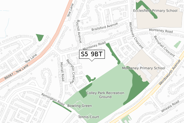
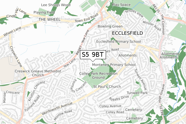
S5 9BT is located in the East Ecclesfield electoral ward, within the metropolitan district of Sheffield and the English Parliamentary constituency of Penistone and Stocksbridge. The Sub Integrated Care Board (ICB) Location is NHS South Yorkshire ICB - 03N and the police force is South Yorkshire. This postcode has been in use since August 2019.


GetTheData
Source: OS Open Zoomstack (Ordnance Survey)
Licence: Open Government Licence (requires attribution)
Attribution: Contains OS data © Crown copyright and database right 2025
Source: Open Postcode Geo
Licence: Open Government Licence (requires attribution)
Attribution: Contains OS data © Crown copyright and database right 2025; Contains Royal Mail data © Royal Mail copyright and database right 2025; Source: Office for National Statistics licensed under the Open Government Licence v.3.0
| Easting | 435155 |
| Northing | 393364 |
| Latitude | 53.435907 |
| Longitude | -1.472296 |
GetTheData
Source: Open Postcode Geo
Licence: Open Government Licence
| Country | England |
| Postcode District | S5 |
➜ See where S5 is on a map ➜ Where is Sheffield? | |
GetTheData
Source: Land Registry Price Paid Data
Licence: Open Government Licence
| Ward | East Ecclesfield |
| Constituency | Penistone And Stocksbridge |
GetTheData
Source: ONS Postcode Database
Licence: Open Government Licence
2024 28 JUN £245,000 |
10, AXE EDGE CLOSE, SHEFFIELD, S5 9BT 2022 11 MAR £214,995 |
2021 5 NOV £206,995 |
11, AXE EDGE CLOSE, SHEFFIELD, S5 9BT 2021 27 OCT £210,995 |
GetTheData
Source: HM Land Registry Price Paid Data
Licence: Contains HM Land Registry data © Crown copyright and database right 2025. This data is licensed under the Open Government Licence v3.0.
| Morrell Road (Monteney Road) | Parson Cross | 122m |
| Yew Lane (Morrall Road) | Parson Cross | 182m |
| Monteney Gardens (Monteney Road) | Ecclesfield | 214m |
| Morrall Road (Remington Road) | Parson Cross | 249m |
| Monteney Crescent (Monteney Road) | Ecclesfield | 267m |
| Chapeltown Station | 3km |
| Meadowhall Station | 4.5km |
GetTheData
Source: NaPTAN
Licence: Open Government Licence
GetTheData
Source: ONS Postcode Database
Licence: Open Government Licence


➜ Get more ratings from the Food Standards Agency
GetTheData
Source: Food Standards Agency
Licence: FSA terms & conditions
| Last Collection | |||
|---|---|---|---|
| Location | Mon-Fri | Sat | Distance |
| 65 Monteney Crescent | 17:30 | 09:30 | 306m |
| Coppin Square | 17:30 | 09:15 | 376m |
| Wheata Road | 17:30 | 09:30 | 418m |
GetTheData
Source: Dracos
Licence: Creative Commons Attribution-ShareAlike
The below table lists the International Territorial Level (ITL) codes (formerly Nomenclature of Territorial Units for Statistics (NUTS) codes) and Local Administrative Units (LAU) codes for S5 9BT:
| ITL 1 Code | Name |
|---|---|
| TLE | Yorkshire and The Humber |
| ITL 2 Code | Name |
| TLE3 | South Yorkshire |
| ITL 3 Code | Name |
| TLE32 | Sheffield |
| LAU 1 Code | Name |
| E08000019 | Sheffield |
GetTheData
Source: ONS Postcode Directory
Licence: Open Government Licence
The below table lists the Census Output Area (OA), Lower Layer Super Output Area (LSOA), and Middle Layer Super Output Area (MSOA) for S5 9BT:
| Code | Name | |
|---|---|---|
| OA | E00040815 | |
| LSOA | E01008058 | Sheffield 006C |
| MSOA | E02001616 | Sheffield 006 |
GetTheData
Source: ONS Postcode Directory
Licence: Open Government Licence
| S5 9BP | High Stones Place | 61m |
| S5 9BQ | Britland Close | 71m |
| S5 9BN | Merryton Crescent | 103m |
| S5 9BR | Parkhouse Court | 132m |
| S5 9DU | Monteney Road | 138m |
| S5 9AJ | Morrall Road | 169m |
| S5 9DT | Monteney Road | 175m |
| S5 9DH | Butchill Avenue | 203m |
| S5 9DL | Brailsford Avenue | 206m |
| S5 9DY | Monteney Gardens | 212m |
GetTheData
Source: Open Postcode Geo; Land Registry Price Paid Data
Licence: Open Government Licence