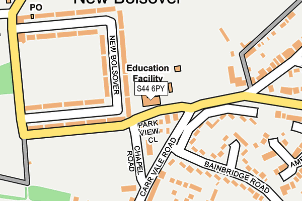
S44 6PY is located in the Bolsover South electoral ward, within the local authority district of Bolsover and the English Parliamentary constituency of Bolsover. The Sub Integrated Care Board (ICB) Location is NHS Derby and Derbyshire ICB - 15M and the police force is Derbyshire. This postcode has been in use since July 2002.


GetTheData
Source: OS OpenMap – Local (Ordnance Survey)
Source: OS VectorMap District (Ordnance Survey)
Licence: Open Government Licence (requires attribution)
| Easting | 446694 |
| Northing | 370270 |
| Latitude | 53.227428 |
| Longitude | -1.302014 |
GetTheData
Source: Open Postcode Geo
Licence: Open Government Licence
| Country | England |
| Postcode District | S44 |
➜ See where S44 is on a map ➜ Where is Bolsover? | |
GetTheData
Source: Land Registry Price Paid Data
Licence: Open Government Licence
Elevation or altitude of S44 6PY as distance above sea level:
| Metres | Feet | |
|---|---|---|
| Elevation | 100m | 328ft |
Elevation is measured from the approximate centre of the postcode, to the nearest point on an OS contour line from OS Terrain 50, which has contour spacing of ten vertical metres.
➜ How high above sea level am I? Find the elevation of your current position using your device's GPS.
GetTheData
Source: Open Postcode Elevation
Licence: Open Government Licence
| Ward | Bolsover South |
| Constituency | Bolsover |
GetTheData
Source: ONS Postcode Database
Licence: Open Government Licence
| Primary School (New Station Road) | New Bolsover | 56m |
| Chapel Road | Carr Vale | 98m |
| Chapel Road | Carr Vale | 124m |
| Carr Vale Road | Carr Vale | 125m |
| Carr Vale Road | Carr Vale | 130m |
GetTheData
Source: NaPTAN
Licence: Open Government Licence
GetTheData
Source: ONS Postcode Database
Licence: Open Government Licence


➜ Get more ratings from the Food Standards Agency
GetTheData
Source: Food Standards Agency
Licence: FSA terms & conditions
| Last Collection | |||
|---|---|---|---|
| Location | Mon-Fri | Sat | Distance |
| Castle Lane | 16:00 | 10:30 | 205m |
| Carr Vale | 16:00 | 11:00 | 333m |
| 17 Ridgedale Road | 16:00 | 10:45 | 492m |
GetTheData
Source: Dracos
Licence: Creative Commons Attribution-ShareAlike
The below table lists the International Territorial Level (ITL) codes (formerly Nomenclature of Territorial Units for Statistics (NUTS) codes) and Local Administrative Units (LAU) codes for S44 6PY:
| ITL 1 Code | Name |
|---|---|
| TLF | East Midlands (England) |
| ITL 2 Code | Name |
| TLF1 | Derbyshire and Nottinghamshire |
| ITL 3 Code | Name |
| TLF12 | East Derbyshire |
| LAU 1 Code | Name |
| E07000033 | Bolsover |
GetTheData
Source: ONS Postcode Directory
Licence: Open Government Licence
The below table lists the Census Output Area (OA), Lower Layer Super Output Area (LSOA), and Middle Layer Super Output Area (MSOA) for S44 6PY:
| Code | Name | |
|---|---|---|
| OA | E00098565 | |
| LSOA | E01019488 | Bolsover 004D |
| MSOA | E02004048 | Bolsover 004 |
GetTheData
Source: ONS Postcode Directory
Licence: Open Government Licence
| S44 6FN | Park View Close | 45m |
| S44 6PZ | New Bolsover | 95m |
| S44 6QB | New Bolsover | 114m |
| S44 6PX | Carr Vale Road | 144m |
| S44 6PU | New Station Road | 144m |
| S44 6QA | New Bolsover | 174m |
| S44 6UD | Bainbridge Road | 214m |
| S44 6QD | New Bolsover | 220m |
| S44 6FF | Croft House Way | 248m |
| S44 6RH | Keswick Close | 275m |
GetTheData
Source: Open Postcode Geo; Land Registry Price Paid Data
Licence: Open Government Licence