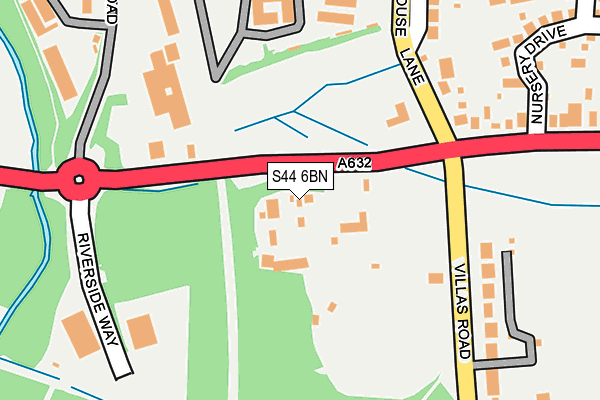
S44 6BN is located in the Bolsover South electoral ward, within the local authority district of Bolsover and the English Parliamentary constituency of Bolsover. The Sub Integrated Care Board (ICB) Location is NHS Derby and Derbyshire ICB - 15M and the police force is Derbyshire. This postcode has been in use since August 1992.


GetTheData
Source: OS OpenMap – Local (Ordnance Survey)
Source: OS VectorMap District (Ordnance Survey)
Licence: Open Government Licence (requires attribution)
| Easting | 446319 |
| Northing | 370767 |
| Latitude | 53.231946 |
| Longitude | -1.307557 |
GetTheData
Source: Open Postcode Geo
Licence: Open Government Licence
| Country | England |
| Postcode District | S44 |
➜ See where S44 is on a map ➜ Where is Bolsover? | |
GetTheData
Source: Land Registry Price Paid Data
Licence: Open Government Licence
Elevation or altitude of S44 6BN as distance above sea level:
| Metres | Feet | |
|---|---|---|
| Elevation | 80m | 262ft |
Elevation is measured from the approximate centre of the postcode, to the nearest point on an OS contour line from OS Terrain 50, which has contour spacing of ten vertical metres.
➜ How high above sea level am I? Find the elevation of your current position using your device's GPS.
GetTheData
Source: Open Postcode Elevation
Licence: Open Government Licence
| Ward | Bolsover South |
| Constituency | Bolsover |
GetTheData
Source: ONS Postcode Database
Licence: Open Government Licence
| Castle Arms (Station Road) | Bolsover | 77m |
| Castle Arms (Station Road) | Bolsover | 122m |
| Business Park (Station Road) | Bolsover | 142m |
| Business Park (Station Road) | Bolsover | 149m |
| Model Village (Villas Road) | New Bolsover | 309m |
GetTheData
Source: NaPTAN
Licence: Open Government Licence
GetTheData
Source: ONS Postcode Database
Licence: Open Government Licence


➜ Get more ratings from the Food Standards Agency
GetTheData
Source: Food Standards Agency
Licence: FSA terms & conditions
| Last Collection | |||
|---|---|---|---|
| Location | Mon-Fri | Sat | Distance |
| Woodhouse Lane | 16:00 | 10:00 | 193m |
| 19a Houfton Road | 16:00 | 10:00 | 423m |
| Leaholme / Chesterfield Road | 16:00 | 10:00 | 664m |
GetTheData
Source: Dracos
Licence: Creative Commons Attribution-ShareAlike
The below table lists the International Territorial Level (ITL) codes (formerly Nomenclature of Territorial Units for Statistics (NUTS) codes) and Local Administrative Units (LAU) codes for S44 6BN:
| ITL 1 Code | Name |
|---|---|
| TLF | East Midlands (England) |
| ITL 2 Code | Name |
| TLF1 | Derbyshire and Nottinghamshire |
| ITL 3 Code | Name |
| TLF12 | East Derbyshire |
| LAU 1 Code | Name |
| E07000033 | Bolsover |
GetTheData
Source: ONS Postcode Directory
Licence: Open Government Licence
The below table lists the Census Output Area (OA), Lower Layer Super Output Area (LSOA), and Middle Layer Super Output Area (MSOA) for S44 6BN:
| Code | Name | |
|---|---|---|
| OA | E00098565 | |
| LSOA | E01019488 | Bolsover 004D |
| MSOA | E02004048 | Bolsover 004 |
GetTheData
Source: ONS Postcode Directory
Licence: Open Government Licence
| S44 6BJ | Woodhouse Lane | 259m |
| S44 6QE | Villas Road | 274m |
| S44 6BH | Station Road | 282m |
| S44 6BP | Houfton Crescent | 320m |
| S44 6SW | Nursery Drive | 342m |
| S44 6QD | New Bolsover | 416m |
| S44 6BW | Houfton Road | 424m |
| S44 6BX | Farmfields Close | 440m |
| S44 6BY | Deepdale Road | 442m |
| S44 6SQ | Houldsworth Crescent | 442m |
GetTheData
Source: Open Postcode Geo; Land Registry Price Paid Data
Licence: Open Government Licence