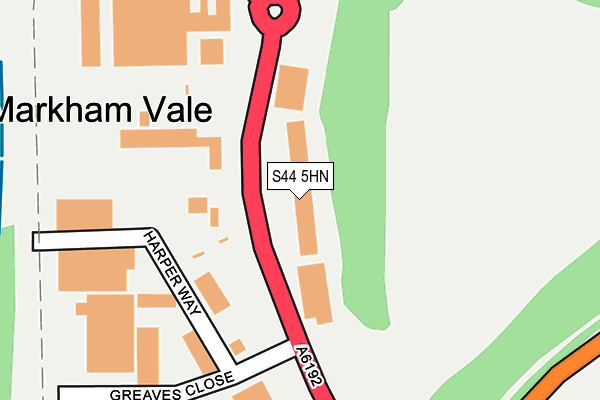
S44 5HN lies on Markham Lane in Markham Vale, Chesterfield. S44 5HN is located in the Staveley South electoral ward, within the local authority district of Chesterfield and the English Parliamentary constituency of Chesterfield. The Sub Integrated Care Board (ICB) Location is NHS Derby and Derbyshire ICB - 15M and the police force is Derbyshire. This postcode has been in use since October 2008.


GetTheData
Source: OS OpenMap – Local (Ordnance Survey)
Source: OS VectorMap District (Ordnance Survey)
Licence: Open Government Licence (requires attribution)
| Easting | 444973 |
| Northing | 371567 |
| Latitude | 53.239252 |
| Longitude | -1.327607 |
GetTheData
Source: Open Postcode Geo
Licence: Open Government Licence
| Street | Markham Lane |
| Locality | Markham Vale |
| Town/City | Chesterfield |
| Country | England |
| Postcode District | S44 |
➜ See where S44 is on a map ➜ Where is Markham Vale? | |
GetTheData
Source: Land Registry Price Paid Data
Licence: Open Government Licence
Elevation or altitude of S44 5HN as distance above sea level:
| Metres | Feet | |
|---|---|---|
| Elevation | 80m | 262ft |
Elevation is measured from the approximate centre of the postcode, to the nearest point on an OS contour line from OS Terrain 50, which has contour spacing of ten vertical metres.
➜ How high above sea level am I? Find the elevation of your current position using your device's GPS.
GetTheData
Source: Open Postcode Elevation
Licence: Open Government Licence
| Ward | Staveley South |
| Constituency | Chesterfield |
GetTheData
Source: ONS Postcode Database
Licence: Open Government Licence
| Waterloo Court (Markham Lane) | Markham Vale | 51m |
| Waterloo Court (Markham Lane) | Markham Vale | 82m |
| Environment Centre (Markham Lane) | Markham Vale | 204m |
| Environment Centre (Markham Lane) | Markham Vale | 243m |
| Chesterfield Road (Markham Lane) | Markham Vale | 296m |
GetTheData
Source: NaPTAN
Licence: Open Government Licence
GetTheData
Source: ONS Postcode Database
Licence: Open Government Licence


➜ Get more ratings from the Food Standards Agency
GetTheData
Source: Food Standards Agency
Licence: FSA terms & conditions
| Last Collection | |||
|---|---|---|---|
| Location | Mon-Fri | Sat | Distance |
| Markham Lane | 16:00 | 10:30 | 193m |
| Markham Lane | 17:30 | 476m | |
| 18 Rectory Road | 16:00 | 11:00 | 742m |
GetTheData
Source: Dracos
Licence: Creative Commons Attribution-ShareAlike
The below table lists the International Territorial Level (ITL) codes (formerly Nomenclature of Territorial Units for Statistics (NUTS) codes) and Local Administrative Units (LAU) codes for S44 5HN:
| ITL 1 Code | Name |
|---|---|
| TLF | East Midlands (England) |
| ITL 2 Code | Name |
| TLF1 | Derbyshire and Nottinghamshire |
| ITL 3 Code | Name |
| TLF12 | East Derbyshire |
| LAU 1 Code | Name |
| E07000034 | Chesterfield |
GetTheData
Source: ONS Postcode Directory
Licence: Open Government Licence
The below table lists the Census Output Area (OA), Lower Layer Super Output Area (LSOA), and Middle Layer Super Output Area (MSOA) for S44 5HN:
| Code | Name | |
|---|---|---|
| OA | E00098887 | |
| LSOA | E01019549 | Chesterfield 006A |
| MSOA | E02004060 | Chesterfield 006 |
GetTheData
Source: ONS Postcode Directory
Licence: Open Government Licence
| S44 5FB | Greaves Close | 338m |
| S44 5HU | Chesterfield Road | 375m |
| S44 5HT | Chesterfield Road | 541m |
| S44 5HX | Chesterfield Road | 639m |
| S44 5JJ | St Peters Close | 661m |
| S44 5JR | Robertsons Avenue | 676m |
| S44 5JP | Rectory Road | 709m |
| S44 5JH | Rectory Road | 741m |
| S44 5JT | Rectory Close | 751m |
| S44 5JW | Rectory Road | 755m |
GetTheData
Source: Open Postcode Geo; Land Registry Price Paid Data
Licence: Open Government Licence