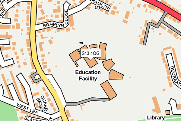
S43 4QG is located in the Barlborough electoral ward, within the local authority district of Bolsover and the English Parliamentary constituency of Bolsover. The Sub Integrated Care Board (ICB) Location is NHS Derby and Derbyshire ICB - 15M and the police force is Derbyshire. This postcode has been in use since January 1980.


GetTheData
Source: OS OpenMap – Local (Ordnance Survey)
Source: OS VectorMap District (Ordnance Survey)
Licence: Open Government Licence (requires attribution)
| Easting | 448876 |
| Northing | 375913 |
| Latitude | 53.277973 |
| Longitude | -1.268466 |
GetTheData
Source: Open Postcode Geo
Licence: Open Government Licence
| Country | England |
| Postcode District | S43 |
➜ See where S43 is on a map ➜ Where is Clowne? | |
GetTheData
Source: Land Registry Price Paid Data
Licence: Open Government Licence
Elevation or altitude of S43 4QG as distance above sea level:
| Metres | Feet | |
|---|---|---|
| Elevation | 140m | 459ft |
Elevation is measured from the approximate centre of the postcode, to the nearest point on an OS contour line from OS Terrain 50, which has contour spacing of ten vertical metres.
➜ How high above sea level am I? Find the elevation of your current position using your device's GPS.
GetTheData
Source: Open Postcode Elevation
Licence: Open Government Licence
| Ward | Barlborough |
| Constituency | Bolsover |
GetTheData
Source: ONS Postcode Database
Licence: Open Government Licence
| Boughton Lane School (Boughton Lane) | Clowne | 198m |
| Boughton Lane School (Boughton Lane) | Clowne | 237m |
| Barlborough Road | Clowne | 243m |
| Barlborough Road | Clowne | 255m |
| Boughton Lane End (Barlborough Road) | Clowne | 284m |
| Creswell (Derbys) Station | 3.8km |
| Whitwell (Derbys) Station | 4.6km |
GetTheData
Source: NaPTAN
Licence: Open Government Licence
GetTheData
Source: ONS Postcode Database
Licence: Open Government Licence


➜ Get more ratings from the Food Standards Agency
GetTheData
Source: Food Standards Agency
Licence: FSA terms & conditions
| Last Collection | |||
|---|---|---|---|
| Location | Mon-Fri | Sat | Distance |
| 93 Boughton Lane | 16:00 | 10:00 | 245m |
| Rotherham Road | 16:00 | 11:00 | 323m |
| 135 Barlborough Road | 16:00 | 10:00 | 412m |
GetTheData
Source: Dracos
Licence: Creative Commons Attribution-ShareAlike
The below table lists the International Territorial Level (ITL) codes (formerly Nomenclature of Territorial Units for Statistics (NUTS) codes) and Local Administrative Units (LAU) codes for S43 4QG:
| ITL 1 Code | Name |
|---|---|
| TLF | East Midlands (England) |
| ITL 2 Code | Name |
| TLF1 | Derbyshire and Nottinghamshire |
| ITL 3 Code | Name |
| TLF12 | East Derbyshire |
| LAU 1 Code | Name |
| E07000033 | Bolsover |
GetTheData
Source: ONS Postcode Directory
Licence: Open Government Licence
The below table lists the Census Output Area (OA), Lower Layer Super Output Area (LSOA), and Middle Layer Super Output Area (MSOA) for S43 4QG:
| Code | Name | |
|---|---|---|
| OA | E00098577 | |
| LSOA | E01019491 | Bolsover 001C |
| MSOA | E02004045 | Bolsover 001 |
GetTheData
Source: ONS Postcode Directory
Licence: Open Government Licence
| S43 4QZ | The Bungalows | 186m |
| S43 4QF | Boughton Lane | 208m |
| S43 4QA | Bramlyn Court | 210m |
| S43 4QP | Bramlyn Close | 232m |
| S43 4JG | Chestnut Drive | 239m |
| S43 4QX | Barlborough Road | 240m |
| S43 4QN | Boughton Lane | 241m |
| S43 4RA | Barlborough Road | 263m |
| S43 4QY | New Barlborough Close | 267m |
| S43 4RD | Barlborough Road | 269m |
GetTheData
Source: Open Postcode Geo; Land Registry Price Paid Data
Licence: Open Government Licence