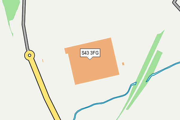
S43 3FG is located in the Staveley North electoral ward, within the local authority district of Chesterfield and the English Parliamentary constituency of North East Derbyshire. The Sub Integrated Care Board (ICB) Location is NHS Derby and Derbyshire ICB - 15M and the police force is Derbyshire. This postcode has been in use since April 2017.


GetTheData
Source: OS OpenMap – Local (Ordnance Survey)
Source: OS VectorMap District (Ordnance Survey)
Licence: Open Government Licence (requires attribution)
| Easting | 445045 |
| Northing | 373960 |
| Latitude | 53.260757 |
| Longitude | -1.326192 |
GetTheData
Source: Open Postcode Geo
Licence: Open Government Licence
| Country | England |
| Postcode District | S43 |
➜ See where S43 is on a map ➜ Where is Woodthorpe? | |
GetTheData
Source: Land Registry Price Paid Data
Licence: Open Government Licence
| Ward | Staveley North |
| Constituency | North East Derbyshire |
GetTheData
Source: ONS Postcode Database
Licence: Open Government Licence
| School (Woodthorpe Lane) | Woodthorpe | 577m |
| Norbriggs Road | Woodthorpe | 626m |
| Norbriggs Road | Woodthorpe | 670m |
| The Grove | Poolsbrook | 795m |
| The Grove | Poolsbrook | 822m |
GetTheData
Source: NaPTAN
Licence: Open Government Licence
GetTheData
Source: ONS Postcode Database
Licence: Open Government Licence


➜ Get more ratings from the Food Standards Agency
GetTheData
Source: Food Standards Agency
Licence: FSA terms & conditions
| Last Collection | |||
|---|---|---|---|
| Location | Mon-Fri | Sat | Distance |
| 4 The Grove | 16:00 | 10:45 | 790m |
| Norbriggs Road | 16:00 | 11:30 | 895m |
| Norbriggs Road | 16:00 | 11:30 | 900m |
GetTheData
Source: Dracos
Licence: Creative Commons Attribution-ShareAlike
The below table lists the International Territorial Level (ITL) codes (formerly Nomenclature of Territorial Units for Statistics (NUTS) codes) and Local Administrative Units (LAU) codes for S43 3FG:
| ITL 1 Code | Name |
|---|---|
| TLF | East Midlands (England) |
| ITL 2 Code | Name |
| TLF1 | Derbyshire and Nottinghamshire |
| ITL 3 Code | Name |
| TLF12 | East Derbyshire |
| LAU 1 Code | Name |
| E07000034 | Chesterfield |
GetTheData
Source: ONS Postcode Directory
Licence: Open Government Licence
The below table lists the Census Output Area (OA), Lower Layer Super Output Area (LSOA), and Middle Layer Super Output Area (MSOA) for S43 3FG:
| Code | Name | |
|---|---|---|
| OA | E00098942 | |
| LSOA | E01019564 | Chesterfield 002B |
| MSOA | E02004056 | Chesterfield 002 |
GetTheData
Source: ONS Postcode Directory
Licence: Open Government Licence
| S43 3DA | Seymour Lane | 505m |
| S43 3BY | Bridle Road | 619m |
| S43 3BZ | Woodthorpe Road | 634m |
| S43 3BT | Norbriggs Road | 817m |
| S43 3BU | Norbriggs Road | 828m |
| S43 3JZ | Poolsbrook Avenue | 833m |
| S43 3BX | Spencer Avenue | 877m |
| S43 3JX | Staveley Road | 897m |
| S43 3LG | Co Op Cottage | 924m |
| S43 3BH | Cranleigh Road | 926m |
GetTheData
Source: Open Postcode Geo; Land Registry Price Paid Data
Licence: Open Government Licence