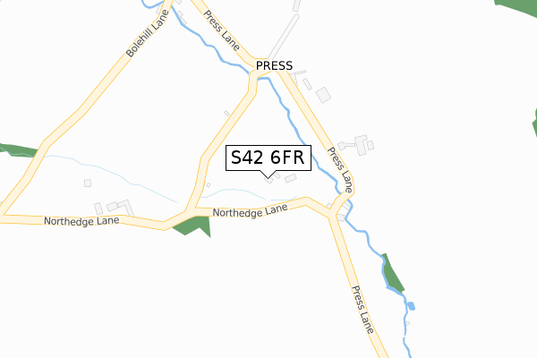
S42 6FR is located in the Ashover electoral ward, within the local authority district of North East Derbyshire and the English Parliamentary constituency of North East Derbyshire. The Sub Integrated Care Board (ICB) Location is NHS Derby and Derbyshire ICB - 15M and the police force is Derbyshire. This postcode has been in use since November 2019.


GetTheData
Source: OS Open Zoomstack (Ordnance Survey)
Licence: Open Government Licence (requires attribution)
Attribution: Contains OS data © Crown copyright and database right 2025
Source: Open Postcode Geo
Licence: Open Government Licence (requires attribution)
Attribution: Contains OS data © Crown copyright and database right 2025; Contains Royal Mail data © Royal Mail copyright and database right 2025; Source: Office for National Statistics licensed under the Open Government Licence v.3.0
| Easting | 436585 |
| Northing | 365115 |
| Latitude | 53.181902 |
| Longitude | -1.454018 |
GetTheData
Source: Open Postcode Geo
Licence: Open Government Licence
| Country | England |
| Postcode District | S42 |
➜ See where S42 is on a map ➜ Where is Press? | |
GetTheData
Source: Land Registry Price Paid Data
Licence: Open Government Licence
| Ward | Ashover |
| Constituency | North East Derbyshire |
GetTheData
Source: ONS Postcode Database
Licence: Open Government Licence
| Press Lane Farm (Press Lane) | Alton | 655m |
| Press Lane Farm (Press Lane) | Alton | 655m |
| Northedge Hall Farm (North Edge Lane) | Alton | 732m |
| Northedge Hall Farm (North Edge Lane) | Alton | 735m |
| The Green (Alton Hill) | Alton | 911m |
GetTheData
Source: NaPTAN
Licence: Open Government Licence
GetTheData
Source: ONS Postcode Database
Licence: Open Government Licence


➜ Get more ratings from the Food Standards Agency
GetTheData
Source: Food Standards Agency
Licence: FSA terms & conditions
| Last Collection | |||
|---|---|---|---|
| Location | Mon-Fri | Sat | Distance |
| Press Lane | 16:00 | 10:00 | 127m |
| Quarry Lane Farm | 16:00 | 09:30 | 932m |
| Millfield Park | 16:00 | 08:00 | 1,389m |
GetTheData
Source: Dracos
Licence: Creative Commons Attribution-ShareAlike
The below table lists the International Territorial Level (ITL) codes (formerly Nomenclature of Territorial Units for Statistics (NUTS) codes) and Local Administrative Units (LAU) codes for S42 6FR:
| ITL 1 Code | Name |
|---|---|
| TLF | East Midlands (England) |
| ITL 2 Code | Name |
| TLF1 | Derbyshire and Nottinghamshire |
| ITL 3 Code | Name |
| TLF12 | East Derbyshire |
| LAU 1 Code | Name |
| E07000038 | North East Derbyshire |
GetTheData
Source: ONS Postcode Directory
Licence: Open Government Licence
The below table lists the Census Output Area (OA), Lower Layer Super Output Area (LSOA), and Middle Layer Super Output Area (MSOA) for S42 6FR:
| Code | Name | |
|---|---|---|
| OA | E00100029 | |
| LSOA | E01019769 | North East Derbyshire 010A |
| MSOA | E02004114 | North East Derbyshire 010 |
GetTheData
Source: ONS Postcode Directory
Licence: Open Government Licence
| S42 6AZ | 194m | |
| S42 6AY | Northedge Lane | 533m |
| S42 6AW | 827m | |
| S42 6AT | Quarry Lane | 835m |
| S42 6RF | Bole Hill | 859m |
| S42 6AH | Press Lane | 930m |
| S42 6AS | Brownhill Lane | 1055m |
| S42 6AP | 1058m | |
| S42 6AR | Tinkley Lane | 1092m |
| S42 6AB | Ashover Road | 1103m |
GetTheData
Source: Open Postcode Geo; Land Registry Price Paid Data
Licence: Open Government Licence