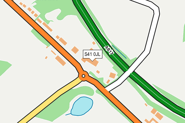
S41 0JL is located in the Grassmoor electoral ward, within the local authority district of North East Derbyshire and the English Parliamentary constituency of North East Derbyshire. The Sub Integrated Care Board (ICB) Location is NHS Derby and Derbyshire ICB - 15M and the police force is Derbyshire. This postcode has been in use since January 1980.


GetTheData
Source: OS OpenMap – Local (Ordnance Survey)
Source: OS VectorMap District (Ordnance Survey)
Licence: Open Government Licence (requires attribution)
| Easting | 440593 |
| Northing | 368694 |
| Latitude | 53.213762 |
| Longitude | -1.393596 |
GetTheData
Source: Open Postcode Geo
Licence: Open Government Licence
| Country | England |
| Postcode District | S41 |
➜ See where S41 is on a map ➜ Where is Chesterfield? | |
GetTheData
Source: Land Registry Price Paid Data
Licence: Open Government Licence
Elevation or altitude of S41 0JL as distance above sea level:
| Metres | Feet | |
|---|---|---|
| Elevation | 100m | 328ft |
Elevation is measured from the approximate centre of the postcode, to the nearest point on an OS contour line from OS Terrain 50, which has contour spacing of ten vertical metres.
➜ How high above sea level am I? Find the elevation of your current position using your device's GPS.
GetTheData
Source: Open Postcode Elevation
Licence: Open Government Licence
| Ward | Grassmoor |
| Constituency | North East Derbyshire |
GetTheData
Source: ONS Postcode Database
Licence: Open Government Licence
| New Inn (Mansfield Road) | Winsick | 221m |
| Mile Hill (Mansfield Road) | Winsick | 254m |
| New Inn (Mansfield Road) | Winsick | 273m |
| Mile Hill (Mansfield Road) | Winsick | 308m |
| Linden Drive 21 (Linden Drive) | Hasland | 585m |
| Chesterfield Station | 3.2km |
GetTheData
Source: NaPTAN
Licence: Open Government Licence
GetTheData
Source: ONS Postcode Database
Licence: Open Government Licence


➜ Get more ratings from the Food Standards Agency
GetTheData
Source: Food Standards Agency
Licence: FSA terms & conditions
| Last Collection | |||
|---|---|---|---|
| Location | Mon-Fri | Sat | Distance |
| Mansfield Road | 16:00 | 10:00 | 283m |
| Mansfield Road | 16:00 | 10:00 | 761m |
| Hillcrest Road | 18:00 | 11:00 | 828m |
GetTheData
Source: Dracos
Licence: Creative Commons Attribution-ShareAlike
The below table lists the International Territorial Level (ITL) codes (formerly Nomenclature of Territorial Units for Statistics (NUTS) codes) and Local Administrative Units (LAU) codes for S41 0JL:
| ITL 1 Code | Name |
|---|---|
| TLF | East Midlands (England) |
| ITL 2 Code | Name |
| TLF1 | Derbyshire and Nottinghamshire |
| ITL 3 Code | Name |
| TLF12 | East Derbyshire |
| LAU 1 Code | Name |
| E07000038 | North East Derbyshire |
GetTheData
Source: ONS Postcode Directory
Licence: Open Government Licence
The below table lists the Census Output Area (OA), Lower Layer Super Output Area (LSOA), and Middle Layer Super Output Area (MSOA) for S41 0JL:
| Code | Name | |
|---|---|---|
| OA | E00100185 | |
| LSOA | E01019798 | North East Derbyshire 007A |
| MSOA | E02004111 | North East Derbyshire 007 |
GetTheData
Source: ONS Postcode Directory
Licence: Open Government Licence
| S41 0JJ | Mansfield Road | 196m |
| S41 0JN | Mile Hill | 334m |
| S41 0JG | Mansfield Road | 445m |
| S41 0JR | Mansfield Road | 490m |
| S41 0NH | Norwood Avenue | 507m |
| S41 0NL | Norwood Close | 539m |
| S41 0NF | Broomfield Avenue | 592m |
| S41 0NQ | Linden Drive | 609m |
| S41 0NJ | Norwood Avenue | 613m |
| S41 0ND | Broomfield Avenue | 641m |
GetTheData
Source: Open Postcode Geo; Land Registry Price Paid Data
Licence: Open Government Licence