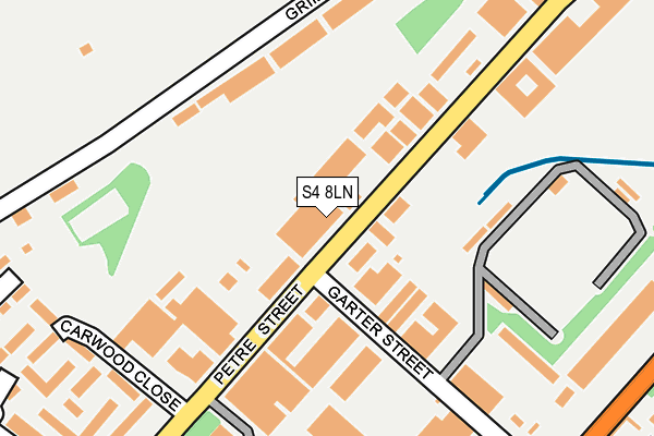
S4 8LN is located in the Burngreave electoral ward, within the metropolitan district of Sheffield and the English Parliamentary constituency of Sheffield, Brightside and Hillsborough. The Sub Integrated Care Board (ICB) Location is NHS South Yorkshire ICB - 03N and the police force is South Yorkshire. This postcode has been in use since January 1980.


GetTheData
Source: OS OpenMap – Local (Ordnance Survey)
Source: OS VectorMap District (Ordnance Survey)
Licence: Open Government Licence (requires attribution)
| Easting | 436874 |
| Northing | 389498 |
| Latitude | 53.401025 |
| Longitude | -1.446873 |
GetTheData
Source: Open Postcode Geo
Licence: Open Government Licence
| Country | England |
| Postcode District | S4 |
➜ See where S4 is on a map ➜ Where is Sheffield? | |
GetTheData
Source: Land Registry Price Paid Data
Licence: Open Government Licence
Elevation or altitude of S4 8LN as distance above sea level:
| Metres | Feet | |
|---|---|---|
| Elevation | 70m | 230ft |
Elevation is measured from the approximate centre of the postcode, to the nearest point on an OS contour line from OS Terrain 50, which has contour spacing of ten vertical metres.
➜ How high above sea level am I? Find the elevation of your current position using your device's GPS.
GetTheData
Source: Open Postcode Elevation
Licence: Open Government Licence
| Ward | Burngreave |
| Constituency | Sheffield, Brightside And Hillsborough |
GetTheData
Source: ONS Postcode Database
Licence: Open Government Licence
| Garter Street (Petre Street) | Grimesthorpe | 41m |
| Garter Street (Petre Street) | Grimesthorpe | 85m |
| Garter Street (Petre Street) | Grimesthorpe | 103m |
| United Cutlers (Petre Street) | Grimesthorpe | 208m |
| United Cutlers (Petre Street) | Grimesthorpe | 257m |
| Attercliffe (Sheffield Supertram) (Shortridge Street) | Attercliffe | 1,485m |
| Woodbourn Road (Sheffield Supertram) (Woodbourn Road) | Attercliffe | 1,583m |
| Sheffield Station | 2.7km |
| Meadowhall Station | 2.9km |
| Darnall Station | 2.9km |
GetTheData
Source: NaPTAN
Licence: Open Government Licence
GetTheData
Source: ONS Postcode Database
Licence: Open Government Licence


➜ Get more ratings from the Food Standards Agency
GetTheData
Source: Food Standards Agency
Licence: FSA terms & conditions
| Last Collection | |||
|---|---|---|---|
| Location | Mon-Fri | Sat | Distance |
| Petre Street | 18:00 | 10:30 | 209m |
| Petre Street | 18:30 | 220m | |
| Atlas Way | 18:30 | 337m | |
GetTheData
Source: Dracos
Licence: Creative Commons Attribution-ShareAlike
The below table lists the International Territorial Level (ITL) codes (formerly Nomenclature of Territorial Units for Statistics (NUTS) codes) and Local Administrative Units (LAU) codes for S4 8LN:
| ITL 1 Code | Name |
|---|---|
| TLE | Yorkshire and The Humber |
| ITL 2 Code | Name |
| TLE3 | South Yorkshire |
| ITL 3 Code | Name |
| TLE32 | Sheffield |
| LAU 1 Code | Name |
| E08000019 | Sheffield |
GetTheData
Source: ONS Postcode Directory
Licence: Open Government Licence
The below table lists the Census Output Area (OA), Lower Layer Super Output Area (LSOA), and Middle Layer Super Output Area (MSOA) for S4 8LN:
| Code | Name | |
|---|---|---|
| OA | E00039880 | |
| LSOA | E01007873 | Sheffield 020C |
| MSOA | E02001630 | Sheffield 020 |
GetTheData
Source: ONS Postcode Directory
Licence: Open Government Licence
| S4 7QX | Garter Street | 151m |
| S4 8LE | Grimesthorpe Road | 165m |
| S4 8LU | Petre Street | 165m |
| S4 8LL | Petre Street | 248m |
| S4 7FB | Carwood Close | 253m |
| S4 8EN | Grimesthorpe Road | 273m |
| S4 8FG | Margate Drive | 279m |
| S4 8FH | Margate Drive | 286m |
| S4 7FF | Carwood Way | 289m |
| S4 7FE | Carwood Grove | 309m |
GetTheData
Source: Open Postcode Geo; Land Registry Price Paid Data
Licence: Open Government Licence