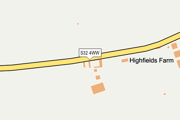
S32 4WW is located in the Hathersage electoral ward, within the local authority district of Derbyshire Dales and the English Parliamentary constituency of Derbyshire Dales. The Sub Integrated Care Board (ICB) Location is NHS Derby and Derbyshire ICB - 15M and the police force is Derbyshire. This postcode has been in use since April 2017.


GetTheData
Source: OS OpenMap – Local (Ordnance Survey)
Source: OS VectorMap District (Ordnance Survey)
Licence: Open Government Licence (requires attribution)
| Easting | 422016 |
| Northing | 375214 |
| Latitude | 53.273476 |
| Longitude | -1.671321 |
GetTheData
Source: Open Postcode Geo
Licence: Open Government Licence
| Country | England |
| Postcode District | S32 |
➜ See where S32 is on a map | |
GetTheData
Source: Land Registry Price Paid Data
Licence: Open Government Licence
| Ward | Hathersage |
| Constituency | Derbyshire Dales |
GetTheData
Source: ONS Postcode Database
Licence: Open Government Licence
| The Dale | Stoney Middleton | 592m |
| The Dale | Stoney Middleton | 599m |
| Toll Bar (The Avenue) | Stoney Middleton | 999m |
| Toll Bar (The Avenue) | Stoney Middleton | 1,005m |
| Church (Church Street) | Eyam | 1,185m |
| Grindleford Station | 4.7km |
GetTheData
Source: NaPTAN
Licence: Open Government Licence
GetTheData
Source: ONS Postcode Database
Licence: Open Government Licence


➜ Get more ratings from the Food Standards Agency
GetTheData
Source: Food Standards Agency
Licence: FSA terms & conditions
| Last Collection | |||
|---|---|---|---|
| Location | Mon-Fri | Sat | Distance |
| Stoney Middleton Post Office | 16:15 | 11:15 | 1,052m |
| Townend | 16:00 | 10:30 | 1,173m |
| The Avenue | 16:15 | 11:15 | 1,387m |
GetTheData
Source: Dracos
Licence: Creative Commons Attribution-ShareAlike
The below table lists the International Territorial Level (ITL) codes (formerly Nomenclature of Territorial Units for Statistics (NUTS) codes) and Local Administrative Units (LAU) codes for S32 4WW:
| ITL 1 Code | Name |
|---|---|
| TLF | East Midlands (England) |
| ITL 2 Code | Name |
| TLF1 | Derbyshire and Nottinghamshire |
| ITL 3 Code | Name |
| TLF13 | South and West Derbyshire |
| LAU 1 Code | Name |
| E07000035 | Derbyshire Dales |
GetTheData
Source: ONS Postcode Directory
Licence: Open Government Licence
The below table lists the Census Output Area (OA), Lower Layer Super Output Area (LSOA), and Middle Layer Super Output Area (MSOA) for S32 4WW:
| Code | Name | |
|---|---|---|
| OA | E00099161 | |
| LSOA | E01019604 | Derbyshire Dales 002B |
| MSOA | E02004069 | Derbyshire Dales 002 |
GetTheData
Source: ONS Postcode Directory
Licence: Open Government Licence
| S32 4TF | The Dale | 784m |
| S32 4TL | High Street | 803m |
| S32 4TY | Eaton Fold | 915m |
| S32 4TE | Royal Oak Mews | 961m |
| S32 4TS | Mill Lane | 994m |
| S32 4TG | Denman Crescent | 1020m |
| S32 4TJ | The Fold | 1027m |
| S32 4AA | Main Road | 1059m |
| S32 4TD | The Bank | 1068m |
| S32 5QU | Lydgate | 1085m |
GetTheData
Source: Open Postcode Geo; Land Registry Price Paid Data
Licence: Open Government Licence