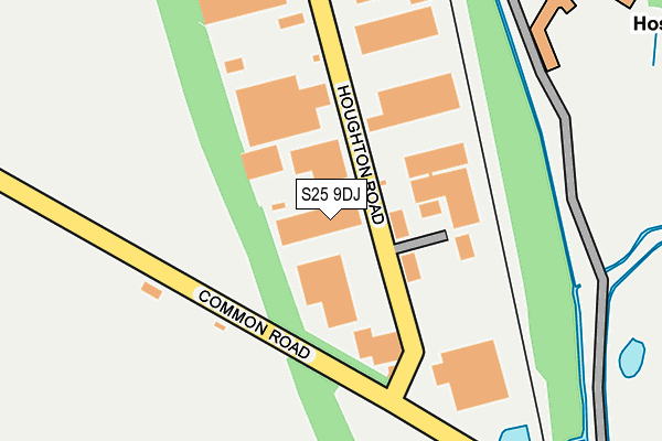
S25 9DJ is located in the Anston & Woodsetts electoral ward, within the metropolitan district of Rotherham and the English Parliamentary constituency of Rother Valley. The Sub Integrated Care Board (ICB) Location is NHS South Yorkshire ICB - 03L and the police force is South Yorkshire. This postcode has been in use since May 2023.


GetTheData
Source: OS OpenMap – Local (Ordnance Survey)
Source: OS VectorMap District (Ordnance Survey)
Licence: Open Government Licence (requires attribution)
| Easting | 450964 |
| Northing | 385667 |
| Latitude | 53.365443 |
| Longitude | -1.235592 |
GetTheData
Source: Open Postcode Geo
Licence: Open Government Licence
| Country | England |
| Postcode District | S25 |
➜ See where S25 is on a map ➜ Where is North Anston? | |
GetTheData
Source: Land Registry Price Paid Data
Licence: Open Government Licence
Elevation or altitude of S25 9DJ as distance above sea level:
| Metres | Feet | |
|---|---|---|
| Elevation | 100m | 328ft |
Elevation is measured from the approximate centre of the postcode, to the nearest point on an OS contour line from OS Terrain 50, which has contour spacing of ten vertical metres.
➜ How high above sea level am I? Find the elevation of your current position using your device's GPS.
GetTheData
Source: Open Postcode Elevation
Licence: Open Government Licence
| Ward | Anston & Woodsetts |
| Constituency | Rother Valley |
GetTheData
Source: ONS Postcode Database
Licence: Open Government Licence
| Houghton Road (Todwick Road) | Laughton Common | 406m |
| Todwick Road (Common Road) | Laughton Common | 497m |
| Common Road (Todwick Road) | Laughton Common | 501m |
| Park Lane (Rotherham Road) | Laughton Common | 884m |
| Monksbridge Road (Rotherham Road) | Laughton Common | 892m |
| Kiveton Park Station | 3.2km |
| Kiveton Bridge Station | 3.4km |
| Shireoaks Station | 6.4km |
GetTheData
Source: NaPTAN
Licence: Open Government Licence
GetTheData
Source: ONS Postcode Database
Licence: Open Government Licence


➜ Get more ratings from the Food Standards Agency
GetTheData
Source: Food Standards Agency
Licence: FSA terms & conditions
| Last Collection | |||
|---|---|---|---|
| Location | Mon-Fri | Sat | Distance |
| 77 Quarry Lane | 18:00 | 12:45 | 879m |
| Limelands Road | 17:00 | 11:15 | 1,156m |
| Nursery Crescent | 17:30 | 12:00 | 1,320m |
GetTheData
Source: Dracos
Licence: Creative Commons Attribution-ShareAlike
The below table lists the International Territorial Level (ITL) codes (formerly Nomenclature of Territorial Units for Statistics (NUTS) codes) and Local Administrative Units (LAU) codes for S25 9DJ:
| ITL 1 Code | Name |
|---|---|
| TLE | Yorkshire and The Humber |
| ITL 2 Code | Name |
| TLE3 | South Yorkshire |
| ITL 3 Code | Name |
| TLE31 | Barnsley, Doncaster and Rotherham |
| LAU 1 Code | Name |
| E08000018 | Rotherham |
GetTheData
Source: ONS Postcode Directory
Licence: Open Government Licence
The below table lists the Census Output Area (OA), Lower Layer Super Output Area (LSOA), and Middle Layer Super Output Area (MSOA) for S25 9DJ:
| Code | Name | |
|---|---|---|
| OA | E00038799 | |
| LSOA | E01007658 | Rotherham 032A |
| MSOA | E02001609 | Rotherham 032 |
GetTheData
Source: ONS Postcode Directory
Licence: Open Government Licence
| S25 4DY | Springfield Terrace | 603m |
| S25 4AJ | Cramfit Road | 681m |
| S25 4DD | Sanctuary Fields | 853m |
| S25 2LX | Church Lane | 880m |
| S25 4GT | Cramfit Close | 904m |
| S25 2XJ | Donstone View | 914m |
| S25 3UG | Park Lane | 931m |
| S25 4JF | Penny Piece Lane | 948m |
| S25 3RF | Rotherham Road | 960m |
| S25 4HD | Edinburgh Drive | 969m |
GetTheData
Source: Open Postcode Geo; Land Registry Price Paid Data
Licence: Open Government Licence