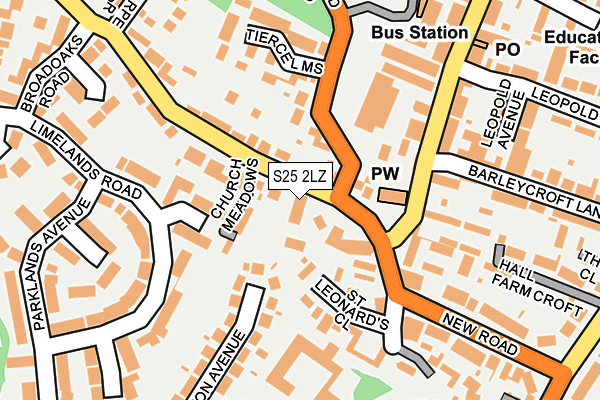
S25 2LZ is located in the Dinnington electoral ward, within the metropolitan district of Rotherham and the English Parliamentary constituency of Rother Valley. The Sub Integrated Care Board (ICB) Location is NHS South Yorkshire ICB - 03L and the police force is South Yorkshire. This postcode has been in use since June 1997.


GetTheData
Source: OS OpenMap – Local (Ordnance Survey)
Source: OS VectorMap District (Ordnance Survey)
Licence: Open Government Licence (requires attribution)
| Easting | 452459 |
| Northing | 385889 |
| Latitude | 53.367273 |
| Longitude | -1.213091 |
GetTheData
Source: Open Postcode Geo
Licence: Open Government Licence
| Country | England |
| Postcode District | S25 |
➜ See where S25 is on a map ➜ Where is Dinnington? | |
GetTheData
Source: Land Registry Price Paid Data
Licence: Open Government Licence
Elevation or altitude of S25 2LZ as distance above sea level:
| Metres | Feet | |
|---|---|---|
| Elevation | 110m | 361ft |
Elevation is measured from the approximate centre of the postcode, to the nearest point on an OS contour line from OS Terrain 50, which has contour spacing of ten vertical metres.
➜ How high above sea level am I? Find the elevation of your current position using your device's GPS.
GetTheData
Source: Open Postcode Elevation
Licence: Open Government Licence
| Ward | Dinnington |
| Constituency | Rother Valley |
GetTheData
Source: ONS Postcode Database
Licence: Open Government Licence
| Nursery Road (New Road) | Dinnington | 236m |
| Dinnington Interchange (Constable Road) | Dinnington | 247m |
| Nursery Road (New Road) | Dinnington | 263m |
| Swinston Hill Road (Lidgett Lane) | Dinnington | 329m |
| Constable Lane (Laughton Road) | Dinnington | 358m |
| Kiveton Park Station | 3.8km |
| Kiveton Bridge Station | 4.6km |
| Shireoaks Station | 5.6km |
GetTheData
Source: NaPTAN
Licence: Open Government Licence
GetTheData
Source: ONS Postcode Database
Licence: Open Government Licence


➜ Get more ratings from the Food Standards Agency
GetTheData
Source: Food Standards Agency
Licence: FSA terms & conditions
| Last Collection | |||
|---|---|---|---|
| Location | Mon-Fri | Sat | Distance |
| Dinnington Post Office | 17:30 | 12:15 | 249m |
| Dinnington Post Office | 17:30 | 12:15 | 249m |
| Safeways | 17:30 | 11:30 | 351m |
GetTheData
Source: Dracos
Licence: Creative Commons Attribution-ShareAlike
The below table lists the International Territorial Level (ITL) codes (formerly Nomenclature of Territorial Units for Statistics (NUTS) codes) and Local Administrative Units (LAU) codes for S25 2LZ:
| ITL 1 Code | Name |
|---|---|
| TLE | Yorkshire and The Humber |
| ITL 2 Code | Name |
| TLE3 | South Yorkshire |
| ITL 3 Code | Name |
| TLE31 | Barnsley, Doncaster and Rotherham |
| LAU 1 Code | Name |
| E08000018 | Rotherham |
GetTheData
Source: ONS Postcode Directory
Licence: Open Government Licence
The below table lists the Census Output Area (OA), Lower Layer Super Output Area (LSOA), and Middle Layer Super Output Area (MSOA) for S25 2LZ:
| Code | Name | |
|---|---|---|
| OA | E00039448 | |
| LSOA | E01007792 | Rotherham 028D |
| MSOA | E02001605 | Rotherham 028 |
GetTheData
Source: ONS Postcode Directory
Licence: Open Government Licence
| S25 2QH | Church Meadows | 66m |
| S25 2NE | Littlefield Road | 71m |
| S25 2PQ | Laughton Road | 97m |
| S25 2XS | Burghley Close | 104m |
| S25 2LT | Church Lane | 110m |
| S25 2RL | St Leonards Close | 111m |
| S25 2PD | Medlock Court | 113m |
| S25 2PL | Laughton Road | 130m |
| S25 2ND | Tiercel Mews | 148m |
| S25 2JU | Falcon Court | 158m |
GetTheData
Source: Open Postcode Geo; Land Registry Price Paid Data
Licence: Open Government Licence