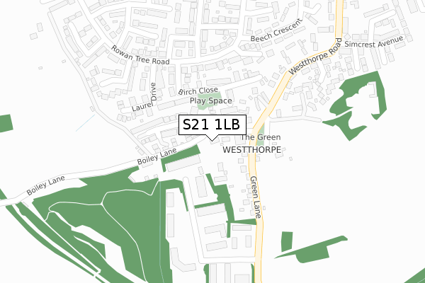
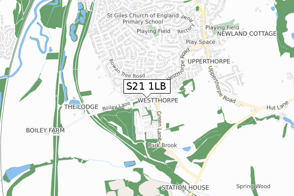
S21 1LB is located in the Killamarsh West electoral ward, within the local authority district of North East Derbyshire and the English Parliamentary constituency of North East Derbyshire. The Sub Integrated Care Board (ICB) Location is NHS Derby and Derbyshire ICB - 15M and the police force is Derbyshire. This postcode has been in use since August 2019.


GetTheData
Source: OS Open Zoomstack (Ordnance Survey)
Licence: Open Government Licence (requires attribution)
Attribution: Contains OS data © Crown copyright and database right 2025
Source: Open Postcode Geo
Licence: Open Government Licence (requires attribution)
Attribution: Contains OS data © Crown copyright and database right 2025; Contains Royal Mail data © Royal Mail copyright and database right 2025; Source: Office for National Statistics licensed under the Open Government Licence v.3.0
| Easting | 445369 |
| Northing | 379845 |
| Latitude | 53.313624 |
| Longitude | -1.320497 |
GetTheData
Source: Open Postcode Geo
Licence: Open Government Licence
| Country | England |
| Postcode District | S21 |
➜ See where S21 is on a map ➜ Where is Killamarsh? | |
GetTheData
Source: Land Registry Price Paid Data
Licence: Open Government Licence
| Ward | Killamarsh West |
| Constituency | North East Derbyshire |
GetTheData
Source: ONS Postcode Database
Licence: Open Government Licence
2024 17 SEP £410,000 |
8, SHEPHERDS CLOSE, KILLAMARSH, SHEFFIELD, S21 1LB 2021 12 NOV £335,000 |
6, SHEPHERDS CLOSE, KILLAMARSH, SHEFFIELD, S21 1LB 2021 10 SEP £310,000 |
3, SHEPHERDS CLOSE, KILLAMARSH, SHEFFIELD, S21 1LB 2021 29 APR £375,000 |
5, SHEPHERDS CLOSE, KILLAMARSH, SHEFFIELD, S21 1LB 2021 27 APR £295,000 |
7, SHEPHERDS CLOSE, KILLAMARSH, SHEFFIELD, S21 1LB 2021 16 FEB £300,000 |
16, SHEPHERDS CLOSE, KILLAMARSH, SHEFFIELD, S21 1LB 2020 26 NOV £285,000 |
18, SHEPHERDS CLOSE, KILLAMARSH, SHEFFIELD, S21 1LB 2020 18 NOV £285,000 |
14, SHEPHERDS CLOSE, KILLAMARSH, SHEFFIELD, S21 1LB 2020 23 OCT £375,000 |
12, SHEPHERDS CLOSE, KILLAMARSH, SHEFFIELD, S21 1LB 2020 12 OCT £344,000 |
GetTheData
Source: HM Land Registry Price Paid Data
Licence: Contains HM Land Registry data © Crown copyright and database right 2025. This data is licensed under the Open Government Licence v3.0.
| West End Hotel (Westthorpe Road) | Westthorpe | 138m |
| West End Hotel (Westthorpe Road) | Westthorpe | 146m |
| Fields Road (Green Lane) | Westthorpe | 200m |
| Fields Road (Green Lane) | Westthorpe | 204m |
| Maple Drive (Rowan Tree Road) | Killamarsh | 293m |
| Kiveton Bridge Station | 4.7km |
GetTheData
Source: NaPTAN
Licence: Open Government Licence
GetTheData
Source: ONS Postcode Database
Licence: Open Government Licence


➜ Get more ratings from the Food Standards Agency
GetTheData
Source: Food Standards Agency
Licence: FSA terms & conditions
| Last Collection | |||
|---|---|---|---|
| Location | Mon-Fri | Sat | Distance |
| Rowan Tree Road | 16:45 | 11:15 | 415m |
| Westthorpe Road | 16:00 | 11:15 | 719m |
| Killamarsh Post Office | 17:15 | 11:15 | 1,093m |
GetTheData
Source: Dracos
Licence: Creative Commons Attribution-ShareAlike
The below table lists the International Territorial Level (ITL) codes (formerly Nomenclature of Territorial Units for Statistics (NUTS) codes) and Local Administrative Units (LAU) codes for S21 1LB:
| ITL 1 Code | Name |
|---|---|
| TLF | East Midlands (England) |
| ITL 2 Code | Name |
| TLF1 | Derbyshire and Nottinghamshire |
| ITL 3 Code | Name |
| TLF12 | East Derbyshire |
| LAU 1 Code | Name |
| E07000038 | North East Derbyshire |
GetTheData
Source: ONS Postcode Directory
Licence: Open Government Licence
The below table lists the Census Output Area (OA), Lower Layer Super Output Area (LSOA), and Middle Layer Super Output Area (MSOA) for S21 1LB:
| Code | Name | |
|---|---|---|
| OA | E00100230 | |
| LSOA | E01019805 | North East Derbyshire 001E |
| MSOA | E02004105 | North East Derbyshire 001 |
GetTheData
Source: ONS Postcode Directory
Licence: Open Government Licence
| S21 1BD | Green Lane | 98m |
| S21 1JH | Crofters Close | 109m |
| S21 1AG | Boiley Lane | 160m |
| S21 1TZ | Westthorpe Fields Road | 161m |
| S21 1FW | Birch Close | 186m |
| S21 1EX | Westthorpe Green | 192m |
| S21 1FZ | Laurel Drive | 220m |
| S21 1FS | Rowan Tree Road | 225m |
| S21 1JR | Rowan Tree Close | 259m |
| S21 1GA | Maple Drive | 274m |
GetTheData
Source: Open Postcode Geo; Land Registry Price Paid Data
Licence: Open Government Licence