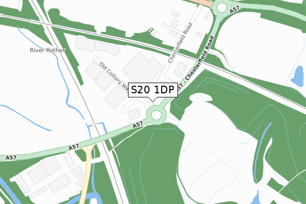
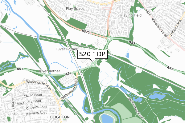
S20 1DP is located in the Aughton & Swallownest electoral ward, within the metropolitan district of Rotherham and the English Parliamentary constituency of Rother Valley. The Sub Integrated Care Board (ICB) Location is NHS South Yorkshire ICB - 03L and the police force is South Yorkshire. This postcode has been in use since March 2019.


GetTheData
Source: OS Open Zoomstack (Ordnance Survey)
Licence: Open Government Licence (requires attribution)
Attribution: Contains OS data © Crown copyright and database right 2025
Source: Open Postcode Geo
Licence: Open Government Licence (requires attribution)
Attribution: Contains OS data © Crown copyright and database right 2025; Contains Royal Mail data © Royal Mail copyright and database right 2025; Source: Office for National Statistics licensed under the Open Government Licence v.3.0
| Easting | 444744 |
| Northing | 384459 |
| Latitude | 53.355147 |
| Longitude | -1.329227 |
GetTheData
Source: Open Postcode Geo
Licence: Open Government Licence
| Country | England |
| Postcode District | S20 |
➜ See where S20 is on a map | |
GetTheData
Source: Land Registry Price Paid Data
Licence: Open Government Licence
| Ward | Aughton & Swallownest |
| Constituency | Rother Valley |
GetTheData
Source: ONS Postcode Database
Licence: Open Government Licence
| A57 (Chesterfield Road) | Swallownest | 96m |
| A57 (Chesterfield Road) | Swallownest | 133m |
| Park Drive (Chesterfield Road) | Swallownest | 610m |
| Wetherby Drive (Chesterfield Road) | Swallownest | 652m |
| Queens Road (High Street) | Beighton | 761m |
| Woodhouse Station | 2.1km |
| Kiveton Bridge Station | 4.4km |
GetTheData
Source: NaPTAN
Licence: Open Government Licence
GetTheData
Source: ONS Postcode Database
Licence: Open Government Licence


➜ Get more ratings from the Food Standards Agency
GetTheData
Source: Food Standards Agency
Licence: FSA terms & conditions
| Last Collection | |||
|---|---|---|---|
| Location | Mon-Fri | Sat | Distance |
| 16 Alexandra Road | 16:45 | 11:30 | 545m |
| Wetherby Drive | 16:00 | 11:45 | 656m |
| Park Hill | 18:00 | 11:45 | 815m |
GetTheData
Source: Dracos
Licence: Creative Commons Attribution-ShareAlike
The below table lists the International Territorial Level (ITL) codes (formerly Nomenclature of Territorial Units for Statistics (NUTS) codes) and Local Administrative Units (LAU) codes for S20 1DP:
| ITL 1 Code | Name |
|---|---|
| TLE | Yorkshire and The Humber |
| ITL 2 Code | Name |
| TLE3 | South Yorkshire |
| ITL 3 Code | Name |
| TLE31 | Barnsley, Doncaster and Rotherham |
| LAU 1 Code | Name |
| E08000018 | Rotherham |
GetTheData
Source: ONS Postcode Directory
Licence: Open Government Licence
The below table lists the Census Output Area (OA), Lower Layer Super Output Area (LSOA), and Middle Layer Super Output Area (MSOA) for S20 1DP:
| Code | Name | |
|---|---|---|
| OA | E00038854 | |
| LSOA | E01007665 | Rotherham 027A |
| MSOA | E02001604 | Rotherham 027 |
GetTheData
Source: ONS Postcode Directory
Licence: Open Government Licence
| S20 1DJ | Old Colliery Way | 219m |
| S26 4SX | Lidget Close | 443m |
| S26 4SY | Thorncliffe Close | 488m |
| S26 4NW | Collingham Road | 497m |
| S26 4TL | Chesterfield Road | 529m |
| S26 4NU | Helmsley Close | 529m |
| S26 4PA | Hoveringham Court | 552m |
| S26 4SU | Swallow Wood Road | 588m |
| S26 4NJ | Harrogate Road | 588m |
| S26 4NY | Wetherby Drive | 588m |
GetTheData
Source: Open Postcode Geo; Land Registry Price Paid Data
Licence: Open Government Licence