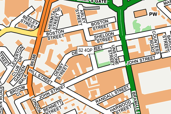
S2 4QP is located in the City electoral ward, within the metropolitan district of Sheffield and the English Parliamentary constituency of Sheffield Central. The Sub Integrated Care Board (ICB) Location is NHS South Yorkshire ICB - 03N and the police force is South Yorkshire. This postcode has been in use since February 1990.


GetTheData
Source: OS OpenMap – Local (Ordnance Survey)
Source: OS VectorMap District (Ordnance Survey)
Licence: Open Government Licence (requires attribution)
| Easting | 435075 |
| Northing | 386255 |
| Latitude | 53.372016 |
| Longitude | -1.474287 |
GetTheData
Source: Open Postcode Geo
Licence: Open Government Licence
| Country | England |
| Postcode District | S2 |
➜ See where S2 is on a map ➜ Where is Sheffield? | |
GetTheData
Source: Land Registry Price Paid Data
Licence: Open Government Licence
Elevation or altitude of S2 4QP as distance above sea level:
| Metres | Feet | |
|---|---|---|
| Elevation | 70m | 230ft |
Elevation is measured from the approximate centre of the postcode, to the nearest point on an OS contour line from OS Terrain 50, which has contour spacing of ten vertical metres.
➜ How high above sea level am I? Find the elevation of your current position using your device's GPS.
GetTheData
Source: Open Postcode Elevation
Licence: Open Government Licence
| Ward | City |
| Constituency | Sheffield Central |
GetTheData
Source: ONS Postcode Database
Licence: Open Government Licence
| Denby Street (Bramall Lane) | Highfield | 128m |
| St Marys Gate (London Road) | Highfield | 163m |
| Sheffield United Fc Stadium (Bramall Lane) | Highfield | 221m |
| London Road (Boston Street) | Sharrow | 224m |
| London Road (Boston Street) | Sharrow | 225m |
| Granville Rd - Sheffield College (Supertram) (Off Granville Road) | Park Hill | 903m |
| West Street (Sheffield Supertram) (West Street) | Sheffield Centre | 975m |
| Park Grange Croft (Sheffield Supertram) (Off Park Grange Road) | Norfolk Park | 1,050m |
| Sheffield Stn - Hallam Uni (Supertram) (Off Sheaf Street) | Sheffield Centre | 1,082m |
| City Hall (Sheffield Supertram) (West Street) | Sheffield Centre | 1,090m |
| Sheffield Station | 1.1km |
| Darnall Station | 4.3km |
| Dore & Totley Station | 5.6km |
GetTheData
Source: NaPTAN
Licence: Open Government Licence
| Percentage of properties with Next Generation Access | 100.0% |
| Percentage of properties with Superfast Broadband | 100.0% |
| Percentage of properties with Ultrafast Broadband | 0.0% |
| Percentage of properties with Full Fibre Broadband | 0.0% |
Superfast Broadband is between 30Mbps and 300Mbps
Ultrafast Broadband is > 300Mbps
| Percentage of properties unable to receive 2Mbps | 0.0% |
| Percentage of properties unable to receive 5Mbps | 0.0% |
| Percentage of properties unable to receive 10Mbps | 0.0% |
| Percentage of properties unable to receive 30Mbps | 0.0% |
GetTheData
Source: Ofcom
Licence: Ofcom Terms of Use (requires attribution)
GetTheData
Source: ONS Postcode Database
Licence: Open Government Licence


➜ Get more ratings from the Food Standards Agency
GetTheData
Source: Food Standards Agency
Licence: FSA terms & conditions
| Last Collection | |||
|---|---|---|---|
| Location | Mon-Fri | Sat | Distance |
| Boston Street | 18:15 | 11:00 | 220m |
| Randall Street | 18:00 | 12:30 | 277m |
| The Moor Post Office | 18:30 | 12:20 | 315m |
GetTheData
Source: Dracos
Licence: Creative Commons Attribution-ShareAlike
| Risk of S2 4QP flooding from rivers and sea | Low |
| ➜ S2 4QP flood map | |
GetTheData
Source: Open Flood Risk by Postcode
Licence: Open Government Licence
The below table lists the International Territorial Level (ITL) codes (formerly Nomenclature of Territorial Units for Statistics (NUTS) codes) and Local Administrative Units (LAU) codes for S2 4QP:
| ITL 1 Code | Name |
|---|---|
| TLE | Yorkshire and The Humber |
| ITL 2 Code | Name |
| TLE3 | South Yorkshire |
| ITL 3 Code | Name |
| TLE32 | Sheffield |
| LAU 1 Code | Name |
| E08000019 | Sheffield |
GetTheData
Source: ONS Postcode Directory
Licence: Open Government Licence
The below table lists the Census Output Area (OA), Lower Layer Super Output Area (LSOA), and Middle Layer Super Output Area (MSOA) for S2 4QP:
| Code | Name | |
|---|---|---|
| OA | E00041068 | |
| LSOA | E01008109 | Sheffield 042B |
| MSOA | E02001652 | Sheffield 042 |
GetTheData
Source: ONS Postcode Directory
Licence: Open Government Licence
| S2 4LN | London Road | 188m |
| S2 4LR | London Road | 234m |
| S1 4TB | Clough Road | 239m |
| S2 4SJ | Randall Street | 243m |
| S1 4TE | Countess Road | 251m |
| S1 4TG | Baron Street | 271m |
| S2 4LE | London Road | 276m |
| S2 4SS | Hill Street | 277m |
| S2 4SE | Harwood Street | 277m |
| S1 4PT | Cumberland Street | 282m |
GetTheData
Source: Open Postcode Geo; Land Registry Price Paid Data
Licence: Open Government Licence