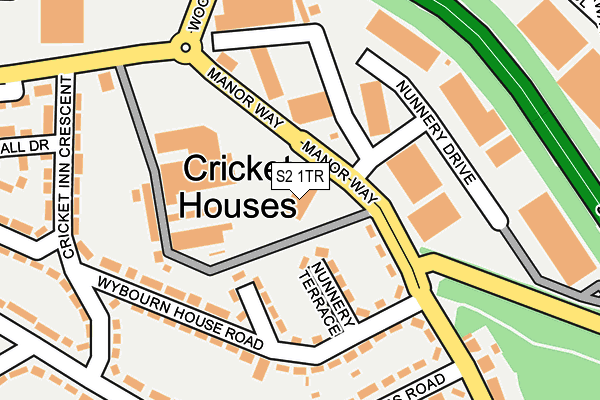
S2 1TR is located in the Manor Castle electoral ward, within the metropolitan district of Sheffield and the English Parliamentary constituency of Sheffield Central. The Sub Integrated Care Board (ICB) Location is NHS South Yorkshire ICB - 03N and the police force is South Yorkshire. This postcode has been in use since January 1980.


GetTheData
Source: OS OpenMap – Local (Ordnance Survey)
Source: OS VectorMap District (Ordnance Survey)
Licence: Open Government Licence (requires attribution)
| Easting | 437487 |
| Northing | 387420 |
| Latitude | 53.382322 |
| Longitude | -1.437899 |
GetTheData
Source: Open Postcode Geo
Licence: Open Government Licence
| Country | England |
| Postcode District | S2 |
➜ See where S2 is on a map ➜ Where is Sheffield? | |
GetTheData
Source: Land Registry Price Paid Data
Licence: Open Government Licence
Elevation or altitude of S2 1TR as distance above sea level:
| Metres | Feet | |
|---|---|---|
| Elevation | 80m | 262ft |
Elevation is measured from the approximate centre of the postcode, to the nearest point on an OS contour line from OS Terrain 50, which has contour spacing of ten vertical metres.
➜ How high above sea level am I? Find the elevation of your current position using your device's GPS.
GetTheData
Source: Open Postcode Elevation
Licence: Open Government Licence
| Ward | Manor Castle |
| Constituency | Sheffield Central |
GetTheData
Source: ONS Postcode Database
Licence: Open Government Licence
| Maltravers Terrace (Maltravers Road) | Wybourn | 238m |
| Maltravers Terrace (Maltravers Road) | Wybourn | 249m |
| Maltravers Crescent (Maltravers Road) | Wybourn | 302m |
| Parkway Avenue (Woodbourn Road) | Wybourn | 306m |
| Parkway Avenue (Woodbourn Road) | Wybourn | 310m |
| Nunnery Square (Sheffield Supertram) (Nunnery Square) | Attercliffe | 439m |
| Cricket Inn Road (Sheffield Supertram) (Cricket Inn Road) | Park Hill | 611m |
| Woodbourn Road (Sheffield Supertram) (Woodbourn Road) | Attercliffe | 762m |
| Hyde Park (Sheffield Supertram) (Cricket Inn Road) | Hyde Park | 999m |
| Attercliffe (Sheffield Supertram) (Shortridge Street) | Attercliffe | 1,230m |
| Sheffield Station | 1.7km |
| Darnall Station | 1.7km |
| Meadowhall Station | 4.3km |
GetTheData
Source: NaPTAN
Licence: Open Government Licence
GetTheData
Source: ONS Postcode Database
Licence: Open Government Licence


➜ Get more ratings from the Food Standards Agency
GetTheData
Source: Food Standards Agency
Licence: FSA terms & conditions
| Last Collection | |||
|---|---|---|---|
| Location | Mon-Fri | Sat | Distance |
| Parkway Avenue | 18:30 | 400m | |
| 299 Manor Oaks Road | 17:30 | 09:00 | 502m |
| Cricket Inn Road | 17:45 | 09:30 | 551m |
GetTheData
Source: Dracos
Licence: Creative Commons Attribution-ShareAlike
The below table lists the International Territorial Level (ITL) codes (formerly Nomenclature of Territorial Units for Statistics (NUTS) codes) and Local Administrative Units (LAU) codes for S2 1TR:
| ITL 1 Code | Name |
|---|---|
| TLE | Yorkshire and The Humber |
| ITL 2 Code | Name |
| TLE3 | South Yorkshire |
| ITL 3 Code | Name |
| TLE32 | Sheffield |
| LAU 1 Code | Name |
| E08000019 | Sheffield |
GetTheData
Source: ONS Postcode Directory
Licence: Open Government Licence
The below table lists the Census Output Area (OA), Lower Layer Super Output Area (LSOA), and Middle Layer Super Output Area (MSOA) for S2 1TR:
| Code | Name | |
|---|---|---|
| OA | E00039913 | |
| LSOA | E01007886 | Sheffield 075F |
| MSOA | E02006868 | Sheffield 075 |
GetTheData
Source: ONS Postcode Directory
Licence: Open Government Licence
| S2 5BL | Nunnery Terrace | 87m |
| S2 5BJ | Wybourn Terrace | 105m |
| S2 5AX | Cricket Inn Road | 128m |
| S2 1UR | Manor Lane | 134m |
| S2 5BG | Wybourn House Road | 156m |
| S2 5BH | Wybourn House Road | 166m |
| S2 1TA | Nunnery Drive | 193m |
| S2 5AJ | Maltravers Road | 225m |
| S2 5AP | Cricket Inn Crescent | 227m |
| S2 5AQ | Cricket Inn Crescent | 251m |
GetTheData
Source: Open Postcode Geo; Land Registry Price Paid Data
Licence: Open Government Licence