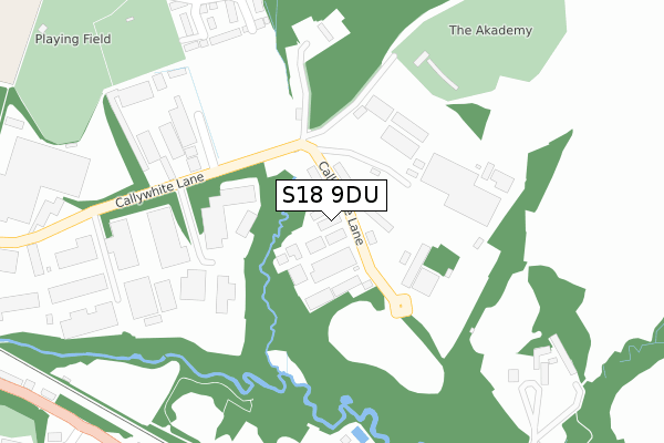
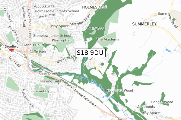
S18 9DU is located in the Dronfield North electoral ward, within the local authority district of North East Derbyshire and the English Parliamentary constituency of North East Derbyshire. The Sub Integrated Care Board (ICB) Location is NHS Derby and Derbyshire ICB - 15M and the police force is Derbyshire. This postcode has been in use since October 2018.


GetTheData
Source: OS Open Zoomstack (Ordnance Survey)
Licence: Open Government Licence (requires attribution)
Attribution: Contains OS data © Crown copyright and database right 2024
Source: Open Postcode Geo
Licence: Open Government Licence (requires attribution)
Attribution: Contains OS data © Crown copyright and database right 2024; Contains Royal Mail data © Royal Mail copyright and database right 2024; Source: Office for National Statistics licensed under the Open Government Licence v.3.0
| Easting | 436573 |
| Northing | 378259 |
| Latitude | 53.300045 |
| Longitude | -1.452694 |
GetTheData
Source: Open Postcode Geo
Licence: Open Government Licence
| Country | England |
| Postcode District | S18 |
➜ See where S18 is on a map ➜ Where is Dronfield? | |
GetTheData
Source: Land Registry Price Paid Data
Licence: Open Government Licence
| Ward | Dronfield North |
| Constituency | North East Derbyshire |
GetTheData
Source: ONS Postcode Database
Licence: Open Government Licence
| Three Tuns (Chesterfield Road) | Dronfield | 457m |
| Three Tuns (Chesterfield Road) | Dronfield | 522m |
| Hallowes Rise (Cemetery Road) | Dronfield | 587m |
| Hallowes Rise (Cemetery Road) | Dronfield | 627m |
| Oakhill Road Bottom (Oakhill Road) | Dronfield | 637m |
| Dronfield Station | 1.1km |
| Dore & Totley Station | 5.2km |
GetTheData
Source: NaPTAN
Licence: Open Government Licence
GetTheData
Source: ONS Postcode Database
Licence: Open Government Licence


➜ Get more ratings from the Food Standards Agency
GetTheData
Source: Food Standards Agency
Licence: FSA terms & conditions
| Last Collection | |||
|---|---|---|---|
| Location | Mon-Fri | Sat | Distance |
| 90 Cemetery Road | 17:30 | 12:00 | 545m |
| Holmesdale Road | 18:00 | 12:30 | 843m |
| Dronfield Post Office | 17:30 | 12:15 | 873m |
GetTheData
Source: Dracos
Licence: Creative Commons Attribution-ShareAlike
The below table lists the International Territorial Level (ITL) codes (formerly Nomenclature of Territorial Units for Statistics (NUTS) codes) and Local Administrative Units (LAU) codes for S18 9DU:
| ITL 1 Code | Name |
|---|---|
| TLF | East Midlands (England) |
| ITL 2 Code | Name |
| TLF1 | Derbyshire and Nottinghamshire |
| ITL 3 Code | Name |
| TLF12 | East Derbyshire |
| LAU 1 Code | Name |
| E07000038 | North East Derbyshire |
GetTheData
Source: ONS Postcode Directory
Licence: Open Government Licence
The below table lists the Census Output Area (OA), Lower Layer Super Output Area (LSOA), and Middle Layer Super Output Area (MSOA) for S18 9DU:
| Code | Name | |
|---|---|---|
| OA | E00100098 | |
| LSOA | E01019782 | North East Derbyshire 004C |
| MSOA | E02004108 | North East Derbyshire 004 |
GetTheData
Source: ONS Postcode Directory
Licence: Open Government Licence
| S18 2XR | Callywhite Lane | 226m |
| S18 4AE | Half Acre Lane | 362m |
| S18 2DA | Frithwood Drive | 370m |
| S18 1XJ | Chesterfield Road | 443m |
| S18 2EU | Shireoaks Road | 478m |
| S18 2ES | Stonelow Crescent | 488m |
| S18 2XP | Callywhite Lane | 501m |
| S18 1YP | Southfield Drive | 523m |
| S18 1XH | Chesterfield Road | 575m |
| S18 2EP | Stonelow Road | 579m |
GetTheData
Source: Open Postcode Geo; Land Registry Price Paid Data
Licence: Open Government Licence