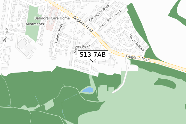
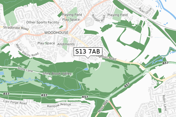
S13 7AB is located in the Woodhouse electoral ward, within the metropolitan district of Sheffield and the English Parliamentary constituency of Sheffield South East. The Sub Integrated Care Board (ICB) Location is NHS South Yorkshire ICB - 03N and the police force is South Yorkshire. This postcode has been in use since April 2018.


GetTheData
Source: OS Open Zoomstack (Ordnance Survey)
Licence: Open Government Licence (requires attribution)
Attribution: Contains OS data © Crown copyright and database right 2024
Source: Open Postcode Geo
Licence: Open Government Licence (requires attribution)
Attribution: Contains OS data © Crown copyright and database right 2024; Contains Royal Mail data © Royal Mail copyright and database right 2024; Source: Office for National Statistics licensed under the Open Government Licence v.3.0
| Easting | 442592 |
| Northing | 384420 |
| Latitude | 53.354973 |
| Longitude | -1.361561 |
GetTheData
Source: Open Postcode Geo
Licence: Open Government Licence
| Country | England |
| Postcode District | S13 |
➜ See where S13 is on a map ➜ Where is Sheffield? | |
GetTheData
Source: Land Registry Price Paid Data
Licence: Open Government Licence
| Ward | Woodhouse |
| Constituency | Sheffield South East |
GetTheData
Source: ONS Postcode Database
Licence: Open Government Licence
2022 12 SEP £340,000 |
2021 26 JUL £218,000 |
12, HURRICANE AVENUE, SHEFFIELD, S13 7AB 2019 25 JAN £264,950 |
28, HURRICANE AVENUE, SHEFFIELD, S13 7AB 2018 21 DEC £214,950 |
14, HURRICANE AVENUE, SHEFFIELD, S13 7AB 2018 21 DEC £269,950 |
26, HURRICANE AVENUE, SHEFFIELD, S13 7AB 2018 21 DEC £244,950 |
22, HURRICANE AVENUE, SHEFFIELD, S13 7AB 2018 21 DEC £234,950 |
33, HURRICANE AVENUE, SHEFFIELD, S13 7AB 2018 20 DEC £242,950 |
31, HURRICANE AVENUE, SHEFFIELD, S13 7AB 2018 20 DEC £229,950 |
2018 20 DEC £199,950 |
GetTheData
Source: HM Land Registry Price Paid Data
Licence: Contains HM Land Registry data © Crown copyright and database right 2024. This data is licensed under the Open Government Licence v3.0.
| John Calvert Road (Beighton Road) | Woodhouse | 143m |
| John Calvert Road (Beighton Road) | Woodhouse | 159m |
| Massey Road (Beighton Road) | Woodhouse | 219m |
| Massey Road (Beighton Road) | Woodhouse | 243m |
| Station Road (Beighton Road) | Woodhouse | 420m |
| Moss Way (Sheffield Supertram) (Moss Way) | Waterthorpe | 1,424m |
| Crystal Peaks (Sheffield Supertram) (Ochre Dike Lane) | Crystal Peaks Shopping Centre | 1,520m |
| Donetsk Way (Sheffield Supertram) (Donetsk Way) | Owlthorpe | 1,584m |
| Beighton - Drake House La (Sheffield Supertram) (Off Eckington Way) | Beighton | 1,746m |
| Hackenthorpe (Sheffield Supertram) (Off Sheffield Road) | Hackenthorpe | 1,813m |
| Woodhouse Station | 1km |
| Darnall Station | 4.7km |
GetTheData
Source: NaPTAN
Licence: Open Government Licence
| Percentage of properties with Next Generation Access | 100.0% |
| Percentage of properties with Superfast Broadband | 100.0% |
| Percentage of properties with Ultrafast Broadband | 100.0% |
| Percentage of properties with Full Fibre Broadband | 100.0% |
Superfast Broadband is between 30Mbps and 300Mbps
Ultrafast Broadband is > 300Mbps
| Percentage of properties unable to receive 2Mbps | 0.0% |
| Percentage of properties unable to receive 5Mbps | 0.0% |
| Percentage of properties unable to receive 10Mbps | 0.0% |
| Percentage of properties unable to receive 30Mbps | 0.0% |
GetTheData
Source: Ofcom
Licence: Ofcom Terms of Use (requires attribution)
GetTheData
Source: ONS Postcode Database
Licence: Open Government Licence


➜ Get more ratings from the Food Standards Agency
GetTheData
Source: Food Standards Agency
Licence: FSA terms & conditions
| Last Collection | |||
|---|---|---|---|
| Location | Mon-Fri | Sat | Distance |
| 1 Massey Road | 18:00 | 10:00 | 261m |
| Market Street | 18:00 | 10:00 | 470m |
| 2 Skelton Walk | 17:45 | 10:00 | 548m |
GetTheData
Source: Dracos
Licence: Creative Commons Attribution-ShareAlike
The below table lists the International Territorial Level (ITL) codes (formerly Nomenclature of Territorial Units for Statistics (NUTS) codes) and Local Administrative Units (LAU) codes for S13 7AB:
| ITL 1 Code | Name |
|---|---|
| TLE | Yorkshire and The Humber |
| ITL 2 Code | Name |
| TLE3 | South Yorkshire |
| ITL 3 Code | Name |
| TLE32 | Sheffield |
| LAU 1 Code | Name |
| E08000019 | Sheffield |
GetTheData
Source: ONS Postcode Directory
Licence: Open Government Licence
The below table lists the Census Output Area (OA), Lower Layer Super Output Area (LSOA), and Middle Layer Super Output Area (MSOA) for S13 7AB:
| Code | Name | |
|---|---|---|
| OA | E00040383 | |
| LSOA | E01007969 | Sheffield 044B |
| MSOA | E02001654 | Sheffield 044 |
GetTheData
Source: ONS Postcode Directory
Licence: Open Government Licence
| S13 7PP | Beighton Road | 137m |
| S13 7ND | Oldale Close | 184m |
| S13 7NB | Oldale Court | 189m |
| S13 7RZ | Trenton Rise | 202m |
| S13 7RX | Stacye Rise | 205m |
| S13 7PW | John Calvert Road | 251m |
| S13 7NA | Oldale Grove | 252m |
| S13 7SA | Massey Road | 258m |
| S13 7RY | Trenton Close | 267m |
| S13 7RW | Stacye Avenue | 272m |
GetTheData
Source: Open Postcode Geo; Land Registry Price Paid Data
Licence: Open Government Licence