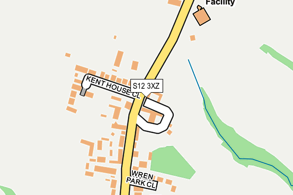
S12 3XZ is located in the Ridgeway & Marsh Lane electoral ward, within the local authority district of North East Derbyshire and the English Parliamentary constituency of North East Derbyshire. The Sub Integrated Care Board (ICB) Location is NHS Derby and Derbyshire ICB - 15M and the police force is Derbyshire. This postcode has been in use since July 2017.


GetTheData
Source: OS OpenMap – Local (Ordnance Survey)
Source: OS VectorMap District (Ordnance Survey)
Licence: Open Government Licence (requires attribution)
| Easting | 440325 |
| Northing | 381675 |
| Latitude | 53.330478 |
| Longitude | -1.395967 |
GetTheData
Source: Open Postcode Geo
Licence: Open Government Licence
| Country | England |
| Postcode District | S12 |
➜ See where S12 is on a map ➜ Where is Ridgeway? | |
GetTheData
Source: Land Registry Price Paid Data
Licence: Open Government Licence
| Ward | Ridgeway & Marsh Lane |
| Constituency | North East Derbyshire |
GetTheData
Source: ONS Postcode Database
Licence: Open Government Licence
| The Swan (Main Road) | Ridgeway | 66m |
| The Swan (Main Road) | Ridgeway | 72m |
| Wren Park Close (Main Road) | Ridgeway | 221m |
| Lowfield Avenue (Main Road) | Ridgeway | 230m |
| Lowfield Avenue (Main Road) | Ridgeway | 273m |
| Birley Lane (Sheffield Supertram) (Birley Lane) | Birley | 1,127m |
| Birley Moor Road (Sheffield Supertram) (Off Sheffield Road) | Owlthorpe | 1,328m |
| Hackenthorpe (Sheffield Supertram) (Off Sheffield Road) | Hackenthorpe | 1,765m |
| Woodhouse Station | 4.5km |
| Dronfield Station | 5.8km |
GetTheData
Source: NaPTAN
Licence: Open Government Licence
| Percentage of properties with Next Generation Access | 100.0% |
| Percentage of properties with Superfast Broadband | 100.0% |
| Percentage of properties with Ultrafast Broadband | 0.0% |
| Percentage of properties with Full Fibre Broadband | 0.0% |
Superfast Broadband is between 30Mbps and 300Mbps
Ultrafast Broadband is > 300Mbps
| Median download speed | 39.1Mbps |
| Average download speed | 36.3Mbps |
| Maximum download speed | 47.55Mbps |
| Median upload speed | 8.6Mbps |
| Average upload speed | 7.8Mbps |
| Maximum upload speed | 9.76Mbps |
| Percentage of properties unable to receive 2Mbps | 0.0% |
| Percentage of properties unable to receive 5Mbps | 0.0% |
| Percentage of properties unable to receive 10Mbps | 0.0% |
| Percentage of properties unable to receive 30Mbps | 0.0% |
GetTheData
Source: Ofcom
Licence: Ofcom Terms of Use (requires attribution)
GetTheData
Source: ONS Postcode Database
Licence: Open Government Licence


➜ Get more ratings from the Food Standards Agency
GetTheData
Source: Food Standards Agency
Licence: FSA terms & conditions
| Last Collection | |||
|---|---|---|---|
| Location | Mon-Fri | Sat | Distance |
| Main Street Ridgeway | 16:45 | 11:00 | 47m |
| 16 High Lane | 16:45 | 11:00 | 493m |
| Westfield Centre Post Office | 16:00 | 11:30 | 787m |
GetTheData
Source: Dracos
Licence: Creative Commons Attribution-ShareAlike
The below table lists the International Territorial Level (ITL) codes (formerly Nomenclature of Territorial Units for Statistics (NUTS) codes) and Local Administrative Units (LAU) codes for S12 3XZ:
| ITL 1 Code | Name |
|---|---|
| TLF | East Midlands (England) |
| ITL 2 Code | Name |
| TLF1 | Derbyshire and Nottinghamshire |
| ITL 3 Code | Name |
| TLF12 | East Derbyshire |
| LAU 1 Code | Name |
| E07000038 | North East Derbyshire |
GetTheData
Source: ONS Postcode Directory
Licence: Open Government Licence
The below table lists the Census Output Area (OA), Lower Layer Super Output Area (LSOA), and Middle Layer Super Output Area (MSOA) for S12 3XZ:
| Code | Name | |
|---|---|---|
| OA | E00100284 | |
| LSOA | E01019816 | North East Derbyshire 002D |
| MSOA | E02004106 | North East Derbyshire 002 |
GetTheData
Source: ONS Postcode Directory
Licence: Open Government Licence
| S12 3XR | Main Road | 77m |
| S12 3XS | Kent House Close | 118m |
| S12 3XT | Wren Park Close | 161m |
| S12 3XP | Lowfield Avenue | 330m |
| S12 3XN | Wellfield Close | 387m |
| S12 3XF | High Lane | 427m |
| S12 3XJ | Phoenix Road | 431m |
| S12 3XX | Church Lane | 577m |
| S12 3XB | Ribblesdale Drive | 648m |
| S12 3XW | Ridgeway Moor | 650m |
GetTheData
Source: Open Postcode Geo; Land Registry Price Paid Data
Licence: Open Government Licence