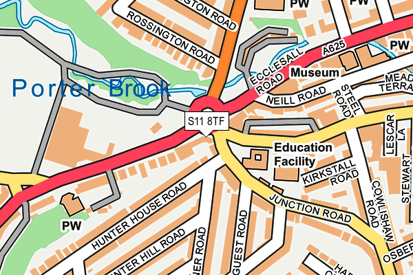
S11 8TF is located in the Ecclesall electoral ward, within the metropolitan district of Sheffield and the English Parliamentary constituency of Sheffield, Hallam. The Sub Integrated Care Board (ICB) Location is NHS South Yorkshire ICB - 03N and the police force is South Yorkshire. This postcode has been in use since February 2008.


GetTheData
Source: OS OpenMap – Local (Ordnance Survey)
Source: OS VectorMap District (Ordnance Survey)
Licence: Open Government Licence (requires attribution)
| Easting | 433213 |
| Northing | 385715 |
| Latitude | 53.367282 |
| Longitude | -1.502328 |
GetTheData
Source: Open Postcode Geo
Licence: Open Government Licence
| Country | England |
| Postcode District | S11 |
➜ See where S11 is on a map ➜ Where is Sheffield? | |
GetTheData
Source: Land Registry Price Paid Data
Licence: Open Government Licence
Elevation or altitude of S11 8TF as distance above sea level:
| Metres | Feet | |
|---|---|---|
| Elevation | 110m | 361ft |
Elevation is measured from the approximate centre of the postcode, to the nearest point on an OS contour line from OS Terrain 50, which has contour spacing of ten vertical metres.
➜ How high above sea level am I? Find the elevation of your current position using your device's GPS.
GetTheData
Source: Open Postcode Elevation
Licence: Open Government Licence
| Ward | Ecclesall |
| Constituency | Sheffield, Hallam |
GetTheData
Source: ONS Postcode Database
Licence: Open Government Licence
| Hunter House Road (Junction Road) | Hunters Bar | 53m |
| Junction Road (Ecclesall Road) | Hunters Bar | 53m |
| Ecclesall Road (Brocco Bank) | Hunters Bar | 85m |
| Neill Road (Ecclesall Road) | Hunters Bar | 120m |
| Neill Road (Ecclesall Road) | Hunters Bar | 136m |
| Sheffield Station | 2.9km |
| Dore & Totley Station | 4.5km |
GetTheData
Source: NaPTAN
Licence: Open Government Licence
GetTheData
Source: ONS Postcode Database
Licence: Open Government Licence


➜ Get more ratings from the Food Standards Agency
GetTheData
Source: Food Standards Agency
Licence: FSA terms & conditions
| Last Collection | |||
|---|---|---|---|
| Location | Mon-Fri | Sat | Distance |
| Sharrow Vale Road | 17:30 | 10:45 | 34m |
| 89 Penrhyn Road | 17:30 | 10:45 | 268m |
| 160 Psalter Lane | 17:30 | 10:00 | 316m |
GetTheData
Source: Dracos
Licence: Creative Commons Attribution-ShareAlike
| Risk of S11 8TF flooding from rivers and sea | Low |
| ➜ S11 8TF flood map | |
GetTheData
Source: Open Flood Risk by Postcode
Licence: Open Government Licence
The below table lists the International Territorial Level (ITL) codes (formerly Nomenclature of Territorial Units for Statistics (NUTS) codes) and Local Administrative Units (LAU) codes for S11 8TF:
| ITL 1 Code | Name |
|---|---|
| TLE | Yorkshire and The Humber |
| ITL 2 Code | Name |
| TLE3 | South Yorkshire |
| ITL 3 Code | Name |
| TLE32 | Sheffield |
| LAU 1 Code | Name |
| E08000019 | Sheffield |
GetTheData
Source: ONS Postcode Directory
Licence: Open Government Licence
The below table lists the Census Output Area (OA), Lower Layer Super Output Area (LSOA), and Middle Layer Super Output Area (MSOA) for S11 8TF:
| Code | Name | |
|---|---|---|
| OA | E00040775 | |
| LSOA | E01008048 | Sheffield 046D |
| MSOA | E02001656 | Sheffield 046 |
GetTheData
Source: ONS Postcode Directory
Licence: Open Government Licence
| S11 8ZP | Sharrow Vale Road | 121m |
| S11 8TG | Ecclesall Road | 127m |
| S11 8XA | Junction Road | 132m |
| S11 8TW | Hunter House Road | 133m |
| S11 8UJ | Guest Road | 140m |
| S11 8UG | Pinner Road | 147m |
| S11 8PT | Ecclesall Road | 148m |
| S11 8TU | Hunter House Road | 154m |
| S11 8SA | Rossington Road | 156m |
| S11 8RS | Brocco Bank | 156m |
GetTheData
Source: Open Postcode Geo; Land Registry Price Paid Data
Licence: Open Government Licence