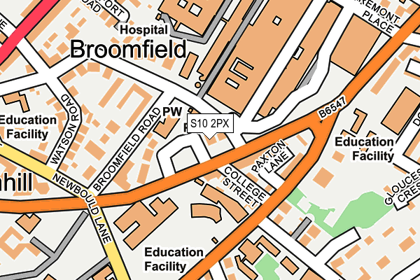
S10 2PX lies on Glossop Road in Sheffield. S10 2PX is located in the Broomhill and Sharrow Vale electoral ward, within the metropolitan district of Sheffield and the English Parliamentary constituency of Sheffield Central. The Sub Integrated Care Board (ICB) Location is NHS South Yorkshire ICB - 03N and the police force is South Yorkshire. This postcode has been in use since January 1980.


GetTheData
Source: OS OpenMap – Local (Ordnance Survey)
Source: OS VectorMap District (Ordnance Survey)
Licence: Open Government Licence (requires attribution)
| Easting | 433731 |
| Northing | 386829 |
| Latitude | 53.377245 |
| Longitude | -1.494427 |
GetTheData
Source: Open Postcode Geo
Licence: Open Government Licence
| Street | Glossop Road |
| Town/City | Sheffield |
| Country | England |
| Postcode District | S10 |
➜ See where S10 is on a map ➜ Where is Sheffield? | |
GetTheData
Source: Land Registry Price Paid Data
Licence: Open Government Licence
Elevation or altitude of S10 2PX as distance above sea level:
| Metres | Feet | |
|---|---|---|
| Elevation | 130m | 427ft |
Elevation is measured from the approximate centre of the postcode, to the nearest point on an OS contour line from OS Terrain 50, which has contour spacing of ten vertical metres.
➜ How high above sea level am I? Find the elevation of your current position using your device's GPS.
GetTheData
Source: Open Postcode Elevation
Licence: Open Government Licence
| Ward | Broomhill And Sharrow Vale |
| Constituency | Sheffield Central |
GetTheData
Source: ONS Postcode Database
Licence: Open Government Licence
440, GLOSSOP ROAD, SHEFFIELD, S10 2PX 2014 20 FEB £120,000 |
442, GLOSSOP ROAD, SHEFFIELD, S10 2PX 2007 4 SEP £675,000 |
GetTheData
Source: HM Land Registry Price Paid Data
Licence: Contains HM Land Registry data © Crown copyright and database right 2025. This data is licensed under the Open Government Licence v3.0.
| Royal Hallamshire Hospital (Beech Hill Road) | Broomhill | 51m |
| Royal Hallamshire Hospital (Glossop Road) | Broomhill | 91m |
| Royal Hallamshire Hospital (Glossop Road) | Broomhill | 107m |
| Newbould Lane (Glossop Road) | Broomhill | 121m |
| Glossop Road (Clarkehouse Road) | Broomhill | 145m |
| University Of Sheffield (Sheffield Supertram) (Hanover Street) | Western Bank | 789m |
| Netherthorpe Road (Sheffield Supertram) (Netherthorpe Road) | Netherthorpe | 1,149m |
| West Street (Sheffield Supertram) (West Street) | Sheffield Centre | 1,186m |
| City Hall (Sheffield Supertram) (West Street) | Sheffield Centre | 1,520m |
| Shalesmoor (Sheffield Supertram) (Corner Of Netherthorpe Rd And Shalesmoor) | Shalesmoor | 1,679m |
| Sheffield Station | 2.2km |
GetTheData
Source: NaPTAN
Licence: Open Government Licence
GetTheData
Source: ONS Postcode Database
Licence: Open Government Licence


➜ Get more ratings from the Food Standards Agency
GetTheData
Source: Food Standards Agency
Licence: FSA terms & conditions
| Last Collection | |||
|---|---|---|---|
| Location | Mon-Fri | Sat | Distance |
| 445 Glossop Road | 18:00 | 09:30 | 47m |
| Clarkehouse Road | 18:30 | 240m | |
| Jessops Wing | 16:30 | 11:45 | 242m |
GetTheData
Source: Dracos
Licence: Creative Commons Attribution-ShareAlike
The below table lists the International Territorial Level (ITL) codes (formerly Nomenclature of Territorial Units for Statistics (NUTS) codes) and Local Administrative Units (LAU) codes for S10 2PX:
| ITL 1 Code | Name |
|---|---|
| TLE | Yorkshire and The Humber |
| ITL 2 Code | Name |
| TLE3 | South Yorkshire |
| ITL 3 Code | Name |
| TLE32 | Sheffield |
| LAU 1 Code | Name |
| E08000019 | Sheffield |
GetTheData
Source: ONS Postcode Directory
Licence: Open Government Licence
The below table lists the Census Output Area (OA), Lower Layer Super Output Area (LSOA), and Middle Layer Super Output Area (MSOA) for S10 2PX:
| Code | Name | |
|---|---|---|
| OA | E00039837 | |
| LSOA | E01007866 | Sheffield 030A |
| MSOA | E02001640 | Sheffield 030 |
GetTheData
Source: ONS Postcode Directory
Licence: Open Government Licence
| S10 2PT | Glossop Road | 52m |
| S10 2PR | Glossop Road | 71m |
| S10 2SG | St Marks Crescent | 82m |
| S10 2PH | College Street | 84m |
| S10 2LB | Clarkehouse Road | 112m |
| S10 2LA | Clarkehouse Road | 139m |
| S10 2SE | Broomfield Road | 153m |
| S10 2SA | Beech Hill Road | 173m |
| S10 2SB | Beech Hill Road | 189m |
| S10 2DZ | Antrim Avenue | 193m |
GetTheData
Source: Open Postcode Geo; Land Registry Price Paid Data
Licence: Open Government Licence