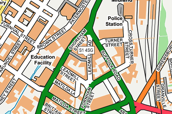
S1 4SG is located in the City electoral ward, within the metropolitan district of Sheffield and the English Parliamentary constituency of Sheffield Central. The Sub Integrated Care Board (ICB) Location is NHS South Yorkshire ICB - 03N and the police force is South Yorkshire. This postcode has been in use since December 2002.


GetTheData
Source: OS OpenMap – Local (Ordnance Survey)
Source: OS VectorMap District (Ordnance Survey)
Licence: Open Government Licence (requires attribution)
| Easting | 435676 |
| Northing | 386713 |
| Latitude | 53.376093 |
| Longitude | -1.465203 |
GetTheData
Source: Open Postcode Geo
Licence: Open Government Licence
| Country | England |
| Postcode District | S1 |
➜ See where S1 is on a map ➜ Where is Sheffield? | |
GetTheData
Source: Land Registry Price Paid Data
Licence: Open Government Licence
Elevation or altitude of S1 4SG as distance above sea level:
| Metres | Feet | |
|---|---|---|
| Elevation | 60m | 197ft |
Elevation is measured from the approximate centre of the postcode, to the nearest point on an OS contour line from OS Terrain 50, which has contour spacing of ten vertical metres.
➜ How high above sea level am I? Find the elevation of your current position using your device's GPS.
GetTheData
Source: Open Postcode Elevation
Licence: Open Government Licence
| Ward | City |
| Constituency | Sheffield Central |
GetTheData
Source: ONS Postcode Database
Licence: Open Government Licence
| Mortimer Street (Leadmill Street) | Sheffield Centre | 84m |
| Sheffield Station (Suffolk Road) | Sheffield Centre | 120m |
| Sheffield Station (Sheaf Street) | Sheffield Centre | 182m |
| Arundel Lane (Furnival Street) | Sheffield Centre | 183m |
| Showroom Cinema (Paternoster Row) | Sheffield Centre | 188m |
| Granville Rd - Sheffield College (Supertram) (Off Granville Road) | Park Hill | 320m |
| Sheffield Stn - Hallam Uni (Supertram) (Off Sheaf Street) | Sheffield Centre | 327m |
| Cathedral (Sheffield Supertram) (Church Street) | Sheffield Centre | 768m |
| Park Grange Croft (Sheffield Supertram) (Off Park Grange Road) | Norfolk Park | 772m |
| Castle Square (Sheffield Supertram) (Jct Of Arundel Gate And Angel Street) | Sheffield Centre | 783m |
| Sheffield Station | 0.3km |
| Darnall Station | 3.6km |
| Meadowhall Station | 5.8km |
GetTheData
Source: NaPTAN
Licence: Open Government Licence
GetTheData
Source: ONS Postcode Database
Licence: Open Government Licence


➜ Get more ratings from the Food Standards Agency
GetTheData
Source: Food Standards Agency
Licence: FSA terms & conditions
| Last Collection | |||
|---|---|---|---|
| Location | Mon-Fri | Sat | Distance |
| Charles Street | 18:30 | 09:30 | 222m |
| Edmund Road | 17:30 | 09:00 | 267m |
| Matilda Street | 17:30 | 09:30 | 271m |
GetTheData
Source: Dracos
Licence: Creative Commons Attribution-ShareAlike
| Risk of S1 4SG flooding from rivers and sea | Medium |
| ➜ S1 4SG flood map | |
GetTheData
Source: Open Flood Risk by Postcode
Licence: Open Government Licence
The below table lists the International Territorial Level (ITL) codes (formerly Nomenclature of Territorial Units for Statistics (NUTS) codes) and Local Administrative Units (LAU) codes for S1 4SG:
| ITL 1 Code | Name |
|---|---|
| TLE | Yorkshire and The Humber |
| ITL 2 Code | Name |
| TLE3 | South Yorkshire |
| ITL 3 Code | Name |
| TLE32 | Sheffield |
| LAU 1 Code | Name |
| E08000019 | Sheffield |
GetTheData
Source: ONS Postcode Directory
Licence: Open Government Licence
The below table lists the Census Output Area (OA), Lower Layer Super Output Area (LSOA), and Middle Layer Super Output Area (MSOA) for S1 4SG:
| Code | Name | |
|---|---|---|
| OA | E00172508 | |
| LSOA | E01033274 | Sheffield 042G |
| MSOA | E02001652 | Sheffield 042 |
GetTheData
Source: ONS Postcode Directory
Licence: Open Government Licence
| S1 4SJ | Leadmill Road | 36m |
| S2 4AR | Fornham Street | 79m |
| S1 4SF | Mortimer Street | 97m |
| S1 4SA | Leadmill Street | 113m |
| S1 4SB | Shoreham Street | 121m |
| S1 2BS | Brown Street | 138m |
| S1 4QG | Matilda Street | 170m |
| S1 4LG | Furnival Street | 198m |
| S1 4QU | Shoreham Street | 206m |
| S1 2NS | Arundel Street | 241m |
GetTheData
Source: Open Postcode Geo; Land Registry Price Paid Data
Licence: Open Government Licence