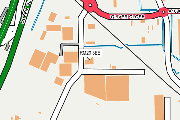
RM20 3EE lies on Oliver Close in Grays. RM20 3EE is located in the West Thurrock and South Stifford electoral ward, within the unitary authority of Thurrock and the English Parliamentary constituency of Thurrock. The Sub Integrated Care Board (ICB) Location is NHS Mid and South Essex ICB - 07G and the police force is Essex. This postcode has been in use since July 1995.


GetTheData
Source: OS OpenMap – Local (Ordnance Survey)
Source: OS VectorMap District (Ordnance Survey)
Licence: Open Government Licence (requires attribution)
| Easting | 557638 |
| Northing | 177125 |
| Latitude | 51.471135 |
| Longitude | 0.268265 |
GetTheData
Source: Open Postcode Geo
Licence: Open Government Licence
| Street | Oliver Close |
| Town/City | Grays |
| Country | England |
| Postcode District | RM20 |
➜ See where RM20 is on a map ➜ Where is West Thurrock? | |
GetTheData
Source: Land Registry Price Paid Data
Licence: Open Government Licence
Elevation or altitude of RM20 3EE as distance above sea level:
| Metres | Feet | |
|---|---|---|
| Elevation | 0m | 0ft |
Elevation is measured from the approximate centre of the postcode, to the nearest point on an OS contour line from OS Terrain 50, which has contour spacing of ten vertical metres.
➜ How high above sea level am I? Find the elevation of your current position using your device's GPS.
GetTheData
Source: Open Postcode Elevation
Licence: Open Government Licence
| Ward | West Thurrock And South Stifford |
| Constituency | Thurrock |
GetTheData
Source: ONS Postcode Database
Licence: Open Government Licence
| Weston Avenue (London Road) | West Thurrock | 563m |
| Weston Avenue (London Road) | West Thurrock | 581m |
| The Rabbits (London Road) | West Thurrock | 710m |
| Motherwell Way | West Thurrock | 729m |
| Weston Avenue South End Menzies (Weston Avenue) | West Thurrock | 764m |
| Chafford Hundred Station | 2.1km |
| Stone Crossing Station | 2.2km |
| Purfleet Station | 2.4km |
GetTheData
Source: NaPTAN
Licence: Open Government Licence
| Median download speed | 2.8Mbps |
| Average download speed | 3.2Mbps |
| Maximum download speed | 4.26Mbps |
| Median upload speed | 0.9Mbps |
| Average upload speed | 0.9Mbps |
| Maximum upload speed | 1.05Mbps |
GetTheData
Source: Ofcom
Licence: Ofcom Terms of Use (requires attribution)
GetTheData
Source: ONS Postcode Database
Licence: Open Government Licence


➜ Get more ratings from the Food Standards Agency
GetTheData
Source: Food Standards Agency
Licence: FSA terms & conditions
| Last Collection | |||
|---|---|---|---|
| Location | Mon-Fri | Sat | Distance |
| Watts Wood | 17:45 | 12:00 | 1,669m |
| Tesco Lakeside | 18:30 | 11:30 | 1,996m |
| Wood Avenue | 17:45 | 12:00 | 2,005m |
GetTheData
Source: Dracos
Licence: Creative Commons Attribution-ShareAlike
| Risk of RM20 3EE flooding from rivers and sea | Very Low |
| ➜ RM20 3EE flood map | |
GetTheData
Source: Open Flood Risk by Postcode
Licence: Open Government Licence
The below table lists the International Territorial Level (ITL) codes (formerly Nomenclature of Territorial Units for Statistics (NUTS) codes) and Local Administrative Units (LAU) codes for RM20 3EE:
| ITL 1 Code | Name |
|---|---|
| TLH | East |
| ITL 2 Code | Name |
| TLH3 | Essex |
| ITL 3 Code | Name |
| TLH32 | Thurrock |
| LAU 1 Code | Name |
| E06000034 | Thurrock |
GetTheData
Source: ONS Postcode Directory
Licence: Open Government Licence
The below table lists the Census Output Area (OA), Lower Layer Super Output Area (LSOA), and Middle Layer Super Output Area (MSOA) for RM20 3EE:
| Code | Name | |
|---|---|---|
| OA | E00080946 | |
| LSOA | E01016012 | Thurrock 015C |
| MSOA | E02003310 | Thurrock 015 |
GetTheData
Source: ONS Postcode Directory
Licence: Open Government Licence
| RM20 3LG | London Road | 477m |
| RM20 3AT | London Road | 567m |
| RM20 3LH | London Road | 633m |
| RM20 3JT | London Road | 730m |
| RM20 3AQ | Fox Field Close | 730m |
| RM19 1SD | London Road | 760m |
| RM20 3AP | Schoolfield Road | 802m |
| RM20 3HX | London Road | 840m |
| RM20 3JA | Essex Road | 845m |
| RM20 3JH | Third Avenue | 851m |
GetTheData
Source: Open Postcode Geo; Land Registry Price Paid Data
Licence: Open Government Licence