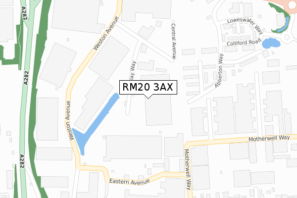
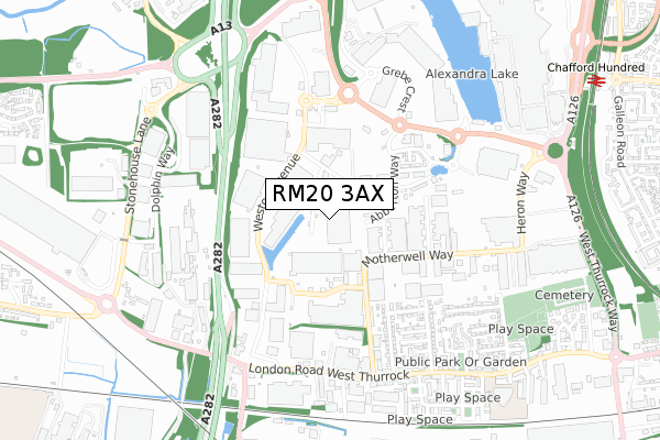
RM20 3AX is located in the West Thurrock and South Stifford electoral ward, within the unitary authority of Thurrock and the English Parliamentary constituency of Thurrock. The Sub Integrated Care Board (ICB) Location is NHS Mid and South Essex ICB - 07G and the police force is Essex. This postcode has been in use since March 2019.


GetTheData
Source: OS Open Zoomstack (Ordnance Survey)
Licence: Open Government Licence (requires attribution)
Attribution: Contains OS data © Crown copyright and database right 2025
Source: Open Postcode Geo
Licence: Open Government Licence (requires attribution)
Attribution: Contains OS data © Crown copyright and database right 2025; Contains Royal Mail data © Royal Mail copyright and database right 2025; Source: Office for National Statistics licensed under the Open Government Licence v.3.0
| Easting | 557911 |
| Northing | 178256 |
| Latitude | 51.481220 |
| Longitude | 0.272726 |
GetTheData
Source: Open Postcode Geo
Licence: Open Government Licence
| Country | England |
| Postcode District | RM20 |
➜ See where RM20 is on a map ➜ Where is West Thurrock? | |
GetTheData
Source: Land Registry Price Paid Data
Licence: Open Government Licence
| Ward | West Thurrock And South Stifford |
| Constituency | Thurrock |
GetTheData
Source: ONS Postcode Database
Licence: Open Government Licence
| Weston Avenue Carland (Weston Avenue) | West Thurrock | 248m |
| Weston Avenue Carland (Weston Avenue) | West Thurrock | 267m |
| Eastern Avenue (Weston Avenue) | West Thurrock | 296m |
| Eastern Avenue (Weston Avenue) | West Thurrock | 300m |
| Motherwell Way Thermalite (Motherwell Way) | West Thurrock | 313m |
| Chafford Hundred Station | 1.1km |
| Purfleet Station | 2.5km |
| Stone Crossing Station | 3.4km |
GetTheData
Source: NaPTAN
Licence: Open Government Licence
GetTheData
Source: ONS Postcode Database
Licence: Open Government Licence

➜ Get more ratings from the Food Standards Agency
GetTheData
Source: Food Standards Agency
Licence: FSA terms & conditions
| Last Collection | |||
|---|---|---|---|
| Location | Mon-Fri | Sat | Distance |
| Tesco Lakeside | 18:30 | 11:30 | 833m |
| Watts Wood | 17:45 | 12:00 | 1,103m |
| Wood Avenue | 17:45 | 12:00 | 1,640m |
GetTheData
Source: Dracos
Licence: Creative Commons Attribution-ShareAlike
| Risk of RM20 3AX flooding from rivers and sea | Very Low |
| ➜ RM20 3AX flood map | |
GetTheData
Source: Open Flood Risk by Postcode
Licence: Open Government Licence
The below table lists the International Territorial Level (ITL) codes (formerly Nomenclature of Territorial Units for Statistics (NUTS) codes) and Local Administrative Units (LAU) codes for RM20 3AX:
| ITL 1 Code | Name |
|---|---|
| TLH | East |
| ITL 2 Code | Name |
| TLH3 | Essex |
| ITL 3 Code | Name |
| TLH32 | Thurrock |
| LAU 1 Code | Name |
| E06000034 | Thurrock |
GetTheData
Source: ONS Postcode Directory
Licence: Open Government Licence
The below table lists the Census Output Area (OA), Lower Layer Super Output Area (LSOA), and Middle Layer Super Output Area (MSOA) for RM20 3AX:
| Code | Name | |
|---|---|---|
| OA | E00080946 | |
| LSOA | E01016012 | Thurrock 015C |
| MSOA | E02003310 | Thurrock 015 |
GetTheData
Source: ONS Postcode Directory
Licence: Open Government Licence
| RM20 3WD | Central Avenue | 228m |
| RM20 3FH | Eastern Avenue | 228m |
| RM20 3XD | Trading Estate | 429m |
| RM20 3JP | Fifth Avenue | 460m |
| RM20 3JR | First Avenue | 483m |
| RM20 3JJ | Fourth Avenue | 515m |
| RM20 3JL | Second Avenue | 520m |
| RM20 3JH | Third Avenue | 594m |
| RM20 3JT | London Road | 613m |
| RM20 3JB | Second Avenue | 623m |
GetTheData
Source: Open Postcode Geo; Land Registry Price Paid Data
Licence: Open Government Licence