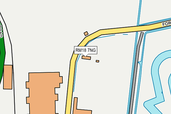
RM18 7NG is located in the Tilbury Riverside and Thurrock Park electoral ward, within the unitary authority of Thurrock and the English Parliamentary constituency of Thurrock. The Sub Integrated Care Board (ICB) Location is NHS Mid and South Essex ICB - 07G and the police force is Essex. This postcode has been in use since November 2003.


GetTheData
Source: OS OpenMap – Local (Ordnance Survey)
Source: OS VectorMap District (Ordnance Survey)
Licence: Open Government Licence (requires attribution)
| Easting | 564340 |
| Northing | 175133 |
| Latitude | 51.451335 |
| Longitude | 0.363778 |
GetTheData
Source: Open Postcode Geo
Licence: Open Government Licence
| Country | England |
| Postcode District | RM18 |
➜ See where RM18 is on a map ➜ Where is Tilbury? | |
GetTheData
Source: Land Registry Price Paid Data
Licence: Open Government Licence
Elevation or altitude of RM18 7NG as distance above sea level:
| Metres | Feet | |
|---|---|---|
| Elevation | 0m | 0ft |
Elevation is measured from the approximate centre of the postcode, to the nearest point on an OS contour line from OS Terrain 50, which has contour spacing of ten vertical metres.
➜ How high above sea level am I? Find the elevation of your current position using your device's GPS.
GetTheData
Source: Open Postcode Elevation
Licence: Open Government Licence
| Ward | Tilbury Riverside And Thurrock Park |
| Constituency | Thurrock |
GetTheData
Source: ONS Postcode Database
Licence: Open Government Licence
| Fort Road | Tilbury | 167m |
| Ferry Road | Tilbury | 757m |
| Montreal Road | Tilbury | 808m |
| St George's Centre (Church Street) | Gravesend | 812m |
| St George's Centre (Church Street) | Gravesend | 825m |
| Gravesend Station | 1.1km |
| Tilbury Town Station | 1.4km |
| Northfleet Station | 2.8km |
GetTheData
Source: NaPTAN
Licence: Open Government Licence
GetTheData
Source: ONS Postcode Database
Licence: Open Government Licence


➜ Get more ratings from the Food Standards Agency
GetTheData
Source: Food Standards Agency
Licence: FSA terms & conditions
| Last Collection | |||
|---|---|---|---|
| Location | Mon-Fri | Sat | Distance |
| Whsmith | 17:15 | 12:00 | 938m |
| New Road Post Office | 18:30 | 12:00 | 1,042m |
| New Road Old Post Office | 18:30 | 11:00 | 1,042m |
GetTheData
Source: Dracos
Licence: Creative Commons Attribution-ShareAlike
| Risk of RM18 7NG flooding from rivers and sea | Low |
| ➜ RM18 7NG flood map | |
GetTheData
Source: Open Flood Risk by Postcode
Licence: Open Government Licence
The below table lists the International Territorial Level (ITL) codes (formerly Nomenclature of Territorial Units for Statistics (NUTS) codes) and Local Administrative Units (LAU) codes for RM18 7NG:
| ITL 1 Code | Name |
|---|---|
| TLH | East |
| ITL 2 Code | Name |
| TLH3 | Essex |
| ITL 3 Code | Name |
| TLH32 | Thurrock |
| LAU 1 Code | Name |
| E06000034 | Thurrock |
GetTheData
Source: ONS Postcode Directory
Licence: Open Government Licence
The below table lists the Census Output Area (OA), Lower Layer Super Output Area (LSOA), and Middle Layer Super Output Area (MSOA) for RM18 7NG:
| Code | Name | |
|---|---|---|
| OA | E00080915 | |
| LSOA | E01016004 | Thurrock 018B |
| MSOA | E02003313 | Thurrock 018 |
GetTheData
Source: ONS Postcode Directory
Licence: Open Government Licence
| DA11 0DD | Clifton Marine Parade | 666m |
| DA11 0DH | Clifton Marine Parade | 672m |
| DA11 0DR | Clifton Marine Parade | 672m |
| DA11 0BP | West Street | 676m |
| DA11 0BW | West Street | 690m |
| DA11 0BE | West Street | 699m |
| DA11 0BG | West Street | 710m |
| DA11 0BN | West Street | 722m |
| DA11 0AH | Clifton Road | 729m |
| DA11 0AN | Clifton Road | 732m |
GetTheData
Source: Open Postcode Geo; Land Registry Price Paid Data
Licence: Open Government Licence