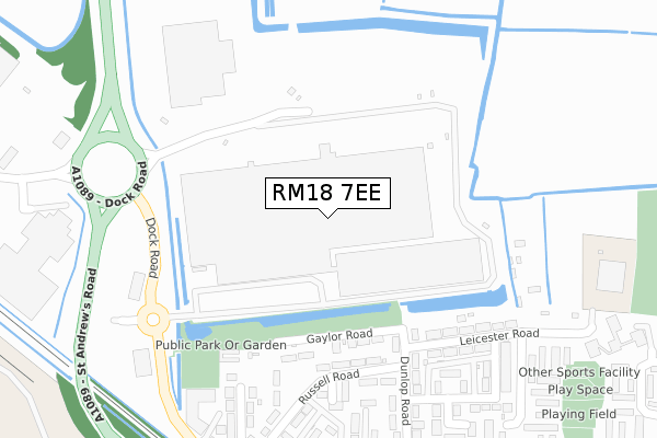
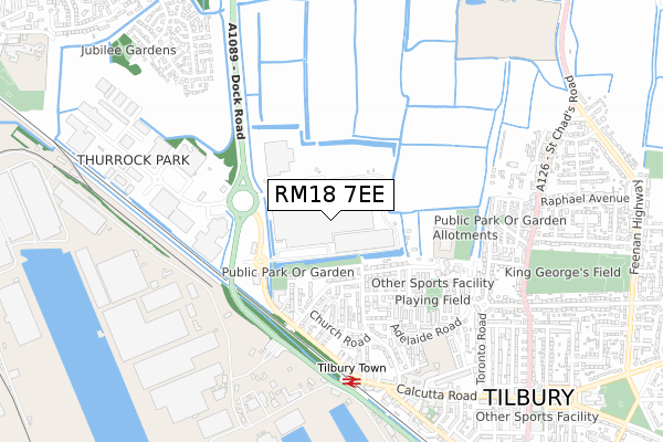
RM18 7EE is located in the Tilbury St Chads electoral ward, within the unitary authority of Thurrock and the English Parliamentary constituency of Thurrock. The Sub Integrated Care Board (ICB) Location is NHS Mid and South Essex ICB - 07G and the police force is Essex. This postcode has been in use since October 2018.


GetTheData
Source: OS Open Zoomstack (Ordnance Survey)
Licence: Open Government Licence (requires attribution)
Attribution: Contains OS data © Crown copyright and database right 2025
Source: Open Postcode Geo
Licence: Open Government Licence (requires attribution)
Attribution: Contains OS data © Crown copyright and database right 2025; Contains Royal Mail data © Royal Mail copyright and database right 2025; Source: Office for National Statistics licensed under the Open Government Licence v.3.0
| Easting | 563549 |
| Northing | 176943 |
| Latitude | 51.467824 |
| Longitude | 0.353241 |
GetTheData
Source: Open Postcode Geo
Licence: Open Government Licence
| Country | England |
| Postcode District | RM18 |
➜ See where RM18 is on a map ➜ Where is Tilbury? | |
GetTheData
Source: Land Registry Price Paid Data
Licence: Open Government Licence
| Ward | Tilbury St Chads |
| Constituency | Thurrock |
GetTheData
Source: ONS Postcode Database
Licence: Open Government Licence
| Russell Road (Dock Road) | Tilbury | 398m |
| Russell Road (Dock Road) | Tilbury | 406m |
| Tilbury Docks Main Entrance (St Andrews Road) | Tilbury | 492m |
| Railway Station (Dock Road) | Tilbury | 554m |
| Asda (Car Park) | Tilbury | 566m |
| Tilbury Town Station | 0.6km |
| Grays Station | 2.4km |
| Gravesend Station | 3.1km |
GetTheData
Source: NaPTAN
Licence: Open Government Licence
GetTheData
Source: ONS Postcode Database
Licence: Open Government Licence


➜ Get more ratings from the Food Standards Agency
GetTheData
Source: Food Standards Agency
Licence: FSA terms & conditions
| Last Collection | |||
|---|---|---|---|
| Location | Mon-Fri | Sat | Distance |
| Gipsy Lane | 17:00 | 12:00 | 1,525m |
| Chadwell Road | 17:30 | 12:00 | 1,939m |
| Southend Road | 17:30 | 12:00 | 2,185m |
GetTheData
Source: Dracos
Licence: Creative Commons Attribution-ShareAlike
| Risk of RM18 7EE flooding from rivers and sea | Low |
| ➜ RM18 7EE flood map | |
GetTheData
Source: Open Flood Risk by Postcode
Licence: Open Government Licence
The below table lists the International Territorial Level (ITL) codes (formerly Nomenclature of Territorial Units for Statistics (NUTS) codes) and Local Administrative Units (LAU) codes for RM18 7EE:
| ITL 1 Code | Name |
|---|---|
| TLH | East |
| ITL 2 Code | Name |
| TLH3 | Essex |
| ITL 3 Code | Name |
| TLH32 | Thurrock |
| LAU 1 Code | Name |
| E06000034 | Thurrock |
GetTheData
Source: ONS Postcode Directory
Licence: Open Government Licence
The below table lists the Census Output Area (OA), Lower Layer Super Output Area (LSOA), and Middle Layer Super Output Area (MSOA) for RM18 7EE:
| Code | Name | |
|---|---|---|
| OA | E00080930 | |
| LSOA | E01016007 | Thurrock 018E |
| MSOA | E02003313 | Thurrock 018 |
GetTheData
Source: ONS Postcode Directory
Licence: Open Government Licence
| RM18 7AS | Gaylor Road | 195m |
| RM18 7AU | Dunlop Road | 252m |
| RM18 7AH | Russell Road | 272m |
| RM18 7AX | Leicester Road | 275m |
| RM18 7AB | Melbourne Road | 299m |
| RM18 7AP | Seymour Road | 340m |
| RM18 7AZ | Melbourne Road | 348m |
| RM18 7AR | Dunlop Road | 350m |
| RM18 7BB | Fairfax Road | 356m |
| RM18 7BA | Sexton Road | 356m |
GetTheData
Source: Open Postcode Geo; Land Registry Price Paid Data
Licence: Open Government Licence