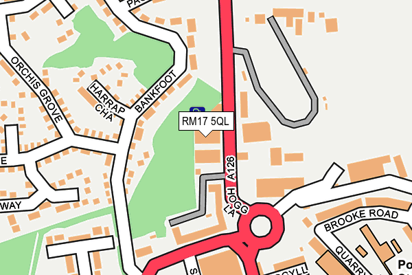
RM17 5QL is located in the Grays Riverside electoral ward, within the unitary authority of Thurrock and the English Parliamentary constituency of Thurrock. The Sub Integrated Care Board (ICB) Location is NHS Mid and South Essex ICB - 07G and the police force is Essex. This postcode has been in use since October 1985.


GetTheData
Source: OS OpenMap – Local (Ordnance Survey)
Source: OS VectorMap District (Ordnance Survey)
Licence: Open Government Licence (requires attribution)
| Easting | 561126 |
| Northing | 178289 |
| Latitude | 51.480611 |
| Longitude | 0.318972 |
GetTheData
Source: Open Postcode Geo
Licence: Open Government Licence
| Country | England |
| Postcode District | RM17 |
➜ See where RM17 is on a map ➜ Where is Grays? | |
GetTheData
Source: Land Registry Price Paid Data
Licence: Open Government Licence
Elevation or altitude of RM17 5QL as distance above sea level:
| Metres | Feet | |
|---|---|---|
| Elevation | 10m | 33ft |
Elevation is measured from the approximate centre of the postcode, to the nearest point on an OS contour line from OS Terrain 50, which has contour spacing of ten vertical metres.
➜ How high above sea level am I? Find the elevation of your current position using your device's GPS.
GetTheData
Source: Open Postcode Elevation
Licence: Open Government Licence
| Ward | Grays Riverside |
| Constituency | Thurrock |
GetTheData
Source: ONS Postcode Database
Licence: Open Government Licence
| Aldi (London Road) | Grays | 463m |
| Russell Road (Hathaway Road) | Grays | 540m |
| Stanley Road (Bedford Road) | Grays | 547m |
| Hathaway Road | Grays | 558m |
| Stanley Road | Grays | 566m |
| Grays Station | 0.5km |
| Chafford Hundred Station | 2.3km |
| Tilbury Town Station | 3.2km |
GetTheData
Source: NaPTAN
Licence: Open Government Licence
GetTheData
Source: ONS Postcode Database
Licence: Open Government Licence


➜ Get more ratings from the Food Standards Agency
GetTheData
Source: Food Standards Agency
Licence: FSA terms & conditions
| Last Collection | |||
|---|---|---|---|
| Location | Mon-Fri | Sat | Distance |
| Grays Delivery Office | 19:00 | 13:00 | 112m |
| Bankfoot/Badgers Dean | 17:30 | 12:00 | 131m |
| Orsett Road | 17:30 | 12:30 | 449m |
GetTheData
Source: Dracos
Licence: Creative Commons Attribution-ShareAlike
The below table lists the International Territorial Level (ITL) codes (formerly Nomenclature of Territorial Units for Statistics (NUTS) codes) and Local Administrative Units (LAU) codes for RM17 5QL:
| ITL 1 Code | Name |
|---|---|
| TLH | East |
| ITL 2 Code | Name |
| TLH3 | Essex |
| ITL 3 Code | Name |
| TLH32 | Thurrock |
| LAU 1 Code | Name |
| E06000034 | Thurrock |
GetTheData
Source: ONS Postcode Directory
Licence: Open Government Licence
The below table lists the Census Output Area (OA), Lower Layer Super Output Area (LSOA), and Middle Layer Super Output Area (MSOA) for RM17 5QL:
| Code | Name | |
|---|---|---|
| OA | E00080669 | |
| LSOA | E01015956 | Thurrock 016B |
| MSOA | E02003311 | Thurrock 016 |
GetTheData
Source: ONS Postcode Directory
Licence: Open Government Licence
| RM17 5JA | Bankfoot | 85m |
| RM17 5QQ | Hogg Lane | 139m |
| RM17 5EW | Harrap Chase | 160m |
| RM17 5XN | Hogg Lane | 194m |
| RM17 5XG | Seally Road | 196m |
| RM17 5BS | Argyll Road | 217m |
| RM17 5BT | Quarry Hill | 219m |
| RM17 5XT | Hogg Lane | 233m |
| RM17 5HS | Pagette Way | 242m |
| RM17 5JE | Kiln Way | 251m |
GetTheData
Source: Open Postcode Geo; Land Registry Price Paid Data
Licence: Open Government Licence