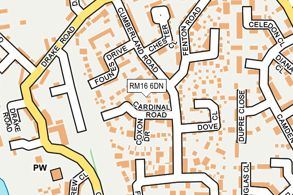
RM16 6DN is located in the Chafford and North Stifford electoral ward, within the unitary authority of Thurrock and the English Parliamentary constituency of Thurrock. The Sub Integrated Care Board (ICB) Location is NHS Mid and South Essex ICB - 07G and the police force is Essex. This postcode has been in use since May 2010.


GetTheData
Source: OS OpenMap – Local (Ordnance Survey)
Source: OS VectorMap District (Ordnance Survey)
Licence: Open Government Licence (requires attribution)
| Easting | 559120 |
| Northing | 179659 |
| Latitude | 51.493487 |
| Longitude | 0.290754 |
GetTheData
Source: Open Postcode Geo
Licence: Open Government Licence
| Country | England |
| Postcode District | RM16 |
➜ See where RM16 is on a map | |
GetTheData
Source: Land Registry Price Paid Data
Licence: Open Government Licence
Elevation or altitude of RM16 6DN as distance above sea level:
| Metres | Feet | |
|---|---|---|
| Elevation | 20m | 66ft |
Elevation is measured from the approximate centre of the postcode, to the nearest point on an OS contour line from OS Terrain 50, which has contour spacing of ten vertical metres.
➜ How high above sea level am I? Find the elevation of your current position using your device's GPS.
GetTheData
Source: Open Postcode Elevation
Licence: Open Government Licence
| Ward | Chafford And North Stifford |
| Constituency | Thurrock |
GetTheData
Source: ONS Postcode Database
Licence: Open Government Licence
| Pilgrims Roundabout (Arterial Road) | Lakeside | 194m |
| Pilgrims Roundabout (Arterial Road) | Lakeside | 260m |
| Burghley Road | Chafford Hundred | 334m |
| Burghley Road | Chafford Hundred | 347m |
| Caravan Park (Pilgrims Lane) | North Stifford | 369m |
| Chafford Hundred Station | 0.9km |
| Grays Station | 2.9km |
| Ockendon Station | 3.2km |
GetTheData
Source: NaPTAN
Licence: Open Government Licence
GetTheData
Source: ONS Postcode Database
Licence: Open Government Licence


➜ Get more ratings from the Food Standards Agency
GetTheData
Source: Food Standards Agency
Licence: FSA terms & conditions
| Last Collection | |||
|---|---|---|---|
| Location | Mon-Fri | Sat | Distance |
| Purfleet Industrial Estate | 18:30 | 08:30 | 524m |
| Drake Road | 18:30 | 12:00 | 953m |
| Cruick Avenue | 16:45 | 12:15 | 1,012m |
GetTheData
Source: Dracos
Licence: Creative Commons Attribution-ShareAlike
The below table lists the International Territorial Level (ITL) codes (formerly Nomenclature of Territorial Units for Statistics (NUTS) codes) and Local Administrative Units (LAU) codes for RM16 6DN:
| ITL 1 Code | Name |
|---|---|
| TLH | East |
| ITL 2 Code | Name |
| TLH3 | Essex |
| ITL 3 Code | Name |
| TLH32 | Thurrock |
| LAU 1 Code | Name |
| E06000034 | Thurrock |
GetTheData
Source: ONS Postcode Directory
Licence: Open Government Licence
The below table lists the Census Output Area (OA), Lower Layer Super Output Area (LSOA), and Middle Layer Super Output Area (MSOA) for RM16 6DN:
| Code | Name | |
|---|---|---|
| OA | E00175295 | |
| LSOA | E01015942 | Thurrock 020C |
| MSOA | E02006926 | Thurrock 020 |
GetTheData
Source: ONS Postcode Directory
Licence: Open Government Licence
| RM16 6DG | Howard Road | 230m |
| RM16 6DD | Fleming Road | 356m |
| RM16 6NR | Gilbert Road | 411m |
| RM16 6NQ | Girona Close | 455m |
| RM16 6YE | Francisco Close | 463m |
| RM16 6NN | Gilbert Road | 471m |
| RM16 6NP | Grifon Road | 477m |
| RM16 6RL | Grifon Road | 484m |
| RM16 5UL | Back Lane | 485m |
| RM16 5UZ | Pilgrims Lane | 491m |
GetTheData
Source: Open Postcode Geo; Land Registry Price Paid Data
Licence: Open Government Licence