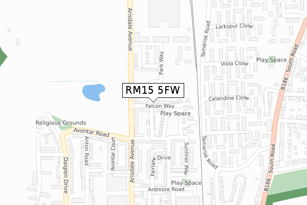
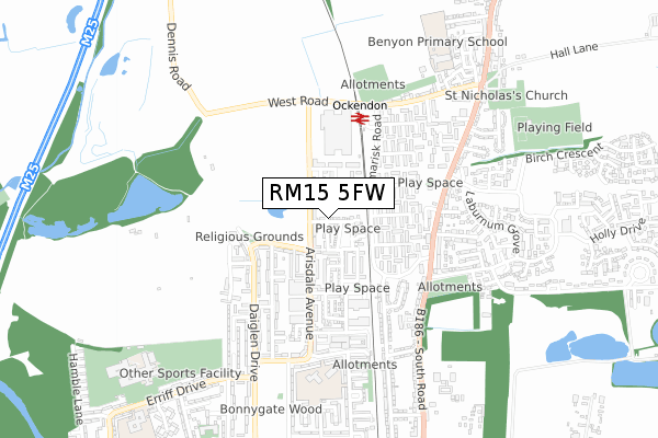
RM15 5FW is located in the Ockendon electoral ward, within the unitary authority of Thurrock and the English Parliamentary constituency of Thurrock. The Sub Integrated Care Board (ICB) Location is NHS Mid and South Essex ICB - 07G and the police force is Essex. This postcode has been in use since December 2018.


GetTheData
Source: OS Open Zoomstack (Ordnance Survey)
Licence: Open Government Licence (requires attribution)
Attribution: Contains OS data © Crown copyright and database right 2025
Source: Open Postcode Geo
Licence: Open Government Licence (requires attribution)
Attribution: Contains OS data © Crown copyright and database right 2025; Contains Royal Mail data © Royal Mail copyright and database right 2025; Source: Office for National Statistics licensed under the Open Government Licence v.3.0
| Easting | 558892 |
| Northing | 182429 |
| Latitude | 51.518438 |
| Longitude | 0.288719 |
GetTheData
Source: Open Postcode Geo
Licence: Open Government Licence
| Country | England |
| Postcode District | RM15 |
➜ See where RM15 is on a map ➜ Where is South Ockendon? | |
GetTheData
Source: Land Registry Price Paid Data
Licence: Open Government Licence
| Ward | Ockendon |
| Constituency | Thurrock |
GetTheData
Source: ONS Postcode Database
Licence: Open Government Licence
2024 31 MAY £490,000 |
110, FALCON WAY, SOUTH OCKENDON, RM15 5FW 2021 5 FEB £497,950 |
108, FALCON WAY, SOUTH OCKENDON, RM15 5FW 2020 30 NOV £489,950 |
112, FALCON WAY, SOUTH OCKENDON, RM15 5FW 2020 25 NOV £482,950 |
104, FALCON WAY, SOUTH OCKENDON, RM15 5FW 2020 24 NOV £489,950 |
25, FALCON WAY, SOUTH OCKENDON, RM15 5FW 2020 30 JAN £449,995 |
2019 23 JUL £442,335 |
19, FALCON WAY, SOUTH OCKENDON, RM15 5FW 2019 24 MAY £443,995 |
17, FALCON WAY, SOUTH OCKENDON, RM15 5FW 2019 30 APR £403,995 |
24, FALCON WAY, SOUTH OCKENDON, RM15 5FW 2019 30 APR £435,000 |
GetTheData
Source: HM Land Registry Price Paid Data
Licence: Contains HM Land Registry data © Crown copyright and database right 2025. This data is licensed under the Open Government Licence v3.0.
| Arisdale Avenue | South Ockendon | 104m |
| Arisdale Avenue | South Ockendon | 106m |
| Mayflower Close (Tamarisk Road) | South Ockendon | 127m |
| Mayflower Close (Tamarisk Road) | South Ockendon | 138m |
| Anton Road (Avontar Road) | South Ockendon | 251m |
| Ockendon Station | 0.4km |
| Chafford Hundred Station | 3.7km |
| Grays Station | 5.2km |
GetTheData
Source: NaPTAN
Licence: Open Government Licence
| Percentage of properties with Next Generation Access | 100.0% |
| Percentage of properties with Superfast Broadband | 100.0% |
| Percentage of properties with Ultrafast Broadband | 100.0% |
| Percentage of properties with Full Fibre Broadband | 100.0% |
Superfast Broadband is between 30Mbps and 300Mbps
Ultrafast Broadband is > 300Mbps
Ofcom does not currently provide download speed data for RM15 5FW. This is because there are less than four broadband connections in this postcode.
Ofcom does not currently provide upload speed data for RM15 5FW. This is because there are less than four broadband connections in this postcode.
| Percentage of properties unable to receive 2Mbps | 0.0% |
| Percentage of properties unable to receive 5Mbps | 0.0% |
| Percentage of properties unable to receive 10Mbps | 0.0% |
| Percentage of properties unable to receive 30Mbps | 0.0% |
GetTheData
Source: Ofcom
Licence: Ofcom Terms of Use (requires attribution)
GetTheData
Source: ONS Postcode Database
Licence: Open Government Licence


➜ Get more ratings from the Food Standards Agency
GetTheData
Source: Food Standards Agency
Licence: FSA terms & conditions
| Last Collection | |||
|---|---|---|---|
| Location | Mon-Fri | Sat | Distance |
| West Road | 17:15 | 12:15 | 542m |
| Arisdale Avenue | 17:15 | 12:15 | 557m |
| Brandon Groves | 17:00 | 12:15 | 806m |
GetTheData
Source: Dracos
Licence: Creative Commons Attribution-ShareAlike
The below table lists the International Territorial Level (ITL) codes (formerly Nomenclature of Territorial Units for Statistics (NUTS) codes) and Local Administrative Units (LAU) codes for RM15 5FW:
| ITL 1 Code | Name |
|---|---|
| TLH | East |
| ITL 2 Code | Name |
| TLH3 | Essex |
| ITL 3 Code | Name |
| TLH32 | Thurrock |
| LAU 1 Code | Name |
| E06000034 | Thurrock |
GetTheData
Source: ONS Postcode Directory
Licence: Open Government Licence
The below table lists the Census Output Area (OA), Lower Layer Super Output Area (LSOA), and Middle Layer Super Output Area (MSOA) for RM15 5FW:
| Code | Name | |
|---|---|---|
| OA | E00080760 | |
| LSOA | E01015973 | Thurrock 006D |
| MSOA | E02003301 | Thurrock 006 |
GetTheData
Source: ONS Postcode Directory
Licence: Open Government Licence
| RM15 5FQ | Falcon Avenue | 150m |
| RM15 5FD | Avontar Road | 212m |
| RM15 5FA | Fairlane Drive | 216m |
| RM15 6HX | Tamarisk Road | 228m |
| RM15 5AX | Avontar Road | 244m |
| RM15 6HU | Tamarisk Road | 246m |
| RM15 6JA | Celandine Close | 250m |
| RM15 6HZ | Mayflower Close | 253m |
| RM15 5TH | Ardmore Road | 275m |
| RM15 6HY | Mayflower Close | 275m |
GetTheData
Source: Open Postcode Geo; Land Registry Price Paid Data
Licence: Open Government Licence