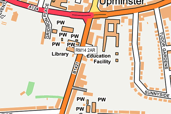
RM14 2AR is located in the Upminster electoral ward, within the London borough of Havering and the English Parliamentary constituency of Hornchurch and Upminster. The Sub Integrated Care Board (ICB) Location is NHS North East London ICB - A3A8R and the police force is Metropolitan Police. This postcode has been in use since January 1980.


GetTheData
Source: OS OpenMap – Local (Ordnance Survey)
Source: OS VectorMap District (Ordnance Survey)
Licence: Open Government Licence (requires attribution)
| Easting | 556002 |
| Northing | 186396 |
| Latitude | 51.554885 |
| Longitude | 0.248857 |
GetTheData
Source: Open Postcode Geo
Licence: Open Government Licence
| Country | England |
| Postcode District | RM14 |
➜ See where RM14 is on a map ➜ Where is Upminster? | |
GetTheData
Source: Land Registry Price Paid Data
Licence: Open Government Licence
Elevation or altitude of RM14 2AR as distance above sea level:
| Metres | Feet | |
|---|---|---|
| Elevation | 20m | 66ft |
Elevation is measured from the approximate centre of the postcode, to the nearest point on an OS contour line from OS Terrain 50, which has contour spacing of ten vertical metres.
➜ How high above sea level am I? Find the elevation of your current position using your device's GPS.
GetTheData
Source: Open Postcode Elevation
Licence: Open Government Licence
| Ward | Upminster |
| Constituency | Hornchurch And Upminster |
GetTheData
Source: ONS Postcode Database
Licence: Open Government Licence
| Upminster Library (Corbets Tey Road) | Upminster | 13m |
| Corbets Tey Road | Upminster | 175m |
| Stewart Avenue | Upminster | 187m |
| Corbets Tey Road | Upminster | 199m |
| Stewart Avenue | Upminster | 204m |
| Upminster Underground Station | Upminster | 486m |
| Upminster Bridge Underground Station | Upminster Bridge | 991m |
| Upminster Station | 0.5km |
| Emerson Park Station | 2.5km |
| Gidea Park Station | 4.2km |
GetTheData
Source: NaPTAN
Licence: Open Government Licence
GetTheData
Source: ONS Postcode Database
Licence: Open Government Licence

➜ Get more ratings from the Food Standards Agency
GetTheData
Source: Food Standards Agency
Licence: FSA terms & conditions
| Last Collection | |||
|---|---|---|---|
| Location | Mon-Fri | Sat | Distance |
| Deyn Court Gardens | 17:00 | 11:45 | 702m |
| Holden Way | 17:00 | 11:45 | 1,287m |
| St. Leonards Hamlet | 16:30 | 11:30 | 1,477m |
GetTheData
Source: Dracos
Licence: Creative Commons Attribution-ShareAlike
The below table lists the International Territorial Level (ITL) codes (formerly Nomenclature of Territorial Units for Statistics (NUTS) codes) and Local Administrative Units (LAU) codes for RM14 2AR:
| ITL 1 Code | Name |
|---|---|
| TLI | London |
| ITL 2 Code | Name |
| TLI5 | Outer London - East and North East |
| ITL 3 Code | Name |
| TLI52 | Barking & Dagenham and Havering |
| LAU 1 Code | Name |
| E09000016 | Havering |
GetTheData
Source: ONS Postcode Directory
Licence: Open Government Licence
The below table lists the Census Output Area (OA), Lower Layer Super Output Area (LSOA), and Middle Layer Super Output Area (MSOA) for RM14 2AR:
| Code | Name | |
|---|---|---|
| OA | E00011914 | |
| LSOA | E01002386 | Havering 022E |
| MSOA | E02000485 | Havering 022 |
GetTheData
Source: ONS Postcode Directory
Licence: Open Government Licence
| RM14 2AU | Corbets Tey Road | 67m |
| RM14 2AJ | Corbets Tey Road | 98m |
| RM14 2BF | Bellmaker Mews | 128m |
| RM14 2BE | Gridiron Place | 167m |
| RM14 2SH | St Mary's Lane | 167m |
| RM14 3DS | Sunnyside Gardens | 169m |
| RM14 2QB | St Marys Lane | 180m |
| RM14 3BS | St Mary's Lane | 182m |
| RM14 2AQ | Springfield Gardens | 184m |
| RM14 2AD | Corbets Tey Road | 190m |
GetTheData
Source: Open Postcode Geo; Land Registry Price Paid Data
Licence: Open Government Licence