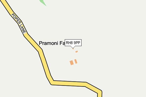
RH8 9PP is located in the Oxted South electoral ward, within the local authority district of Tandridge and the English Parliamentary constituency of East Surrey. The Sub Integrated Care Board (ICB) Location is NHS Surrey Heartlands ICB - 92A and the police force is Surrey. This postcode has been in use since March 2008.


GetTheData
Source: OS OpenMap – Local (Ordnance Survey)
Source: OS VectorMap District (Ordnance Survey)
Licence: Open Government Licence (requires attribution)
| Easting | 539398 |
| Northing | 150036 |
| Latitude | 51.232491 |
| Longitude | -0.004773 |
GetTheData
Source: Open Postcode Geo
Licence: Open Government Licence
| Country | England |
| Postcode District | RH8 |
➜ See where RH8 is on a map | |
GetTheData
Source: Land Registry Price Paid Data
Licence: Open Government Licence
Elevation or altitude of RH8 9PP as distance above sea level:
| Metres | Feet | |
|---|---|---|
| Elevation | 70m | 230ft |
Elevation is measured from the approximate centre of the postcode, to the nearest point on an OS contour line from OS Terrain 50, which has contour spacing of ten vertical metres.
➜ How high above sea level am I? Find the elevation of your current position using your device's GPS.
GetTheData
Source: Open Postcode Elevation
Licence: Open Government Licence
| Ward | Oxted South |
| Constituency | East Surrey |
GetTheData
Source: ONS Postcode Database
Licence: Open Government Licence
| Warren Lane | Holland | 899m |
| Mill Lane | Holland | 919m |
| Holland Road | Holland | 985m |
| Holland Road | Holland | 997m |
| Coldshott | Holland | 1,016m |
| Hurst Green Station | 1.5km |
| Oxted Station | 2.8km |
| Godstone Station | 3.5km |
GetTheData
Source: NaPTAN
Licence: Open Government Licence
GetTheData
Source: ONS Postcode Database
Licence: Open Government Licence


➜ Get more ratings from the Food Standards Agency
GetTheData
Source: Food Standards Agency
Licence: FSA terms & conditions
| Last Collection | |||
|---|---|---|---|
| Location | Mon-Fri | Sat | Distance |
| Merle Common | 17:00 | 08:00 | 1,379m |
| Hurstlands | 17:15 | 12:00 | 1,462m |
| Hall Hill | 16:15 | 08:45 | 1,820m |
GetTheData
Source: Dracos
Licence: Creative Commons Attribution-ShareAlike
The below table lists the International Territorial Level (ITL) codes (formerly Nomenclature of Territorial Units for Statistics (NUTS) codes) and Local Administrative Units (LAU) codes for RH8 9PP:
| ITL 1 Code | Name |
|---|---|
| TLJ | South East (England) |
| ITL 2 Code | Name |
| TLJ2 | Surrey, East and West Sussex |
| ITL 3 Code | Name |
| TLJ26 | East Surrey |
| LAU 1 Code | Name |
| E07000215 | Tandridge |
GetTheData
Source: ONS Postcode Directory
Licence: Open Government Licence
The below table lists the Census Output Area (OA), Lower Layer Super Output Area (LSOA), and Middle Layer Super Output Area (MSOA) for RH8 9PP:
| Code | Name | |
|---|---|---|
| OA | E00157252 | |
| LSOA | E01030843 | Tandridge 007D |
| MSOA | E02006434 | Tandridge 007 |
GetTheData
Source: ONS Postcode Directory
Licence: Open Government Licence
| RH8 9PJ | Popes Lane | 370m |
| RH8 9NX | Gibbs Brook Lane | 431m |
| RH8 9PL | Popes Lane | 600m |
| RH8 9DB | Warren Lane | 720m |
| RH8 9DD | Mill Lane | 769m |
| RH8 9ET | Coltsfoot Lane | 774m |
| RH8 9DE | Mill Lane | 815m |
| RH8 9DG | Mill Lane | 869m |
| RH8 9DS | Mill Lane | 925m |
| RH8 9DA | Warren Lane | 943m |
GetTheData
Source: Open Postcode Geo; Land Registry Price Paid Data
Licence: Open Government Licence