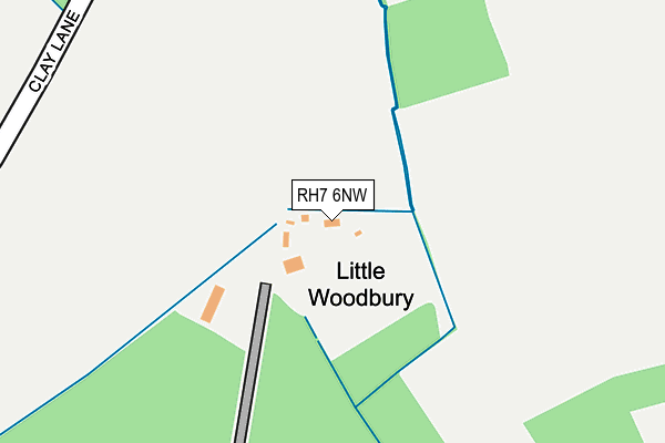
RH7 6NW is located in the Burstow, Horne and Outwood electoral ward, within the local authority district of Tandridge and the English Parliamentary constituency of East Surrey. The Sub Integrated Care Board (ICB) Location is NHS Surrey Heartlands ICB - 92A and the police force is Surrey. This postcode has been in use since July 2017.


GetTheData
Source: OS OpenMap – Local (Ordnance Survey)
Source: OS VectorMap District (Ordnance Survey)
Licence: Open Government Licence (requires attribution)
| Easting | 535910 |
| Northing | 142814 |
| Latitude | 51.168426 |
| Longitude | -0.057405 |
GetTheData
Source: Open Postcode Geo
Licence: Open Government Licence
| Country | England |
| Postcode District | RH7 |
➜ See where RH7 is on a map | |
GetTheData
Source: Land Registry Price Paid Data
Licence: Open Government Licence
| Ward | Burstow, Horne And Outwood |
| Constituency | East Surrey |
GetTheData
Source: ONS Postcode Database
Licence: Open Government Licence
| Mormon Temple (West Park Road) | Newchapel | 605m |
| Mormon Temple (West Park Road) | Newchapel | 622m |
| Newchapel (Newchapel Road) | Newchapel | 686m |
| Newchapel (Newchapel Road) | Newchapel | 688m |
| Wembury Park (Eastbourne Road) | Newchapel | 898m |
| Lingfield Station | 3.6km |
| Dormans Station | 4km |
| East Grinstead Station | 5.4km |
GetTheData
Source: NaPTAN
Licence: Open Government Licence
| Percentage of properties with Next Generation Access | 100.0% |
| Percentage of properties with Superfast Broadband | 75.0% |
| Percentage of properties with Ultrafast Broadband | 75.0% |
| Percentage of properties with Full Fibre Broadband | 75.0% |
Superfast Broadband is between 30Mbps and 300Mbps
Ultrafast Broadband is > 300Mbps
| Percentage of properties unable to receive 2Mbps | 0.0% |
| Percentage of properties unable to receive 5Mbps | 0.0% |
| Percentage of properties unable to receive 10Mbps | 0.0% |
| Percentage of properties unable to receive 30Mbps | 25.0% |
GetTheData
Source: Ofcom
Licence: Ofcom Terms of Use (requires attribution)
GetTheData
Source: ONS Postcode Database
Licence: Open Government Licence


➜ Get more ratings from the Food Standards Agency
GetTheData
Source: Food Standards Agency
Licence: FSA terms & conditions
| Last Collection | |||
|---|---|---|---|
| Location | Mon-Fri | Sat | Distance |
| Horne Park | 16:30 | 09:30 | 451m |
| Hare Lane | 16:30 | 09:30 | 983m |
| Hobbs Barracks | 16:15 | 09:15 | 1,270m |
GetTheData
Source: Dracos
Licence: Creative Commons Attribution-ShareAlike
The below table lists the International Territorial Level (ITL) codes (formerly Nomenclature of Territorial Units for Statistics (NUTS) codes) and Local Administrative Units (LAU) codes for RH7 6NW:
| ITL 1 Code | Name |
|---|---|
| TLJ | South East (England) |
| ITL 2 Code | Name |
| TLJ2 | Surrey, East and West Sussex |
| ITL 3 Code | Name |
| TLJ26 | East Surrey |
| LAU 1 Code | Name |
| E07000215 | Tandridge |
GetTheData
Source: ONS Postcode Directory
Licence: Open Government Licence
The below table lists the Census Output Area (OA), Lower Layer Super Output Area (LSOA), and Middle Layer Super Output Area (MSOA) for RH7 6NW:
| Code | Name | |
|---|---|---|
| OA | E00157139 | |
| LSOA | E01030816 | Tandridge 011A |
| MSOA | E02006438 | Tandridge 011 |
GetTheData
Source: ONS Postcode Directory
Licence: Open Government Licence
| RH7 6HX | Clay Lane | 411m |
| RH7 6HP | West Park Road | 515m |
| RH7 6HY | Brickhouse Lane | 618m |
| RH7 6LF | Eastbourne Road | 672m |
| RH7 6HR | Bones Lane | 811m |
| RH7 6LE | Newchapel Road | 875m |
| RH7 6HH | Wembury Park | 980m |
| RH7 6JA | Hare Lane | 992m |
| RH7 6BL | Newchapel Road | 1131m |
| RH7 6HJ | Wire Mill Lane | 1196m |
GetTheData
Source: Open Postcode Geo; Land Registry Price Paid Data
Licence: Open Government Licence