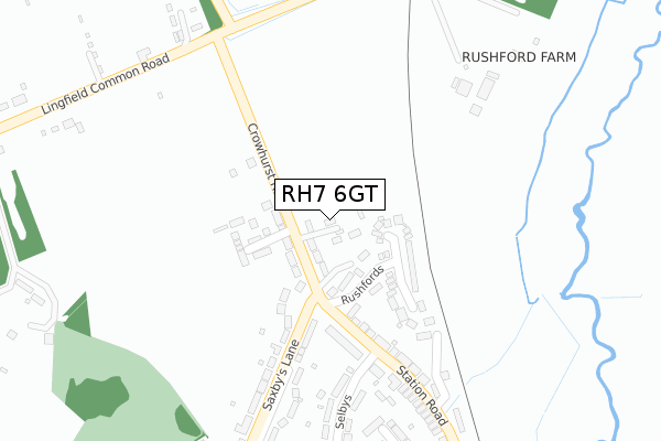
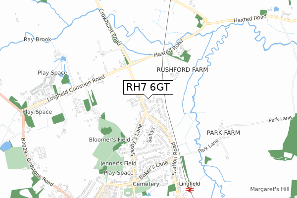
RH7 6GT is located in the Lingfield and Crowhurst electoral ward, within the local authority district of Tandridge and the English Parliamentary constituency of East Surrey. The Sub Integrated Care Board (ICB) Location is NHS Surrey Heartlands ICB - 92A and the police force is Surrey. This postcode has been in use since December 2019.


GetTheData
Source: OS Open Zoomstack (Ordnance Survey)
Licence: Open Government Licence (requires attribution)
Attribution: Contains OS data © Crown copyright and database right 2025
Source: Open Postcode Geo
Licence: Open Government Licence (requires attribution)
Attribution: Contains OS data © Crown copyright and database right 2025; Contains Royal Mail data © Royal Mail copyright and database right 2025; Source: Office for National Statistics licensed under the Open Government Licence v.3.0
| Easting | 539081 |
| Northing | 144589 |
| Latitude | 51.183616 |
| Longitude | -0.011393 |
GetTheData
Source: Open Postcode Geo
Licence: Open Government Licence
| Country | England |
| Postcode District | RH7 |
➜ See where RH7 is on a map ➜ Where is Lingfield? | |
GetTheData
Source: Land Registry Price Paid Data
Licence: Open Government Licence
| Ward | Lingfield And Crowhurst |
| Constituency | East Surrey |
GetTheData
Source: ONS Postcode Database
Licence: Open Government Licence
| Crowhurst Road (Saxbys Lane) | Lingfield | 236m |
| Crowhurst Road (Saxbys Lane) | Lingfield | 252m |
| Hare And Hounds (Lingfield Common Road) | Lingfield | 361m |
| Pauls Mead (Station Road) | Lingfield | 368m |
| Hare And Hounds (Lingfield Common Road) | Lingfield | 376m |
| Lingfield Station | 0.9km |
| Dormans Station | 3.1km |
| Godstone Station | 4.7km |
GetTheData
Source: NaPTAN
Licence: Open Government Licence
GetTheData
Source: ONS Postcode Database
Licence: Open Government Licence


➜ Get more ratings from the Food Standards Agency
GetTheData
Source: Food Standards Agency
Licence: FSA terms & conditions
| Last Collection | |||
|---|---|---|---|
| Location | Mon-Fri | Sat | Distance |
| Station Road | 16:45 | 11:00 | 316m |
| Little Lullenden | 16:45 | 11:15 | 499m |
| Vicarage Road | 17:00 | 11:00 | 816m |
GetTheData
Source: Dracos
Licence: Creative Commons Attribution-ShareAlike
| Risk of RH7 6GT flooding from rivers and sea | Low |
| ➜ RH7 6GT flood map | |
GetTheData
Source: Open Flood Risk by Postcode
Licence: Open Government Licence
The below table lists the International Territorial Level (ITL) codes (formerly Nomenclature of Territorial Units for Statistics (NUTS) codes) and Local Administrative Units (LAU) codes for RH7 6GT:
| ITL 1 Code | Name |
|---|---|
| TLJ | South East (England) |
| ITL 2 Code | Name |
| TLJ2 | Surrey, East and West Sussex |
| ITL 3 Code | Name |
| TLJ26 | East Surrey |
| LAU 1 Code | Name |
| E07000215 | Tandridge |
GetTheData
Source: ONS Postcode Directory
Licence: Open Government Licence
The below table lists the Census Output Area (OA), Lower Layer Super Output Area (LSOA), and Middle Layer Super Output Area (MSOA) for RH7 6GT:
| Code | Name | |
|---|---|---|
| OA | E00157219 | |
| LSOA | E01030834 | Tandridge 010D |
| MSOA | E02006437 | Tandridge 010 |
GetTheData
Source: ONS Postcode Directory
Licence: Open Government Licence
| RH7 6DA | Crowhurst Road | 70m |
| RH7 6EG | Rushfords | 121m |
| RH7 6EJ | Knights Mead | 152m |
| RH7 6DY | Station Road | 226m |
| RH7 6DR | Saxbys Lane | 309m |
| RH7 6DU | Selbys | 324m |
| RH7 6DP | Saxbys Lane | 327m |
| RH7 6DX | Station Road | 339m |
| RH7 6DT | Grove Road | 370m |
| RH7 6DZ | Station Road | 381m |
GetTheData
Source: Open Postcode Geo; Land Registry Price Paid Data
Licence: Open Government Licence