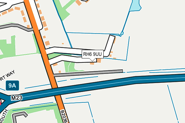
RH6 9UU is located in the Horley Central & South electoral ward, within the local authority district of Reigate and Banstead and the English Parliamentary constituency of East Surrey. The Sub Integrated Care Board (ICB) Location is NHS Surrey Heartlands ICB - 92A and the police force is Surrey. This postcode has been in use since July 1983.


GetTheData
Source: OS OpenMap – Local (Ordnance Survey)
Source: OS VectorMap District (Ordnance Survey)
Licence: Open Government Licence (requires attribution)
| Easting | 529514 |
| Northing | 141774 |
| Latitude | 51.160566 |
| Longitude | -0.149238 |
GetTheData
Source: Open Postcode Geo
Licence: Open Government Licence
| Country | England |
| Postcode District | RH6 |
➜ See where RH6 is on a map ➜ Where is Horley? | |
GetTheData
Source: Land Registry Price Paid Data
Licence: Open Government Licence
Elevation or altitude of RH6 9UU as distance above sea level:
| Metres | Feet | |
|---|---|---|
| Elevation | 60m | 197ft |
Elevation is measured from the approximate centre of the postcode, to the nearest point on an OS contour line from OS Terrain 50, which has contour spacing of ten vertical metres.
➜ How high above sea level am I? Find the elevation of your current position using your device's GPS.
GetTheData
Source: Open Postcode Elevation
Licence: Open Government Licence
| Ward | Horley Central & South |
| Constituency | East Surrey |
GetTheData
Source: ONS Postcode Database
Licence: Open Government Licence
| Coppingham Arms (Balcombe Road) | Horley | 165m |
| Coppingham Arms (Balcombe Road) | Horley | 167m |
| Courtyard Marriott Hotel (Buckingham Gate) | Gatwick Airport | 308m |
| Meadowcroft Close | Horley | 356m |
| Meadowcroft Close | Horley | 381m |
| Gatwick South Terminal Shuttle Station (South Terminal) | Gatwick Airport | 938m |
| Gatwick Airport Station | 0.9km |
| Horley Station | 1.2km |
| Salfords (Surrey) Station | 4.7km |
GetTheData
Source: NaPTAN
Licence: Open Government Licence
GetTheData
Source: ONS Postcode Database
Licence: Open Government Licence


➜ Get more ratings from the Food Standards Agency
GetTheData
Source: Food Standards Agency
Licence: FSA terms & conditions
| Last Collection | |||
|---|---|---|---|
| Location | Mon-Fri | Sat | Distance |
| Coppingham Arms | 17:00 | 09:15 | 159m |
| Haroldslea | 17:15 | 12:00 | 720m |
| Gatwick South Top Floor | 18:30 | 12:00 | 1,083m |
GetTheData
Source: Dracos
Licence: Creative Commons Attribution-ShareAlike
The below table lists the International Territorial Level (ITL) codes (formerly Nomenclature of Territorial Units for Statistics (NUTS) codes) and Local Administrative Units (LAU) codes for RH6 9UU:
| ITL 1 Code | Name |
|---|---|
| TLJ | South East (England) |
| ITL 2 Code | Name |
| TLJ2 | Surrey, East and West Sussex |
| ITL 3 Code | Name |
| TLJ26 | East Surrey |
| LAU 1 Code | Name |
| E07000211 | Reigate and Banstead |
GetTheData
Source: ONS Postcode Directory
Licence: Open Government Licence
The below table lists the Census Output Area (OA), Lower Layer Super Output Area (LSOA), and Middle Layer Super Output Area (MSOA) for RH6 9UU:
| Code | Name | |
|---|---|---|
| OA | E00155972 | |
| LSOA | E01030583 | Reigate and Banstead 017D |
| MSOA | E02006391 | Reigate and Banstead 017 |
GetTheData
Source: ONS Postcode Directory
Licence: Open Government Licence
| RH6 9ER | Balcombe Road | 238m |
| RH6 9EB | The Close | 252m |
| RH6 9EF | Balcombe Road | 253m |
| RH6 9EJ | Meadowcroft Close | 330m |
| RH6 9SJ | Balcombe Road | 332m |
| RH6 9EL | Meadowcroft Close | 386m |
| RH6 9EP | Warltersville Way | 457m |
| RH6 9FZ | Thomas Waters Way | 464m |
| RH6 9ES | Balcombe Road | 537m |
| RH6 9EA | Balcombe Road | 553m |
GetTheData
Source: Open Postcode Geo; Land Registry Price Paid Data
Licence: Open Government Licence