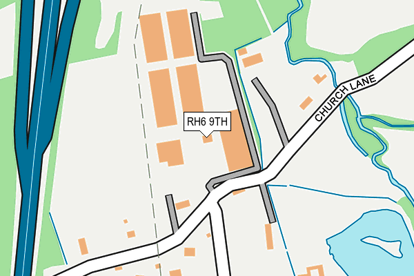
RH6 9TH is located in the Burstow, Horne and Outwood electoral ward, within the local authority district of Tandridge and the English Parliamentary constituency of East Surrey. The Sub Integrated Care Board (ICB) Location is NHS Surrey Heartlands ICB - 92A and the police force is Surrey. This postcode has been in use since March 2017.


GetTheData
Source: OS OpenMap – Local (Ordnance Survey)
Source: OS VectorMap District (Ordnance Survey)
Licence: Open Government Licence (requires attribution)
| Easting | 530727 |
| Northing | 141227 |
| Latitude | 51.155370 |
| Longitude | -0.132072 |
GetTheData
Source: Open Postcode Geo
Licence: Open Government Licence
| Country | England |
| Postcode District | RH6 |
➜ See where RH6 is on a map ➜ Where is Burstow? | |
GetTheData
Source: Land Registry Price Paid Data
Licence: Open Government Licence
| Ward | Burstow, Horne And Outwood |
| Constituency | East Surrey |
GetTheData
Source: ONS Postcode Database
Licence: Open Government Licence
| Antlands Lane | Shipley Bridge | 794m |
| Antlands Lane | Shipley Bridge | 808m |
| Shipley Bridge Inn (Antlands Lane) | Shipley Bridge | 821m |
| Shipley Bridge Inn (Antlands Lane) | Shipley Bridge | 832m |
| Burstow Nurseries (Antlands Lane) | Crawley | 853m |
| Gatwick Airport Station | 2km |
| Horley Station | 2.5km |
| Three Bridges Station | 4.7km |
GetTheData
Source: NaPTAN
Licence: Open Government Licence
GetTheData
Source: ONS Postcode Database
Licence: Open Government Licence


➜ Get more ratings from the Food Standards Agency
GetTheData
Source: Food Standards Agency
Licence: FSA terms & conditions
| Last Collection | |||
|---|---|---|---|
| Location | Mon-Fri | Sat | Distance |
| Balcombe Road | 16:45 | 09:00 | 1,069m |
| Coppingham Arms | 17:00 | 09:15 | 1,483m |
| Keepers Corner | 16:30 | 08:45 | 1,500m |
GetTheData
Source: Dracos
Licence: Creative Commons Attribution-ShareAlike
The below table lists the International Territorial Level (ITL) codes (formerly Nomenclature of Territorial Units for Statistics (NUTS) codes) and Local Administrative Units (LAU) codes for RH6 9TH:
| ITL 1 Code | Name |
|---|---|
| TLJ | South East (England) |
| ITL 2 Code | Name |
| TLJ2 | Surrey, East and West Sussex |
| ITL 3 Code | Name |
| TLJ26 | East Surrey |
| LAU 1 Code | Name |
| E07000215 | Tandridge |
GetTheData
Source: ONS Postcode Directory
Licence: Open Government Licence
The below table lists the Census Output Area (OA), Lower Layer Super Output Area (LSOA), and Middle Layer Super Output Area (MSOA) for RH6 9TH:
| Code | Name | |
|---|---|---|
| OA | E00157126 | |
| LSOA | E01030819 | Tandridge 011D |
| MSOA | E02006438 | Tandridge 011 |
GetTheData
Source: ONS Postcode Directory
Licence: Open Government Licence
| RH6 9TG | Church Lane | 170m |
| RH6 9TJ | Green Lane | 380m |
| RH6 9ST | Peeks Brook Lane | 401m |
| RH6 9RG | Church Road | 653m |
| RH6 9SS | Peeks Brook Lane | 701m |
| RH6 9TE | Antlands Lane | 737m |
| RH6 9SZ | Donkey Lane | 812m |
| RH6 9SR | Antlands Lane | 844m |
| RH6 9SY | Fernhill | 856m |
| RH6 9SN | Balcombe Road | 1008m |
GetTheData
Source: Open Postcode Geo; Land Registry Price Paid Data
Licence: Open Government Licence