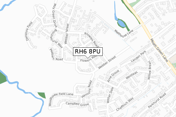
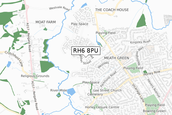
RH6 8PU is located in the Horley West & Sidlow electoral ward, within the local authority district of Reigate and Banstead and the English Parliamentary constituency of East Surrey. The Sub Integrated Care Board (ICB) Location is NHS Surrey Heartlands ICB - 92A and the police force is Surrey. This postcode has been in use since April 2019.


GetTheData
Source: OS Open Zoomstack (Ordnance Survey)
Licence: Open Government Licence (requires attribution)
Attribution: Contains OS data © Crown copyright and database right 2024
Source: Open Postcode Geo
Licence: Open Government Licence (requires attribution)
Attribution: Contains OS data © Crown copyright and database right 2024; Contains Royal Mail data © Royal Mail copyright and database right 2024; Source: Office for National Statistics licensed under the Open Government Licence v.3.0
| Easting | 527009 |
| Northing | 144154 |
| Latitude | 51.182514 |
| Longitude | -0.184175 |
GetTheData
Source: Open Postcode Geo
Licence: Open Government Licence
| Country | England |
| Postcode District | RH6 |
➜ See where RH6 is on a map ➜ Where is Horley? | |
GetTheData
Source: Land Registry Price Paid Data
Licence: Open Government Licence
| Ward | Horley West & Sidlow |
| Constituency | East Surrey |
GetTheData
Source: ONS Postcode Database
Licence: Open Government Licence
12, FLOWERS ROAD, HORLEY, RH6 8PU 2020 24 JAN £549,950 |
10, FLOWERS ROAD, HORLEY, RH6 8PU 2019 19 DEC £510,000 |
15, FLOWERS ROAD, HORLEY, RH6 8PU 2019 31 OCT £439,950 |
7, FLOWERS ROAD, HORLEY, RH6 8PU 2019 26 APR £419,950 |
9, FLOWERS ROAD, HORLEY, RH6 8PU 2019 29 MAR £514,950 |
GetTheData
Source: HM Land Registry Price Paid Data
Licence: Contains HM Land Registry data © Crown copyright and database right 2024. This data is licensed under the Open Government Licence v3.0.
| Chesters | Meath Green | 230m |
| Westleas | Meath Green | 276m |
| Willow Brean | Meath Green | 361m |
| Landen Park | Meath Green | 364m |
| Wither Dale | Meath Green | 368m |
| Horley Station | 2.2km |
| Salfords (Surrey) Station | 2.6km |
| Gatwick Airport Station | 3.3km |
GetTheData
Source: NaPTAN
Licence: Open Government Licence
| Percentage of properties with Next Generation Access | 100.0% |
| Percentage of properties with Superfast Broadband | 100.0% |
| Percentage of properties with Ultrafast Broadband | 60.0% |
| Percentage of properties with Full Fibre Broadband | 60.0% |
Superfast Broadband is between 30Mbps and 300Mbps
Ultrafast Broadband is > 300Mbps
| Percentage of properties unable to receive 2Mbps | 0.0% |
| Percentage of properties unable to receive 5Mbps | 0.0% |
| Percentage of properties unable to receive 10Mbps | 0.0% |
| Percentage of properties unable to receive 30Mbps | 0.0% |
GetTheData
Source: Ofcom
Licence: Ofcom Terms of Use (requires attribution)
GetTheData
Source: ONS Postcode Database
Licence: Open Government Licence


➜ Get more ratings from the Food Standards Agency
GetTheData
Source: Food Standards Agency
Licence: FSA terms & conditions
| Last Collection | |||
|---|---|---|---|
| Location | Mon-Fri | Sat | Distance |
| Westleas | 17:00 | 12:00 | 257m |
| The Mill | 17:15 | 12:00 | 621m |
| Greenfields | 17:15 | 12:00 | 679m |
GetTheData
Source: Dracos
Licence: Creative Commons Attribution-ShareAlike
The below table lists the International Territorial Level (ITL) codes (formerly Nomenclature of Territorial Units for Statistics (NUTS) codes) and Local Administrative Units (LAU) codes for RH6 8PU:
| ITL 1 Code | Name |
|---|---|
| TLJ | South East (England) |
| ITL 2 Code | Name |
| TLJ2 | Surrey, East and West Sussex |
| ITL 3 Code | Name |
| TLJ26 | East Surrey |
| LAU 1 Code | Name |
| E07000211 | Reigate and Banstead |
GetTheData
Source: ONS Postcode Directory
Licence: Open Government Licence
The below table lists the Census Output Area (OA), Lower Layer Super Output Area (LSOA), and Middle Layer Super Output Area (MSOA) for RH6 8PU:
| Code | Name | |
|---|---|---|
| OA | E00155995 | |
| LSOA | E01030584 | Reigate and Banstead 016A |
| MSOA | E02006390 | Reigate and Banstead 016 |
GetTheData
Source: ONS Postcode Directory
Licence: Open Government Licence
| RH6 8DQ | Arne Grove | 157m |
| RH6 8BP | Chesters | 213m |
| RH6 8DG | Charm Close | 223m |
| RH6 8AF | Westleas | 252m |
| RH6 8DZ | Landen Park | 276m |
| RH6 8AQ | Downe Close | 309m |
| RH6 8BW | Witherdale | 332m |
| RH6 8EA | Willow Brean | 354m |
| RH6 8JQ | Bullfinch Close | 356m |
| RH6 8HJ | Chaffinch Way | 362m |
GetTheData
Source: Open Postcode Geo; Land Registry Price Paid Data
Licence: Open Government Licence