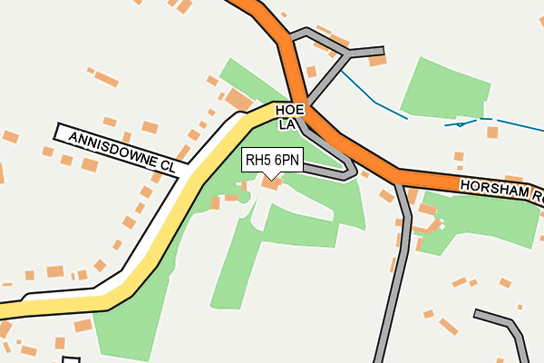
RH5 6PN is located in the Tillingbourne electoral ward, within the local authority district of Guildford and the English Parliamentary constituency of Mole Valley. The Sub Integrated Care Board (ICB) Location is NHS Surrey Heartlands ICB - 92A and the police force is Surrey. This postcode has been in use since January 1980.


GetTheData
Source: OS OpenMap – Local (Ordnance Survey)
Source: OS VectorMap District (Ordnance Survey)
Licence: Open Government Licence (requires attribution)
| Easting | 509998 |
| Northing | 145998 |
| Latitude | 51.202615 |
| Longitude | -0.426916 |
GetTheData
Source: Open Postcode Geo
Licence: Open Government Licence
| Country | England |
| Postcode District | RH5 |
➜ See where RH5 is on a map | |
GetTheData
Source: Land Registry Price Paid Data
Licence: Open Government Licence
Elevation or altitude of RH5 6PN as distance above sea level:
| Metres | Feet | |
|---|---|---|
| Elevation | 120m | 394ft |
Elevation is measured from the approximate centre of the postcode, to the nearest point on an OS contour line from OS Terrain 50, which has contour spacing of ten vertical metres.
➜ How high above sea level am I? Find the elevation of your current position using your device's GPS.
GetTheData
Source: Open Postcode Elevation
Licence: Open Government Licence
| Ward | Tillingbourne |
| Constituency | Mole Valley |
GetTheData
Source: ONS Postcode Database
Licence: Open Government Licence
| Hoe Lane (Horsham Road) | Sutton Abinger | 72m |
| Hoe Lane (Horsham Road) | Sutton Abinger | 89m |
| Horsham Road | Sutton Abinger | 471m |
| Horsham Road | Sutton Abinger | 473m |
| Rad Lane (Horsham Road) | Sutton Abinger | 634m |
| Gomshall Station | 2.1km |
GetTheData
Source: NaPTAN
Licence: Open Government Licence
GetTheData
Source: ONS Postcode Database
Licence: Open Government Licence


➜ Get more ratings from the Food Standards Agency
GetTheData
Source: Food Standards Agency
Licence: FSA terms & conditions
| Last Collection | |||
|---|---|---|---|
| Location | Mon-Fri | Sat | Distance |
| Sutton | 17:00 | 07:30 | 503m |
| Franksfield | 16:30 | 07:00 | 1,231m |
| Peaslake Post Office | 16:30 | 10:45 | 1,801m |
GetTheData
Source: Dracos
Licence: Creative Commons Attribution-ShareAlike
The below table lists the International Territorial Level (ITL) codes (formerly Nomenclature of Territorial Units for Statistics (NUTS) codes) and Local Administrative Units (LAU) codes for RH5 6PN:
| ITL 1 Code | Name |
|---|---|
| TLJ | South East (England) |
| ITL 2 Code | Name |
| TLJ2 | Surrey, East and West Sussex |
| ITL 3 Code | Name |
| TLJ25 | West Surrey |
| LAU 1 Code | Name |
| E07000209 | Guildford |
GetTheData
Source: ONS Postcode Directory
Licence: Open Government Licence
The below table lists the Census Output Area (OA), Lower Layer Super Output Area (LSOA), and Middle Layer Super Output Area (MSOA) for RH5 6PN:
| Code | Name | |
|---|---|---|
| OA | E00155531 | |
| LSOA | E01030492 | Guildford 018C |
| MSOA | E02006361 | Guildford 018 |
GetTheData
Source: ONS Postcode Directory
Licence: Open Government Licence
| RH5 6RG | Hoe Lane | 99m |
| RH5 6RE | Horsham Road | 124m |
| RH5 6RH | Hoe Lane | 186m |
| RH5 6RQ | Anisdowne Close | 200m |
| RH5 6RD | Horsham Road | 268m |
| RH5 6PW | Horsham Road | 307m |
| RH5 6RL | Sutton Place | 348m |
| RH5 6RJ | Knob Field | 357m |
| RH5 6RN | Sutton Place | 449m |
| RH5 6NN | Woodhouse Lane | 506m |
GetTheData
Source: Open Postcode Geo; Land Registry Price Paid Data
Licence: Open Government Licence