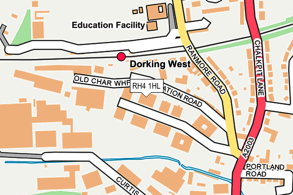
RH4 1HL is located in the Dorking North electoral ward, within the local authority district of Mole Valley and the English Parliamentary constituency of Mole Valley. The Sub Integrated Care Board (ICB) Location is NHS Surrey Heartlands ICB - 92A and the police force is Surrey. This postcode has been in use since August 2010.


GetTheData
Source: OS OpenMap – Local (Ordnance Survey)
Source: OS VectorMap District (Ordnance Survey)
Licence: Open Government Licence (requires attribution)
| Easting | 516112 |
| Northing | 149711 |
| Latitude | 51.234776 |
| Longitude | -0.338217 |
GetTheData
Source: Open Postcode Geo
Licence: Open Government Licence
| Country | England |
| Postcode District | RH4 |
➜ See where RH4 is on a map ➜ Where is Dorking? | |
GetTheData
Source: Land Registry Price Paid Data
Licence: Open Government Licence
Elevation or altitude of RH4 1HL as distance above sea level:
| Metres | Feet | |
|---|---|---|
| Elevation | 60m | 197ft |
Elevation is measured from the approximate centre of the postcode, to the nearest point on an OS contour line from OS Terrain 50, which has contour spacing of ten vertical metres.
➜ How high above sea level am I? Find the elevation of your current position using your device's GPS.
GetTheData
Source: Open Postcode Elevation
Licence: Open Government Licence
| Ward | Dorking North |
| Constituency | Mole Valley |
GetTheData
Source: ONS Postcode Database
Licence: Open Government Licence
| St Martins School (Ranmore Road) | Dorking | 277m |
| Glebe Road (Westcott Road) | Dorking | 370m |
| West Street | Dorking | 391m |
| Glebe Road (Westcott Road) | Dorking | 438m |
| South Street | Dorking | 531m |
| Dorking West Station | 0.2km |
| Dorking Deepdene Station | 1km |
| Dorking Station | 1.2km |
GetTheData
Source: NaPTAN
Licence: Open Government Licence
GetTheData
Source: ONS Postcode Database
Licence: Open Government Licence


➜ Get more ratings from the Food Standards Agency
GetTheData
Source: Food Standards Agency
Licence: FSA terms & conditions
| Last Collection | |||
|---|---|---|---|
| Location | Mon-Fri | Sat | Distance |
| Church Street | 17:00 | 12:15 | 374m |
| Chalkpit Lane | 17:15 | 12:15 | 377m |
| Nutcombe Lane | 17:15 | 12:30 | 399m |
GetTheData
Source: Dracos
Licence: Creative Commons Attribution-ShareAlike
The below table lists the International Territorial Level (ITL) codes (formerly Nomenclature of Territorial Units for Statistics (NUTS) codes) and Local Administrative Units (LAU) codes for RH4 1HL:
| ITL 1 Code | Name |
|---|---|
| TLJ | South East (England) |
| ITL 2 Code | Name |
| TLJ2 | Surrey, East and West Sussex |
| ITL 3 Code | Name |
| TLJ26 | East Surrey |
| LAU 1 Code | Name |
| E07000210 | Mole Valley |
GetTheData
Source: ONS Postcode Directory
Licence: Open Government Licence
The below table lists the Census Output Area (OA), Lower Layer Super Output Area (LSOA), and Middle Layer Super Output Area (MSOA) for RH4 1HL:
| Code | Name | |
|---|---|---|
| OA | E00155729 | |
| LSOA | E01030534 | Mole Valley 009C |
| MSOA | E02006370 | Mole Valley 009 |
GetTheData
Source: ONS Postcode Directory
Licence: Open Government Licence
| RH4 1HG | Station Terrace | 95m |
| RH4 1HA | Ranmore Road | 119m |
| RH4 1HE | Ranmore Road | 137m |
| RH4 1EN | Station Road | 146m |
| RH4 1ES | Havenbury Industrial Estate | 150m |
| RH4 1HD | Ranmore Road | 154m |
| RH4 1EG | Curtis Gardens | 172m |
| RH4 1ER | Chalkpit Lane | 176m |
| RH4 1EZ | Chalkpit Lane | 183m |
| RH4 1ED | Station Road | 193m |
GetTheData
Source: Open Postcode Geo; Land Registry Price Paid Data
Licence: Open Government Licence