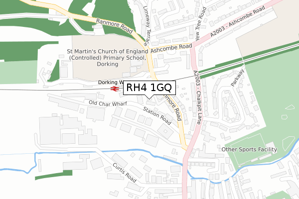
RH4 1GQ is located in the Dorking North electoral ward, within the local authority district of Mole Valley and the English Parliamentary constituency of Mole Valley. The Sub Integrated Care Board (ICB) Location is NHS Surrey Heartlands ICB - 92A and the police force is Surrey. This postcode has been in use since September 2019.


GetTheData
Source: OS Open Zoomstack (Ordnance Survey)
Licence: Open Government Licence (requires attribution)
Attribution: Contains OS data © Crown copyright and database right 2025
Source: Open Postcode Geo
Licence: Open Government Licence (requires attribution)
Attribution: Contains OS data © Crown copyright and database right 2025; Contains Royal Mail data © Royal Mail copyright and database right 2025; Source: Office for National Statistics licensed under the Open Government Licence v.3.0
| Easting | 516104 |
| Northing | 149848 |
| Latitude | 51.236009 |
| Longitude | -0.338287 |
GetTheData
Source: Open Postcode Geo
Licence: Open Government Licence
| Country | England |
| Postcode District | RH4 |
➜ See where RH4 is on a map ➜ Where is Dorking? | |
GetTheData
Source: Land Registry Price Paid Data
Licence: Open Government Licence
| Ward | Dorking North |
| Constituency | Mole Valley |
GetTheData
Source: ONS Postcode Database
Licence: Open Government Licence
| St Martins School (Ranmore Road) | Dorking | 139m |
| Glebe Road (Westcott Road) | Dorking | 501m |
| West Street | Dorking | 515m |
| Ashcombe Road | Dorking | 551m |
| Ashcombe Road | Dorking | 561m |
| Dorking West Station | 0.1km |
| Dorking Deepdene Station | 1km |
| Dorking Station | 1.1km |
GetTheData
Source: NaPTAN
Licence: Open Government Licence
GetTheData
Source: ONS Postcode Database
Licence: Open Government Licence


➜ Get more ratings from the Food Standards Agency
GetTheData
Source: Food Standards Agency
Licence: FSA terms & conditions
| Last Collection | |||
|---|---|---|---|
| Location | Mon-Fri | Sat | Distance |
| Chalkpit Lane | 17:15 | 12:15 | 265m |
| Church Street | 17:00 | 12:15 | 482m |
| Nutcombe Lane | 17:15 | 12:30 | 526m |
GetTheData
Source: Dracos
Licence: Creative Commons Attribution-ShareAlike
The below table lists the International Territorial Level (ITL) codes (formerly Nomenclature of Territorial Units for Statistics (NUTS) codes) and Local Administrative Units (LAU) codes for RH4 1GQ:
| ITL 1 Code | Name |
|---|---|
| TLJ | South East (England) |
| ITL 2 Code | Name |
| TLJ2 | Surrey, East and West Sussex |
| ITL 3 Code | Name |
| TLJ26 | East Surrey |
| LAU 1 Code | Name |
| E07000210 | Mole Valley |
GetTheData
Source: ONS Postcode Directory
Licence: Open Government Licence
The below table lists the Census Output Area (OA), Lower Layer Super Output Area (LSOA), and Middle Layer Super Output Area (MSOA) for RH4 1GQ:
| Code | Name | |
|---|---|---|
| OA | E00155729 | |
| LSOA | E01030534 | Mole Valley 009C |
| MSOA | E02006370 | Mole Valley 009 |
GetTheData
Source: ONS Postcode Directory
Licence: Open Government Licence
| RH4 1ES | Havenbury Industrial Estate | 33m |
| RH4 1HE | Ranmore Road | 52m |
| RH4 1HG | Station Terrace | 87m |
| RH4 1HD | Ranmore Road | 105m |
| RH4 1HP | Fraser Gardens | 110m |
| RH4 1EZ | Chalkpit Lane | 153m |
| RH4 1HR | Fraser Gardens | 158m |
| RH4 1HA | Ranmore Road | 175m |
| RH4 1HS | Fraser Gardens | 183m |
| RH4 1EY | Chalkpit Lane | 189m |
GetTheData
Source: Open Postcode Geo; Land Registry Price Paid Data
Licence: Open Government Licence